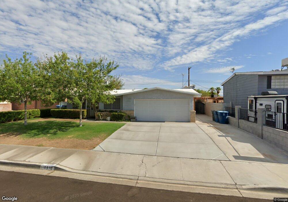
5516 Seabaugh Ave Las Vegas, NV 89107
Michael Way NeighborhoodEstimated Value: $333,000 - $371,000
3
Beds
2
Baths
1,384
Sq Ft
$256/Sq Ft
Est. Value
About This Home
This home is located at 5516 Seabaugh Ave, Las Vegas, NV 89107 and is currently estimated at $354,629, approximately $256 per square foot. 5516 Seabaugh Ave is a home located in Clark County with nearby schools including J.T. McWlliams Elementary School, Robert O Gibson Middle School, and Western High School.
Ownership History
Date
Name
Owned For
Owner Type
Purchase Details
Closed on
Aug 10, 2022
Sold by
Raul Dela Riva-Reyes
Bought by
Dereyes Rosa Nelly Flores
Current Estimated Value
Purchase Details
Closed on
Apr 25, 1995
Sold by
Oxborrow Lester E and Oxborrow Doris S
Bought by
Delariva Reyes Raul and Delariva Reyes Rosa
Home Financials for this Owner
Home Financials are based on the most recent Mortgage that was taken out on this home.
Original Mortgage
$79,475
Interest Rate
8.44%
Create a Home Valuation Report for This Property
The Home Valuation Report is an in-depth analysis detailing your home's value as well as a comparison with similar homes in the area
Home Values in the Area
Average Home Value in this Area
Purchase History
| Date | Buyer | Sale Price | Title Company |
|---|---|---|---|
| Dereyes Rosa Nelly Flores | -- | None Listed On Document | |
| Delariva Reyes Raul | $93,500 | Nevada Title Company |
Source: Public Records
Mortgage History
| Date | Status | Borrower | Loan Amount |
|---|---|---|---|
| Previous Owner | Delariva Reyes Raul | $79,475 |
Source: Public Records
Tax History Compared to Growth
Tax History
| Year | Tax Paid | Tax Assessment Tax Assessment Total Assessment is a certain percentage of the fair market value that is determined by local assessors to be the total taxable value of land and additions on the property. | Land | Improvement |
|---|---|---|---|---|
| 2025 | $916 | $50,193 | $29,750 | $20,443 |
| 2024 | $786 | $50,193 | $29,750 | $20,443 |
| 2023 | $786 | $47,515 | $29,050 | $18,465 |
| 2022 | $728 | $42,015 | $25,550 | $16,465 |
| 2021 | $674 | $39,827 | $24,500 | $15,327 |
| 2020 | $623 | $35,882 | $21,000 | $14,882 |
| 2019 | $584 | $31,891 | $17,500 | $14,391 |
| 2018 | $558 | $29,262 | $15,750 | $13,512 |
| 2017 | $955 | $29,139 | $15,750 | $13,389 |
| 2016 | $523 | $24,137 | $11,200 | $12,937 |
| 2015 | $521 | $23,102 | $9,800 | $13,302 |
| 2014 | $505 | $14,935 | $5,250 | $9,685 |
Source: Public Records
Map
Nearby Homes
- 5420 Moonstruck Ave
- 600 Woodmount Dr
- 5620 Roseridge Ave
- 5705 Pearldrop Ave
- 5612 Pearldrop Ave
- 5713 Whiteridge Ave
- 5709 Goldmount Ave
- 5400 Maddox Ave
- 5720 Goldmount Ave
- 304 Orland St Unit 53
- 304 Orland St Unit 56
- 304 Orland St Unit 39
- 304 Orland St Unit 38
- 304 Orland St Unit 47
- 304 Orland St Unit 43
- 5305 Sugarfoot Ave
- 212 Orland St Unit 23
- 212 Orland St Unit 28
- 212 Orland St Unit 22
- 212 Orland St Unit 19
- 5512 Seabaugh Ave
- 5600 Seabaugh Ave
- 5601 Bromley Ave
- 5517 Bromley Ave
- 5508 Seabaugh Ave
- 5604 Seabaugh Ave
- 5517 Seabaugh Ave
- 5513 Bromley Ave
- 5513 Seabaugh Ave
- 5601 Seabaugh Ave
- 240 Kipling St
- 5509 Seabaugh Ave
- 5504 Seabaugh Ave
- 5608 Seabaugh Ave
- 5509 Bromley Ave
- 5505 Seabaugh Ave
- 5516 Morendo Dr
- 5512 Morendo Dr
- 5445 Moonstruck Ave
- 5500 Seabaugh Ave