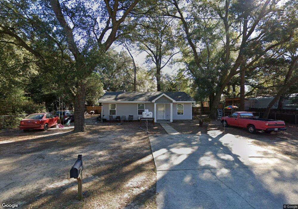
5518 Ormond Dr Pensacola, FL 32526
Estimated Value: $149,295 - $243,000
--
Bed
1
Bath
1,064
Sq Ft
$177/Sq Ft
Est. Value
About This Home
This home is located at 5518 Ormond Dr, Pensacola, FL 32526 and is currently estimated at $188,074, approximately $176 per square foot. 5518 Ormond Dr is a home located in Escambia County with nearby schools including Bellview Elementary School, Bellview Middle School, and Pine Forest High School.
Ownership History
Date
Name
Owned For
Owner Type
Purchase Details
Closed on
Apr 13, 2020
Sold by
Nuykin Kenstin and Nuykin Nadi
Bought by
Bohn Larry and Bohn Eva
Current Estimated Value
Purchase Details
Closed on
Sep 28, 2007
Sold by
Pensacola Habitat For Humanity Inc
Bought by
Nuykin Konstantin V and Lazareva Nadezhda G
Home Financials for this Owner
Home Financials are based on the most recent Mortgage that was taken out on this home.
Original Mortgage
$102,100
Interest Rate
6.57%
Mortgage Type
Seller Take Back
Purchase Details
Closed on
Sep 9, 2005
Sold by
Burnham Jeanette S
Bought by
Pensacola Habitat For Humanity Inc
Create a Home Valuation Report for This Property
The Home Valuation Report is an in-depth analysis detailing your home's value as well as a comparison with similar homes in the area
Home Values in the Area
Average Home Value in this Area
Purchase History
| Date | Buyer | Sale Price | Title Company |
|---|---|---|---|
| Bohn Larry | $14,000 | None Available | |
| Nuykin Konstantin V | $103,000 | First American Title Ins Co | |
| Pensacola Habitat For Humanity Inc | $7,800 | First American Title Ins Co |
Source: Public Records
Mortgage History
| Date | Status | Borrower | Loan Amount |
|---|---|---|---|
| Previous Owner | Nuykin Konstantin V | $102,100 |
Source: Public Records
Tax History Compared to Growth
Tax History
| Year | Tax Paid | Tax Assessment Tax Assessment Total Assessment is a certain percentage of the fair market value that is determined by local assessors to be the total taxable value of land and additions on the property. | Land | Improvement |
|---|---|---|---|---|
| 2024 | $1,622 | $112,286 | -- | -- |
| 2023 | $1,622 | $112,804 | $7,600 | $105,204 |
| 2022 | $222 | $7,220 | $7,220 | $0 |
| 2021 | $225 | $7,220 | $0 | $0 |
| 2020 | $257 | $9,675 | $0 | $0 |
| 2019 | $933 | $58,809 | $0 | $0 |
| 2018 | $906 | $55,657 | $0 | $0 |
| 2017 | $863 | $51,465 | $0 | $0 |
| 2016 | $862 | $50,540 | $0 | $0 |
| 2015 | $820 | $48,628 | $0 | $0 |
| 2014 | $374 | $44,244 | $0 | $0 |
Source: Public Records
Map
Nearby Homes
- 5224 Westwind Cir
- 5689 Nicholas Ln
- 3237 Tallship Ln
- 3710 N Blue Angel Pkwy
- 5346 & 5336 N Blue Angel Pkwy
- 3216 Tallship Ln
- 5721 Perkins St
- 3191 Muldoon Rd Unit A & B
- 5820 Perkins St
- 3084 Creole Way
- 5635 Turkey Rd
- 7909 Red Bean Dr
- 5750 Turkey Rd
- 3394 N Blue Angel Pkwy
- 4866 Cuerro Ct
- 4712 Clara St
- 3001 Christine St
- 5842 Princeton Dr
- 3104 Fayal Dr
- 7315 Hayward Ave
- 5520 Ormond Dr
- 5524 Ormond Dr
- 5521 Ormond Dr
- 5320 Cerny Rd
- 5519 Ormond Dr
- 0 Ormond Dr
- 5330 Cerny Rd
- 5525 Ormond Dr
- 5523 Ormond Dr
- 5400 Cerny Rd
- 5400 Cerny Rd Unit Vacant Lot 5400 BLK
- 5400 Cerny Rd Unit BLK
- 4940 Muldoon Pointe Rd
- 4969 Muldoon Pointe Rd Unit 8B
- 4953 Muldoon Pointe Rd Unit 12B
- 4940 Muldoon Pointe Rd Unit 16A
- 4949 Muldoon Pointe Rd Unit 13B
- 4936 Muldoon Pointe Rd Unit 17A
- 4957 Muldoon Pointe Rd Unit 11B
- 4961 Muldoon Pointe Rd Unit 10B