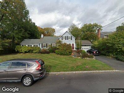
552 N Chestnut St Westfield, NJ 07090
Estimated Value: $941,800 - $1,048,000
--
Bed
--
Bath
1,718
Sq Ft
$575/Sq Ft
Est. Value
About This Home
This home is located at 552 N Chestnut St, Westfield, NJ 07090 and is currently estimated at $988,700, approximately $575 per square foot. 552 N Chestnut St is a home located in Union County with nearby schools including Wilson Elementary School, Roosevelt Intermediate School, and Westfield Senior High School.
Ownership History
Date
Name
Owned For
Owner Type
Purchase Details
Closed on
Oct 10, 2000
Sold by
Sailer Dennis H and Hengst Loretta M
Bought by
Priscoe Alfred A and Priscoe Susan J
Current Estimated Value
Home Financials for this Owner
Home Financials are based on the most recent Mortgage that was taken out on this home.
Original Mortgage
$200,000
Interest Rate
8.37%
Mortgage Type
Stand Alone First
Create a Home Valuation Report for This Property
The Home Valuation Report is an in-depth analysis detailing your home's value as well as a comparison with similar homes in the area
Home Values in the Area
Average Home Value in this Area
Purchase History
| Date | Buyer | Sale Price | Title Company |
|---|---|---|---|
| Priscoe Alfred A | $300,000 | -- |
Source: Public Records
Mortgage History
| Date | Status | Borrower | Loan Amount |
|---|---|---|---|
| Open | Priscoe Alfred A | $200,000 | |
| Closed | Priscoe Alfred A | $300,000 | |
| Closed | Priscoe Alfred A | $174,000 | |
| Closed | Priscoe Alfred | $202,200 | |
| Closed | Priscoe Alfred A | $200,000 |
Source: Public Records
Tax History Compared to Growth
Tax History
| Year | Tax Paid | Tax Assessment Tax Assessment Total Assessment is a certain percentage of the fair market value that is determined by local assessors to be the total taxable value of land and additions on the property. | Land | Improvement |
|---|---|---|---|---|
| 2024 | $15,054 | $682,400 | $489,600 | $192,800 |
| 2023 | $15,054 | $682,400 | $489,600 | $192,800 |
| 2022 | $14,740 | $682,400 | $489,600 | $192,800 |
| 2021 | $14,760 | $682,400 | $489,600 | $192,800 |
| 2020 | $14,726 | $682,400 | $489,600 | $192,800 |
| 2019 | $14,672 | $682,400 | $489,600 | $192,800 |
| 2018 | $14,773 | $158,900 | $92,300 | $66,600 |
| 2017 | $14,692 | $158,900 | $92,300 | $66,600 |
| 2016 | $14,347 | $158,900 | $92,300 | $66,600 |
| 2015 | $14,061 | $158,900 | $92,300 | $66,600 |
| 2014 | $13,597 | $158,900 | $92,300 | $66,600 |
Source: Public Records
Map
Nearby Homes
- 591 Terrace Place
- 752 Belvidere Ave
- 569 Colonial Ave
- 520 Mountain Ave
- 534 Alden Ave
- 504 Mountain Ave
- 512 Sherwood Pkwy
- 800 Franklin Ave
- 520 Raymond St
- 821 Grant Ave
- 826 Wallberg Ave
- 445 Topping Hill Rd
- 800 Hillside Ave
- 861 Bradford Ave
- 521 Topping Hill Rd
- 460 Topping Hill Rd
- 303 Harrison Ave
- 920 Highland Ave
- 657 Hillside Ave
- 460 Hillside Ave
- 552 N Chestnut St
- 560 N Chestnut St
- 546 N Chestnut St
- 710 Crescent Pkwy
- 712 Belvidere Ave
- 566 N Chestnut St
- 538 N Chestnut St
- 714 Crescent Pkwy
- 716 Belvidere Ave
- 718 Crescent Pkwy
- 633 N Chestnut St
- 639 N Chestnut St
- 627 N Chestnut St
- 720 Belvidere Ave
- 536 N Chestnut St
- 645 N Chestnut St
- 623 N Chestnut St
- 722 Crescent Pkwy
- 576 N Chestnut St
- 619 N Chestnut St