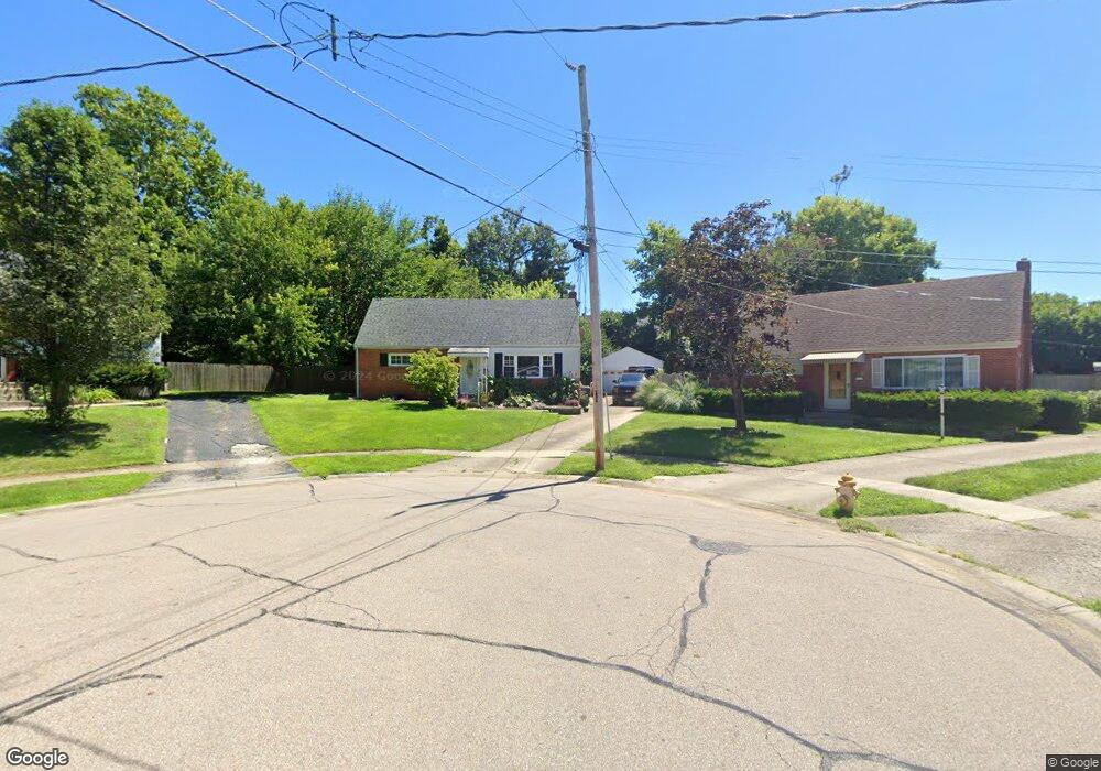
552 Picuda Ct Cincinnati, OH 45238
Central Delhi NeighborhoodEstimated Value: $243,304 - $268,000
4
Beds
2
Baths
1,406
Sq Ft
$183/Sq Ft
Est. Value
About This Home
This home is located at 552 Picuda Ct, Cincinnati, OH 45238 and is currently estimated at $257,076, approximately $182 per square foot. 552 Picuda Ct is a home located in Hamilton County with nearby schools including C.O. Harrison Elementary School, Delhi Middle School, and Oak Hills High School.
Ownership History
Date
Name
Owned For
Owner Type
Purchase Details
Closed on
Jan 19, 2007
Sold by
Houston William G and Houston Veronica
Bought by
Kuhn Jeffrey M and Kuhn Janette M
Current Estimated Value
Home Financials for this Owner
Home Financials are based on the most recent Mortgage that was taken out on this home.
Original Mortgage
$108,000
Outstanding Balance
$69,818
Interest Rate
8.12%
Mortgage Type
Unknown
Estimated Equity
$187,258
Purchase Details
Closed on
Jun 24, 1994
Sold by
Campbell David C and Campbell Sally T
Bought by
Houston William G and Houston Veronica
Home Financials for this Owner
Home Financials are based on the most recent Mortgage that was taken out on this home.
Original Mortgage
$92,689
Interest Rate
8.66%
Mortgage Type
FHA
Create a Home Valuation Report for This Property
The Home Valuation Report is an in-depth analysis detailing your home's value as well as a comparison with similar homes in the area
Home Values in the Area
Average Home Value in this Area
Purchase History
| Date | Buyer | Sale Price | Title Company |
|---|---|---|---|
| Kuhn Jeffrey M | $135,000 | Tower City Title Agency Llc | |
| Houston William G | -- | -- |
Source: Public Records
Mortgage History
| Date | Status | Borrower | Loan Amount |
|---|---|---|---|
| Open | Kuhn Jeffrey M | $108,000 | |
| Previous Owner | Houston William G | $92,689 |
Source: Public Records
Tax History
| Year | Tax Paid | Tax Assessment Tax Assessment Total Assessment is a certain percentage of the fair market value that is determined by local assessors to be the total taxable value of land and additions on the property. | Land | Improvement |
|---|---|---|---|---|
| 2025 | $4,410 | $74,074 | $10,500 | $63,574 |
| 2023 | $4,318 | $74,074 | $10,500 | $63,574 |
| 2022 | $3,346 | $51,023 | $9,744 | $41,279 |
| 2021 | $3,281 | $51,023 | $9,744 | $41,279 |
| 2020 | $3,323 | $51,023 | $9,744 | $41,279 |
| 2019 | $3,189 | $43,985 | $8,400 | $35,585 |
| 2018 | $3,192 | $43,985 | $8,400 | $35,585 |
| 2017 | $2,885 | $43,985 | $8,400 | $35,585 |
| 2016 | $2,615 | $39,897 | $7,980 | $31,917 |
| 2015 | $2,755 | $39,897 | $7,980 | $31,917 |
| 2014 | $2,758 | $39,897 | $7,980 | $31,917 |
| 2013 | $2,733 | $41,997 | $8,400 | $33,597 |
Source: Public Records
Map
Nearby Homes
- 548 Anderson Ferry Rd
- 5361 Pembina Dr
- 553 Starling Ct
- 4272 Foley Rd
- 5140 Old Oak Trail
- 5330 Plumridge Dr
- 481 Viscount Dr
- 813 Allenwood Ct
- 410 Morrvue Dr
- 411 Morrvue Dr
- 621 Covedale Ave
- 5019 Garden Grove Ln
- 5468 Courier Ct
- 5012 Garden Grove Ln
- 5256 Glen Creek Dr
- 859 Gilcrest Ln
- 5449 Dengail Dr
- 951 Villa View Ct
- 949 Anderson Ferry Rd
- 287 Shaker Ct
- 560 Picuda Ct
- 551 Picuda Ct
- 5316 Romance Ln
- 5312 Romance Ln
- 5320 Romance Ln
- 5308 Romance Ln
- 539 Anderson Ferry Rd
- 543 Anderson Ferry Rd
- 570 Picuda Ct
- 5324 Romance Ln
- 545 Anderson Ferry Rd
- 5304 Romance Ln
- 559 Picuda Ct
- 5328 Romance Ln
- 567 Picuda Ct
- 549 Anderson Ferry Rd
- 5300 Romance Ln
- 5332 Romance Ln
- 575 Picuda Ct
- 553 Anderson Ferry Rd
Your Personal Tour Guide
Ask me questions while you tour the home.