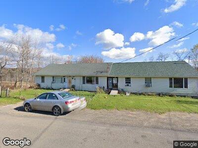
552 Sapbush Rd Chenango Forks, NY 13746
Estimated Value: $246,000 - $249,579
4
Beds
2
Baths
1,344
Sq Ft
$184/Sq Ft
Est. Value
About This Home
This home is located at 552 Sapbush Rd, Chenango Forks, NY 13746 and is currently estimated at $247,790, approximately $184 per square foot. 552 Sapbush Rd is a home located in Broome County with nearby schools including Chenango Forks Elementary School, Chenango Forks Middle School, and Chenango Forks High School.
Ownership History
Date
Name
Owned For
Owner Type
Purchase Details
Closed on
Aug 10, 2015
Sold by
Denny Irving
Bought by
Samson Raymond P and Samson Anna M
Current Estimated Value
Home Financials for this Owner
Home Financials are based on the most recent Mortgage that was taken out on this home.
Original Mortgage
$7,000
Interest Rate
4.08%
Mortgage Type
Seller Take Back
Create a Home Valuation Report for This Property
The Home Valuation Report is an in-depth analysis detailing your home's value as well as a comparison with similar homes in the area
Home Values in the Area
Average Home Value in this Area
Purchase History
| Date | Buyer | Sale Price | Title Company |
|---|---|---|---|
| Samson Raymond P | $23,000 | None Available |
Source: Public Records
Mortgage History
| Date | Status | Borrower | Loan Amount |
|---|---|---|---|
| Closed | Samson Raymond P | $7,000 | |
| Closed | Denny Irving | $7,157 | |
| Closed | Denny Irving | $107,000 | |
| Closed | Denny Irving D | $23,428 |
Source: Public Records
Tax History Compared to Growth
Tax History
| Year | Tax Paid | Tax Assessment Tax Assessment Total Assessment is a certain percentage of the fair market value that is determined by local assessors to be the total taxable value of land and additions on the property. | Land | Improvement |
|---|---|---|---|---|
| 2024 | $5,590 | $159,300 | $86,300 | $73,000 |
| 2023 | $5,617 | $159,300 | $86,300 | $73,000 |
| 2022 | $5,173 | $150,000 | $86,300 | $63,700 |
| 2021 | $4,981 | $150,000 | $86,300 | $63,700 |
| 2020 | $3,758 | $150,000 | $86,300 | $63,700 |
| 2019 | -- | $150,000 | $86,300 | $63,700 |
| 2018 | $3,780 | $150,000 | $86,300 | $63,700 |
| 2017 | $3,762 | $150,000 | $86,300 | $63,700 |
| 2016 | $3,800 | $150,000 | $86,300 | $63,700 |
| 2015 | -- | $150,000 | $86,300 | $63,700 |
| 2014 | -- | $150,000 | $86,300 | $63,700 |
Source: Public Records
Map
Nearby Homes
- L20.2 Indian Brook Rd
- 50 North St
- 373 Bull Creek Rd
- 373 Bear Swamp Rd
- 177 Johnson Rd
- 193 County Road 2
- 7625 State Route 79
- 577 Foster Hill Rd
- 430 Conklin Hill Rd
- 391 Conklin Hill Rd
- 446 Laurel Rd
- 248 Ticknor Brook Rd
- 122 Quinn Rd
- 784 State Highway 206
- 29 Parsons Rd
- 7800 New York 79
- 5 Emerson Rd
- 64 S Chenango St
- 37 S Canal St
- 10 W Juliand