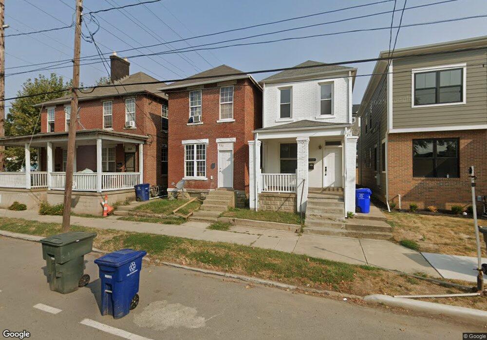
552 W Town St Columbus, OH 43215
East Franklinton NeighborhoodEstimated Value: $190,869 - $358,000
3
Beds
1
Bath
1,536
Sq Ft
$179/Sq Ft
Est. Value
About This Home
This home is located at 552 W Town St, Columbus, OH 43215 and is currently estimated at $274,967, approximately $179 per square foot. 552 W Town St is a home located in Franklin County with nearby schools including Starling PK-8, Sullivant Elementary School, and West High School.
Ownership History
Date
Name
Owned For
Owner Type
Purchase Details
Closed on
Mar 9, 2005
Sold by
Scott Franklin C and Scott Rita
Bought by
Blue Grass Properties Llc
Current Estimated Value
Purchase Details
Closed on
Nov 9, 2004
Sold by
Vance Betty and Ripley Helen
Bought by
Scott Franklin C
Purchase Details
Closed on
Sep 15, 2004
Sold by
Estate Of Leona Scott
Bought by
Mullin Gwyn Scott
Purchase Details
Closed on
Sep 14, 2004
Sold by
Estate Of George R Scott
Bought by
Estate Of Leona Scott
Purchase Details
Closed on
Feb 5, 2003
Sold by
Estate Of Raymond Scott
Bought by
Scott Franklin C and Vance Betty
Purchase Details
Closed on
Jan 2, 2003
Sold by
Estate Of Leona Scott
Bought by
Bradley Tim
Purchase Details
Closed on
Oct 15, 1975
Bought by
Scott Raymond and Scott Jane
Create a Home Valuation Report for This Property
The Home Valuation Report is an in-depth analysis detailing your home's value as well as a comparison with similar homes in the area
Home Values in the Area
Average Home Value in this Area
Purchase History
| Date | Buyer | Sale Price | Title Company |
|---|---|---|---|
| Blue Grass Properties Llc | $18,500 | -- | |
| Scott Franklin C | -- | -- | |
| Mullin Gwyn Scott | -- | -- | |
| Estate Of Leona Scott | -- | -- | |
| Scott Franklin C | -- | -- | |
| Scott Raymond C | -- | -- | |
| Bradley Tim | -- | -- | |
| Scott Leona | -- | -- | |
| Scott Franklin C | -- | -- | |
| Scott Raymond W | -- | -- | |
| Scott Raymond | -- | -- |
Source: Public Records
Tax History Compared to Growth
Tax History
| Year | Tax Paid | Tax Assessment Tax Assessment Total Assessment is a certain percentage of the fair market value that is determined by local assessors to be the total taxable value of land and additions on the property. | Land | Improvement |
|---|---|---|---|---|
| 2024 | $1,922 | $40,180 | $18,900 | $21,280 |
| 2023 | $1,818 | $40,180 | $18,900 | $21,280 |
| 2022 | $653 | $12,290 | $670 | $11,620 |
| 2021 | $814 | $12,290 | $670 | $11,620 |
| 2020 | $710 | $12,290 | $670 | $11,620 |
| 2019 | $636 | $10,230 | $530 | $9,700 |
| 2018 | $573 | $10,230 | $530 | $9,700 |
| 2017 | $575 | $10,230 | $530 | $9,700 |
| 2016 | $514 | $7,560 | $840 | $6,720 |
| 2015 | $468 | $7,560 | $840 | $6,720 |
| 2014 | $469 | $7,560 | $840 | $6,720 |
| 2013 | $257 | $8,400 | $945 | $7,455 |
Source: Public Records
Map
Nearby Homes
- 550 W Town St
- 546 W Town St
- 536 W Town St
- 538 W Town St
- 502 W Town St
- 642 W State St
- 601 W Rich St Unit 601
- 609 W Rich St Unit 609
- 245 S Skidmore St
- 251 S Skidmore St Unit 251
- 273 S Grubb St Unit 273
- 763 W Rich St
- 772 Sullivant Ave Unit 772
- 839 W Rich St
- 45 N Hartford Ave
- 765 Campbell Ave
- 49 S Hartford Ave
- 45 S Hartford Ave
- The Summit Plan at Homes on Hartford - Single Family
- 760 Thomas Ave