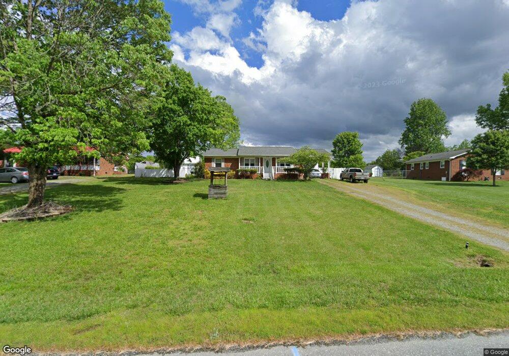
5520 Lancer Dr High Point, NC 27263
Estimated Value: $223,511 - $296,000
Studio
2
Baths
1,254
Sq Ft
$208/Sq Ft
Est. Value
About This Home
This home is located at 5520 Lancer Dr, High Point, NC 27263 and is currently estimated at $260,378, approximately $207 per square foot. 5520 Lancer Dr is a home located in Randolph County with nearby schools including John R. Lawrence Elementary School, Wheatmore Middle School, and Wheatmore High School.
Ownership History
Date
Name
Owned For
Owner Type
Purchase Details
Closed on
Apr 12, 2018
Sold by
Garcia German Olivo
Bought by
Anglin Susana Elizabeth
Current Estimated Value
Purchase Details
Closed on
Feb 8, 2018
Sold by
Midfirst Bank
Bought by
Garcia German Olivo
Purchase Details
Closed on
Dec 22, 2017
Sold by
Self Billy M and Self Sandra M
Bought by
Midfirst Bank
Purchase Details
Closed on
Jul 30, 2008
Sold by
Mckinney David E and Mckinney Tina L
Bought by
Self Billy M and Self Sandra M
Home Financials for this Owner
Home Financials are based on the most recent Mortgage that was taken out on this home.
Original Mortgage
$135,724
Interest Rate
6.37%
Mortgage Type
FHA
Purchase Details
Closed on
Dec 12, 1990
Bought by
Self Billy M Self Sandra M
Create a Home Valuation Report for This Property
The Home Valuation Report is an in-depth analysis detailing your home's value as well as a comparison with similar homes in the area
Home Values in the Area
Average Home Value in this Area
Purchase History
| Date | Buyer | Sale Price | Title Company |
|---|---|---|---|
| Anglin Susana Elizabeth | $144,500 | None Available | |
| Garcia German Olivo | $68,500 | None Available | |
| Midfirst Bank | $68,400 | None Available | |
| Self Billy M | $138,000 | None Available | |
| Self Billy M Self Sandra M | $64,000 | -- |
Source: Public Records
Mortgage History
| Date | Status | Borrower | Loan Amount |
|---|---|---|---|
| Previous Owner | Self Billy M | $135,724 |
Source: Public Records
Tax History
| Year | Tax Paid | Tax Assessment Tax Assessment Total Assessment is a certain percentage of the fair market value that is determined by local assessors to be the total taxable value of land and additions on the property. | Land | Improvement |
|---|---|---|---|---|
| 2025 | $1,301 | $177,480 | $54,870 | $122,610 |
| 2024 | $1,283 | $177,480 | $54,870 | $122,610 |
| 2023 | $1,283 | $177,480 | $54,870 | $122,610 |
| 2022 | $959 | $109,070 | $23,350 | $85,720 |
| 2021 | $959 | $109,070 | $23,350 | $85,720 |
| 2020 | $952 | $109,070 | $23,350 | $85,720 |
| 2019 | $952 | $109,070 | $23,350 | $85,720 |
| 2018 | $939 | $104,210 | $22,510 | $81,700 |
| 2016 | $914 | $104,210 | $22,510 | $81,700 |
| 2015 | $917 | $104,210 | $22,510 | $81,700 |
| 2014 | $917 | $104,210 | $22,510 | $81,700 |
Source: Public Records
Map
Nearby Homes
- 8434 Us Highway 311
- 5590 Old Cedar Square Rd
- 0 Old Cedar Square Rd
- 4045 Old Glenola Rd
- 9256 Us Highway 311
- 0 Arbor Dr
- 0 Kreamer Dr
- 0 Windemere Cir
- 132 Royal Pines Dr
- 0-B Us Highway 311
- 134 Royal Pines Dr
- 136 Royal Pines Dr
- 138 Royal Pines Dr
- 3796 Wood Village Dr
- 5511 Windemere Cir
- 103 Diamond Cir
- 101 Diamond Cir
- 0 Crestwood Dr
- 100 Diamond Cir
- 102 Diamond Cir
Your Personal Tour Guide
Ask me questions while you tour the home.