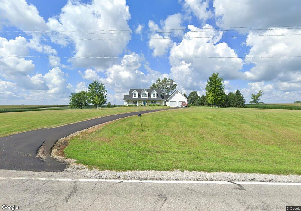
5521 Highway T22 S Newton, IA 50208
Estimated Value: $352,000 - $460,767
3
Beds
3
Baths
1,750
Sq Ft
$234/Sq Ft
Est. Value
About This Home
This home is located at 5521 Highway T22 S, Newton, IA 50208 and is currently estimated at $408,942, approximately $233 per square foot. 5521 Highway T22 S is a home with nearby schools including Lynnville-Sully Elementary School, Lynnville-Sully Middle School, and Lynnville-Sully High School.
Create a Home Valuation Report for This Property
The Home Valuation Report is an in-depth analysis detailing your home's value as well as a comparison with similar homes in the area
Home Values in the Area
Average Home Value in this Area
Tax History Compared to Growth
Tax History
| Year | Tax Paid | Tax Assessment Tax Assessment Total Assessment is a certain percentage of the fair market value that is determined by local assessors to be the total taxable value of land and additions on the property. | Land | Improvement |
|---|---|---|---|---|
| 2025 | $4,078 | $417,080 | $57,100 | $359,980 |
| 2024 | $4,078 | $373,150 | $38,230 | $334,920 |
| 2023 | $3,978 | $373,150 | $38,230 | $334,920 |
| 2022 | $3,384 | $291,570 | $38,230 | $253,340 |
| 2021 | $3,274 | $266,190 | $38,230 | $227,960 |
| 2020 | $3,274 | $246,470 | $36,690 | $209,780 |
| 2019 | $3,064 | $214,540 | $0 | $0 |
| 2018 | $3,064 | $214,540 | $0 | $0 |
| 2017 | $3,110 | $214,540 | $0 | $0 |
| 2016 | $3,110 | $214,540 | $0 | $0 |
| 2015 | $3,072 | $214,540 | $0 | $0 |
| 2014 | $2,986 | $214,540 | $0 | $0 |
Source: Public Records
Map
Nearby Homes
- 5122 E 84th St S
- 7233 Highway T 22 S
- 6657 E 78th St S
- 4683 Legion St Unit ST80
- 11790 Highway F62 E
- 5211 S 70th Ave E
- 205 N 8th Ave
- 202 8th Ave
- 5760 S 80th Ave E
- 1006 2nd St
- 805 5th St
- 115 Railroad St
- 507 Main St
- 702 10th Ave
- 506 Reuel Ave
- 503 2nd St
- 621 Water St
- 119 Northfield Dr
- 112 Northfield Dr
- TBD Northfield Dr