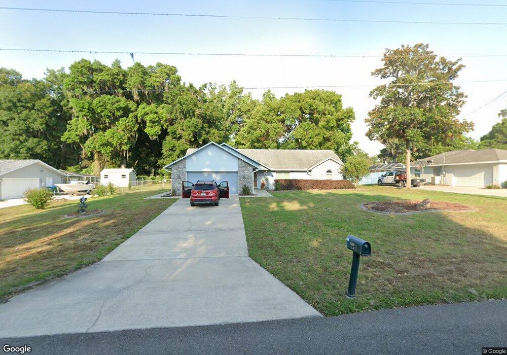
5523 NE 6th Ct Ocala, FL 34479
Northeast Ocala NeighborhoodEstimated Value: $318,643 - $369,000
3
Beds
2
Baths
1,830
Sq Ft
$185/Sq Ft
Est. Value
About This Home
This home is located at 5523 NE 6th Ct, Ocala, FL 34479 and is currently estimated at $339,411, approximately $185 per square foot. 5523 NE 6th Ct is a home located in Marion County with nearby schools including Sparr Elementary School, Howard Middle School, and Vanguard High School.
Ownership History
Date
Name
Owned For
Owner Type
Purchase Details
Closed on
Feb 22, 2023
Sold by
Smith Thomas P Le
Bought by
Colby Amanda R
Current Estimated Value
Purchase Details
Closed on
Apr 6, 2016
Sold by
Lane Smith Barbara C La Rosa and Smith Thomas P
Bought by
The Thomas P & Barbara La Rosa Lane Smit and Lane Smith Barbara C La Rosa
Purchase Details
Closed on
Apr 1, 2016
Bought by
Lane Smith Barbara C Tr
Purchase Details
Closed on
Nov 20, 2013
Sold by
Lane Smith Barbara C and Lane Barbara C
Bought by
Lane Smith Barbara C and Smith Thomas P
Home Financials for this Owner
Home Financials are based on the most recent Mortgage that was taken out on this home.
Original Mortgage
$77,850
Interest Rate
4.43%
Mortgage Type
New Conventional
Create a Home Valuation Report for This Property
The Home Valuation Report is an in-depth analysis detailing your home's value as well as a comparison with similar homes in the area
Home Values in the Area
Average Home Value in this Area
Purchase History
| Date | Buyer | Sale Price | Title Company |
|---|---|---|---|
| Colby Amanda R | -- | -- | |
| Smith Thomas P | $100 | None Listed On Document | |
| Smith Thomas P | -- | -- | |
| The Thomas P & Barbara La Rosa Lane Smit | -- | Attorney | |
| Lane Smith Barbara C Tr | $100 | -- | |
| Lane Smith Barbara C | $37,100 | Attorney |
Source: Public Records
Mortgage History
| Date | Status | Borrower | Loan Amount |
|---|---|---|---|
| Previous Owner | Lane Smith Barbara C | $77,850 |
Source: Public Records
Tax History Compared to Growth
Tax History
| Year | Tax Paid | Tax Assessment Tax Assessment Total Assessment is a certain percentage of the fair market value that is determined by local assessors to be the total taxable value of land and additions on the property. | Land | Improvement |
|---|---|---|---|---|
| 2025 | $3,852 | $257,628 | $24,095 | $233,533 |
| 2024 | $4,475 | $267,142 | $36,666 | $230,476 |
| 2023 | $1,744 | $131,395 | $0 | $0 |
| 2022 | $1,692 | $127,568 | $0 | $0 |
| 2021 | $1,684 | $123,852 | $0 | $0 |
| 2020 | $1,667 | $122,142 | $0 | $0 |
| 2019 | $1,639 | $119,396 | $0 | $0 |
| 2018 | $1,643 | $117,170 | $0 | $0 |
| 2017 | $1,741 | $114,760 | $0 | $0 |
| 2016 | $1,705 | $112,400 | $0 | $0 |
| 2015 | $1,710 | $111,619 | $0 | $0 |
| 2014 | $1,621 | $110,733 | $0 | $0 |
Source: Public Records
Map
Nearby Homes
- 0 NE 6th Ct
- 380 NE 53rd St
- 393 NE 58th St
- 00 NE 55th St
- 1405 NE 55th St
- 1066 NE 49th St
- HWY 441 and W Anthony Rd
- 5735 NE 14th Ave
- 1506 NE 57th St
- 1515 NE 55th St
- 5028 W Anthony Rd
- 6497 W Anthony Rd
- 4420 NE 7th Ave
- 911 NE 45th St
- 1200 NE 45th Place
- 4450 NE 2nd Ct
- 67 NW 45th Loop
- 810 NE 44th St
- 78 NW 45th Loop
- 55 NW 45th Loop