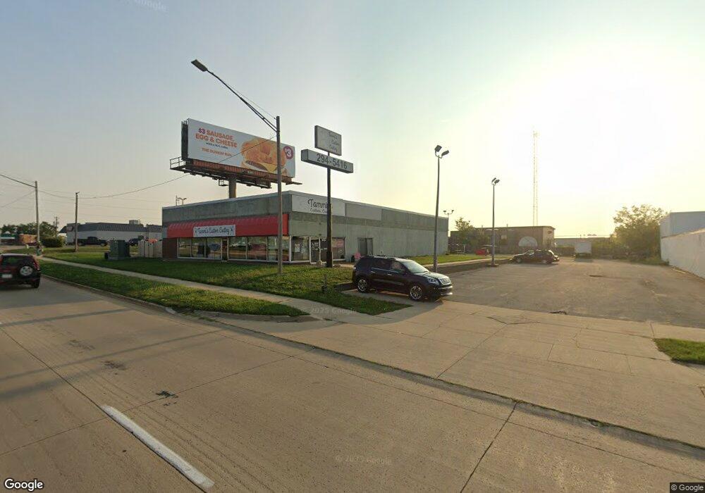
5524 Center Point Rd NE Cedar Rapids, IA 52402
Noelridge Park NeighborhoodEstimated Value: $1,419,070
--
Bed
--
Bath
7,200
Sq Ft
$197/Sq Ft
Est. Value
About This Home
This home is located at 5524 Center Point Rd NE, Cedar Rapids, IA 52402 and is currently estimated at $1,419,070, approximately $197 per square foot. 5524 Center Point Rd NE is a home located in Linn County with nearby schools including T.C. Cherry Elementary School, Wright Elementary School, and Harding Middle School.
Ownership History
Date
Name
Owned For
Owner Type
Purchase Details
Closed on
Oct 31, 2025
Sold by
Progressive Investments Inc
Bought by
Sunny Legacy Holdings Inc
Current Estimated Value
Purchase Details
Closed on
Apr 8, 2005
Sold by
Tlsco Investments Inc
Bought by
Progressive Investments Inc
Home Financials for this Owner
Home Financials are based on the most recent Mortgage that was taken out on this home.
Original Mortgage
$600,000
Interest Rate
6.06%
Mortgage Type
Unknown
Create a Home Valuation Report for This Property
The Home Valuation Report is an in-depth analysis detailing your home's value as well as a comparison with similar homes in the area
Home Values in the Area
Average Home Value in this Area
Purchase History
| Date | Buyer | Sale Price | Title Company |
|---|---|---|---|
| Sunny Legacy Holdings Inc | $712,500 | River Ridge Escrow | |
| Progressive Investments Inc | $749,500 | -- |
Source: Public Records
Mortgage History
| Date | Status | Borrower | Loan Amount |
|---|---|---|---|
| Closed | Progressive Investments Inc | $600,000 |
Source: Public Records
Tax History Compared to Growth
Tax History
| Year | Tax Paid | Tax Assessment Tax Assessment Total Assessment is a certain percentage of the fair market value that is determined by local assessors to be the total taxable value of land and additions on the property. | Land | Improvement |
|---|---|---|---|---|
| 2025 | $18,182 | $644,800 | $235,000 | $409,800 |
| 2024 | $20,986 | $601,800 | $235,000 | $366,800 |
| 2023 | $20,986 | $601,800 | $235,000 | $366,800 |
| 2022 | $18,842 | $663,100 | $235,000 | $428,100 |
| 2021 | $19,020 | $1,024,200 | $235,000 | $789,200 |
| 2020 | $19,020 | $1,020,800 | $235,000 | $785,800 |
| 2019 | $18,246 | $627,900 | $235,000 | $392,900 |
| 2018 | $18,164 | $627,900 | $235,000 | $392,900 |
| 2017 | $15,362 | $544,100 | $235,000 | $309,100 |
| 2016 | $18,713 | $544,100 | $235,000 | $309,100 |
| 2015 | $18,696 | $544,121 | $235,000 | $309,121 |
| 2014 | $16,290 | $544,121 | $235,000 | $309,121 |
| 2013 | $18,862 | $544,121 | $235,000 | $309,121 |
Source: Public Records
Map
Nearby Homes
- 109 E Willman St
- 105 W Willman St
- 5455 Blairs Ferry Rd NE
- 1 N Center Point Rd
- 3 N Center Point Rd
- 250 Cimarron Dr Unit 311
- 1638 47th St NE
- 0 Council St NE
- 6505 Brookview Ln NE
- 1006 Messina Dr NE
- 1138 Messina Dr NE
- 114 Northwood Dr
- 327 Meadows Field Dr NE
- 4609 White Pine Dr NE
- 2106 42nd St NE
- 780 Ryan Ave
- 306 10th Ave
- 4309 Benton St NE
- 4216 Marilyn Dr NE
- 6410 Creekside Dr NE Unit 1
- 1977 Blairs Ferry Rd NE
- 5454 Center Point Rd NE
- 5454 Center Point Rd NE Unit A
- 1957 Blairs Ferry Rd NE Unit 300
- 1957 Blairs Ferry Rd NE Unit 600
- 1957 Blairs Ferry Rd NE Unit 500
- 1957 Blairs Ferry Rd NE Unit 475
- 1957 Blairs Ferry Rd NE Unit 650
- 1957 Blairs Ferry Rd NE Unit 104
- 1957 Blairs Ferry Rd NE Unit 700
- 1957 Blairs Ferry Rd NE Unit 400
- 1957 Blairs Ferry Rd NE Unit 106
- 1957 Blairs Ferry Rd NE Unit 100
- 1957 Blairs Ferry Rd NE Unit 750
- 1957 Blairs Ferry Rd NE Unit 450
- 1957 Blairs Ferry Rd NE Unit 110
- 1957 Blairs Ferry Rd NE Unit 109
- 1957 Blairs Ferry Rd NE Unit 108
- 1957 Blairs Ferry Rd NE Unit 107
- 1961 Blairs Ferry Rd NE Unit 2