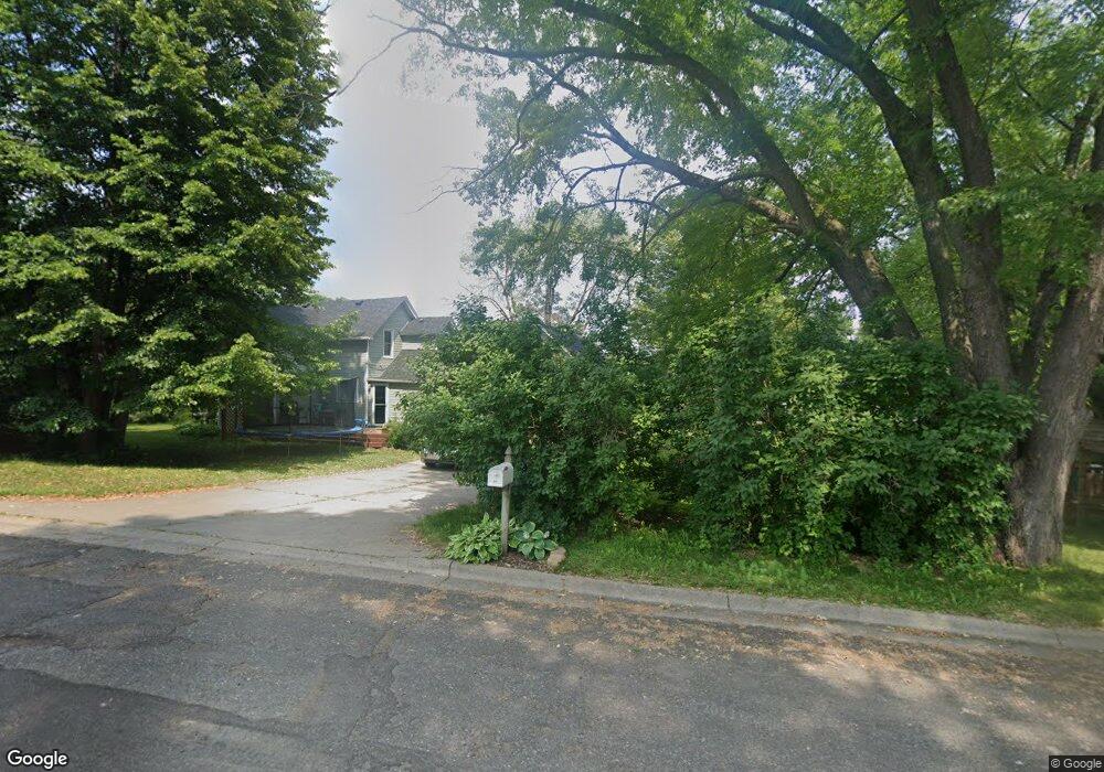
5526 Angus Ave Inver Grove Heights, MN 55077
Estimated Value: $320,000 - $445,000
4
Beds
2
Baths
1,325
Sq Ft
$277/Sq Ft
Est. Value
About This Home
This home is located at 5526 Angus Ave, Inver Grove Heights, MN 55077 and is currently estimated at $366,931, approximately $276 per square foot. 5526 Angus Ave is a home located in Dakota County with nearby schools including Salem Hills Elementary School, Inver Grove Heights Middle School, and Simley Senior High School.
Ownership History
Date
Name
Owned For
Owner Type
Purchase Details
Closed on
May 25, 2021
Sold by
Johnson Quinten C and Johnson Cassandra M
Bought by
Erickson Leslie
Current Estimated Value
Home Financials for this Owner
Home Financials are based on the most recent Mortgage that was taken out on this home.
Original Mortgage
$310,400
Outstanding Balance
$280,416
Interest Rate
2.9%
Mortgage Type
New Conventional
Estimated Equity
$86,515
Purchase Details
Closed on
Apr 3, 2014
Sold by
Sandahl Jay K and Gergen Dena R
Bought by
Johnson Quinten C and Johnson Cassandra M
Home Financials for this Owner
Home Financials are based on the most recent Mortgage that was taken out on this home.
Original Mortgage
$166,429
Interest Rate
4.25%
Mortgage Type
FHA
Purchase Details
Closed on
Jul 26, 2004
Sold by
Hauwiller Thomas J and Hauwiller Michele L
Bought by
Sandahl Jay and Sandahl Dena
Create a Home Valuation Report for This Property
The Home Valuation Report is an in-depth analysis detailing your home's value as well as a comparison with similar homes in the area
Home Values in the Area
Average Home Value in this Area
Purchase History
| Date | Buyer | Sale Price | Title Company |
|---|---|---|---|
| Erickson Leslie | $320,000 | All American Title Co Inc | |
| Johnson Quinten C | $169,500 | Burnet Title | |
| Sandahl Jay | $184,500 | -- | |
| Erickson Leslie Leslie | $320,000 | -- |
Source: Public Records
Mortgage History
| Date | Status | Borrower | Loan Amount |
|---|---|---|---|
| Open | Erickson Leslie | $310,400 | |
| Previous Owner | Johnson Quinten C | $166,429 | |
| Closed | Erickson Leslie Leslie | $315,000 |
Source: Public Records
Tax History Compared to Growth
Tax History
| Year | Tax Paid | Tax Assessment Tax Assessment Total Assessment is a certain percentage of the fair market value that is determined by local assessors to be the total taxable value of land and additions on the property. | Land | Improvement |
|---|---|---|---|---|
| 2024 | $2,504 | $252,100 | $76,400 | $175,700 |
| 2023 | $2,504 | $254,900 | $74,500 | $180,400 |
| 2022 | $2,054 | $245,900 | $74,400 | $171,500 |
| 2021 | $1,832 | $201,200 | $64,700 | $136,500 |
| 2020 | $1,812 | $180,000 | $61,600 | $118,400 |
| 2019 | $1,816 | $177,900 | $58,700 | $119,200 |
| 2018 | $1,624 | $167,900 | $55,900 | $112,000 |
| 2017 | $1,615 | $151,900 | $53,200 | $98,700 |
| 2016 | $1,556 | $148,600 | $50,700 | $97,900 |
| 2015 | $1,663 | $120,156 | $41,189 | $78,967 |
| 2014 | -- | $121,791 | $39,734 | $82,057 |
| 2013 | -- | $123,862 | $37,209 | $86,653 |
Source: Public Records
Map
Nearby Homes
- 5875 Asher Ave
- 6090 Babcock Trail
- 4825 Babcock Trail Unit 2005
- 1855 63rd St E
- 260 Salem Church Rd
- 6320 Baker Ave
- 240 Salem Church Rd
- 6426 Agate Trail
- 6495 Beckman Ave
- 357 Salem Church Rd
- 4739 Blaine Ave Unit 506
- 6680 S Robert Trail
- 2116 65th St E
- 4680 Bloomberg Ln
- 2012 Pine Ridge Dr
- 4570 Blaylock Way Unit 4202
- 4898 Bitterman Path Unit 9101
- 4552 Blaylock Way
- 5870 Blackberry Bridge Path
- 310 23rd Ct S
- 1404 Upper 55th St E
- 1404 1404 Upper 55th St E
- 1420 Upper 55th St E
- 5580 Angus Ave
- 5539 Angus Ave
- 1372 Upper 55th St E
- 1444 Upper 55th St E
- 5555 Angus Ave
- 1425 56th St E
- 1470 Upper 55th St E
- 1445 56th St E
- 1340 Upper 55th St E
- 1335 56th St E
- 5592 Angus Ave
- 1366 56th St E
- 1490 Upper 55th St E
- 1435 56th St E
- 5575 Annette Ave
- 1338 56th St E
- 1320 Upper 55th St E