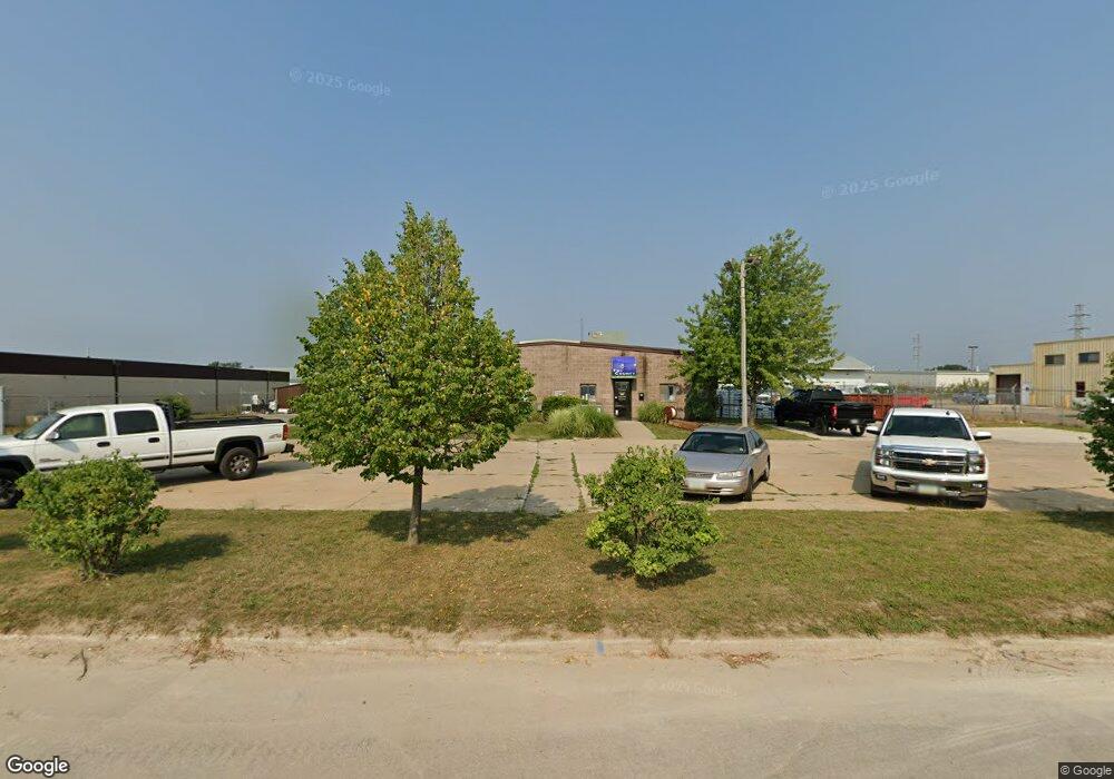
5527 Crane Ln NE Cedar Rapids, IA 52402
Noelridge Park Neighborhood
--
Bed
--
Bath
3,000
Sq Ft
0.85
Acres
About This Home
This home is located at 5527 Crane Ln NE, Cedar Rapids, IA 52402. 5527 Crane Ln NE is a home located in Linn County with nearby schools including T.C. Cherry Elementary School, Wright Elementary School, and Harding Middle School.
Ownership History
Date
Name
Owned For
Owner Type
Purchase Details
Closed on
Apr 30, 2021
Sold by
Lakeside Commercial Properties Llc
Bought by
Samos Investments Llc
Home Financials for this Owner
Home Financials are based on the most recent Mortgage that was taken out on this home.
Original Mortgage
$335,000
Outstanding Balance
$303,119
Interest Rate
3%
Mortgage Type
Purchase Money Mortgage
Purchase Details
Closed on
Mar 19, 2012
Sold by
Progressive Investments Inc
Bought by
Lakeside Commercial Properties Llc
Purchase Details
Closed on
Mar 20, 2003
Sold by
Gray Kirk M and Gray Catherine M
Bought by
Progressive Investments Inc
Home Financials for this Owner
Home Financials are based on the most recent Mortgage that was taken out on this home.
Original Mortgage
$250,000
Interest Rate
5.94%
Mortgage Type
Unknown
Create a Home Valuation Report for This Property
The Home Valuation Report is an in-depth analysis detailing your home's value as well as a comparison with similar homes in the area
Home Values in the Area
Average Home Value in this Area
Purchase History
| Date | Buyer | Sale Price | Title Company |
|---|---|---|---|
| Samos Investments Llc | $305,000 | None Available | |
| Lakeside Commercial Properties Llc | $287,500 | None Available | |
| Progressive Investments Inc | $228,000 | -- |
Source: Public Records
Mortgage History
| Date | Status | Borrower | Loan Amount |
|---|---|---|---|
| Open | Samos Investments Llc | $335,000 | |
| Previous Owner | Progressive Investments Inc | $250,000 |
Source: Public Records
Tax History Compared to Growth
Tax History
| Year | Tax Paid | Tax Assessment Tax Assessment Total Assessment is a certain percentage of the fair market value that is determined by local assessors to be the total taxable value of land and additions on the property. | Land | Improvement |
|---|---|---|---|---|
| 2025 | $7,954 | $319,500 | $105,900 | $213,600 |
| 2024 | $8,360 | $304,200 | $105,900 | $198,300 |
| 2023 | $8,360 | $304,200 | $105,900 | $198,300 |
| 2022 | $7,476 | $299,600 | $105,900 | $193,700 |
| 2021 | $7,650 | $493,300 | $105,900 | $387,400 |
| 2020 | $7,650 | $503,900 | $105,900 | $398,000 |
| 2019 | $7,238 | $304,900 | $105,900 | $199,000 |
| 2018 | $7,210 | $304,900 | $105,900 | $199,000 |
| 2017 | $6,236 | $279,000 | $105,900 | $173,100 |
| 2016 | $9,595 | $279,000 | $105,900 | $173,100 |
| 2015 | $9,358 | $272,346 | $105,875 | $166,471 |
| 2014 | $6,952 | $272,346 | $105,875 | $166,471 |
| 2013 | $8,978 | $272,346 | $105,875 | $166,471 |
Source: Public Records
Map
Nearby Homes
- 109 E Willman St
- 105 W Willman St
- 5455 Blairs Ferry Rd NE
- 1638 47th St NE
- 250 Cimarron Dr Unit 311
- 1 N Center Point Rd
- 3 N Center Point Rd
- 0 Council St NE
- 1006 Messina Dr NE
- 1138 Messina Dr NE
- 327 Meadows Field Dr NE
- 6505 Brookview Ln NE
- 114 Northwood Dr
- 4309 Benton St NE
- 915 Suburban St NE
- 2106 42nd St NE
- 6410 Creekside Dr NE Unit 1
- 6410 Creekside Dr NE
- 6430 Creekside Dr NE Unit 4
- 1200 Murray St NE Unit 11
- 5527 Crane Ln NE Unit A
- 1925 Blairs Ferry Rd NE Unit Bldgs 1,2,3
- 1925 Blairs Ferry Rd NE Unit Bldgs 2 & 3
- 1925 Blairs Ferry Rd NE Unit Bldg 1
- 1925 Blairs Ferry Rd NE Unit Bldgs 1 & 2
- 1925 Blairs Ferry Rd NE
- 1957 Blairs Ferry Rd NE Unit 300
- 1957 Blairs Ferry Rd NE Unit 600
- 1957 Blairs Ferry Rd NE Unit 500
- 1957 Blairs Ferry Rd NE Unit 475
- 1957 Blairs Ferry Rd NE Unit 650
- 1957 Blairs Ferry Rd NE Unit 104
- 1957 Blairs Ferry Rd NE Unit 700
- 1957 Blairs Ferry Rd NE Unit 400
- 1957 Blairs Ferry Rd NE Unit 106
- 1957 Blairs Ferry Rd NE Unit 100
- 1957 Blairs Ferry Rd NE Unit 750
- 1957 Blairs Ferry Rd NE Unit 450
- 1957 Blairs Ferry Rd NE Unit 110
- 1957 Blairs Ferry Rd NE Unit 109