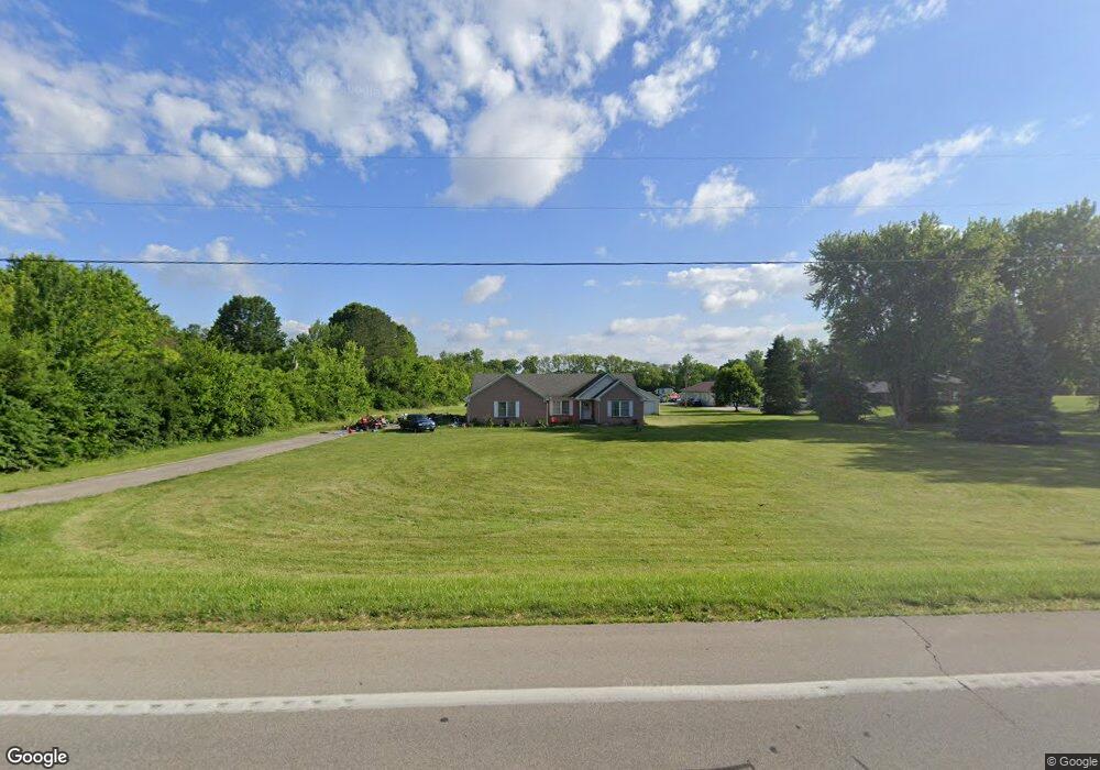
5527 E State Route 571 Tipp City, OH 45371
Estimated Value: $475,000 - $711,000
3
Beds
3
Baths
1,938
Sq Ft
$287/Sq Ft
Est. Value
About This Home
This home is located at 5527 E State Route 571, Tipp City, OH 45371 and is currently estimated at $556,239, approximately $287 per square foot. 5527 E State Route 571 is a home located in Miami County with nearby schools including Bethel Elementary School, Bethel Middle School, and Bethel High School.
Ownership History
Date
Name
Owned For
Owner Type
Purchase Details
Closed on
Dec 12, 2000
Sold by
Mantia Karen L
Bought by
Flanders Susan R
Current Estimated Value
Home Financials for this Owner
Home Financials are based on the most recent Mortgage that was taken out on this home.
Original Mortgage
$171,500
Outstanding Balance
$63,199
Interest Rate
7.7%
Mortgage Type
New Conventional
Estimated Equity
$493,040
Purchase Details
Closed on
Jun 1, 1988
Bought by
Mantia Anthony M
Create a Home Valuation Report for This Property
The Home Valuation Report is an in-depth analysis detailing your home's value as well as a comparison with similar homes in the area
Home Values in the Area
Average Home Value in this Area
Purchase History
| Date | Buyer | Sale Price | Title Company |
|---|---|---|---|
| Flanders Susan R | $64,000 | -- | |
| Mantia Anthony M | $15,000 | -- |
Source: Public Records
Mortgage History
| Date | Status | Borrower | Loan Amount |
|---|---|---|---|
| Open | Flanders Susan R | $171,500 |
Source: Public Records
Tax History Compared to Growth
Tax History
| Year | Tax Paid | Tax Assessment Tax Assessment Total Assessment is a certain percentage of the fair market value that is determined by local assessors to be the total taxable value of land and additions on the property. | Land | Improvement |
|---|---|---|---|---|
| 2024 | $5,410 | $122,640 | $44,100 | $78,540 |
| 2023 | $5,410 | $122,640 | $44,100 | $78,540 |
| 2022 | $5,445 | $122,640 | $44,100 | $78,540 |
| 2021 | $4,762 | $102,200 | $36,750 | $65,450 |
| 2020 | $4,734 | $102,200 | $36,750 | $65,450 |
| 2019 | $4,788 | $102,200 | $36,750 | $65,450 |
| 2018 | $4,550 | $83,300 | $21,980 | $61,320 |
| 2017 | $4,556 | $83,300 | $21,980 | $61,320 |
| 2016 | $4,104 | $83,300 | $21,980 | $61,320 |
| 2015 | $4,086 | $80,120 | $21,140 | $58,980 |
| 2014 | $4,086 | $80,120 | $21,140 | $58,980 |
| 2013 | $3,467 | $80,120 | $21,140 | $58,980 |
Source: Public Records
Map
Nearby Homes
- 5315 E State Route 571
- 6345 Ohio 202
- 0 Ohio 202 Unit 23014095
- 0 Ohio 202 Unit 23014098
- 0 Ohio 201
- 7817 Ohio 201
- 6570 S Tipp Cowl Rd
- 7715 E New Carlisle Rd
- 4320 Ginghamsburg West Charleston Rd
- 1037 Arbor Dr
- 7032 Honeylocust St
- 7540 Agenbroad Rd
- 4019 Lupine Way
- 4207 Forestedge St
- 7337 Ross Rd
- 1117 Honeydew Dr
- 1109 Honeydew Dr
- 36 Wilhelm St
- 423 S 2nd St
- 514 S 3rd St
- 5565 E State Route 571
- 5495 E State Route 571
- 5495 Ohio 571
- 5565 Ohio 571
- 5591 E State Route 571
- 5591 Ohio 571
- 5425 E State Route 571
- 5633 E State Route 571
- 5614 E State Route 571
- 5373 E State Route 571
- 5700 E State Route 571
- 5315 Ohio 571
- 5370 E State Route 571
- 5277 E State Route 571
- 5775 E State Route 571
- 5260 E State Route 571
- 5770 Ohio 571
- 5225 Ohio 718
- 5225 E State Route 571
- 5225 Ohio 571