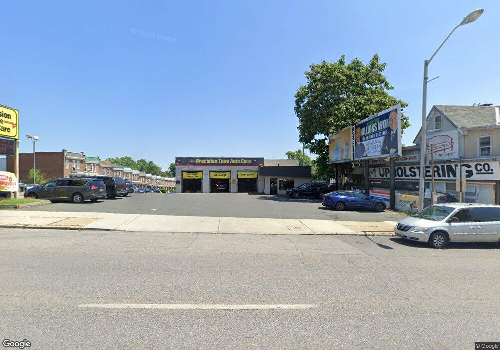
5529 Belair Rd Baltimore, MD 21206
Frankford NeighborhoodEstimated Value: $549,908
--
Bed
--
Bath
1,780
Sq Ft
$309/Sq Ft
Est. Value
About This Home
This home is located at 5529 Belair Rd, Baltimore, MD 21206 and is currently estimated at $549,908, approximately $308 per square foot. 5529 Belair Rd is a home located in Baltimore City with nearby schools including Gardenville Elementary School, Booker T. Washington Middle School, and Paul Laurence Dunbar High School.
Ownership History
Date
Name
Owned For
Owner Type
Purchase Details
Closed on
May 23, 2024
Sold by
L & L Realty Services Llc
Bought by
Mae Group Llc
Current Estimated Value
Home Financials for this Owner
Home Financials are based on the most recent Mortgage that was taken out on this home.
Original Mortgage
$450,000
Outstanding Balance
$444,087
Interest Rate
7.22%
Mortgage Type
Credit Line Revolving
Estimated Equity
$94,353
Purchase Details
Closed on
Jun 29, 2006
Sold by
Levitas Leonard
Bought by
L & L Realty Services Llc
Create a Home Valuation Report for This Property
The Home Valuation Report is an in-depth analysis detailing your home's value as well as a comparison with similar homes in the area
Home Values in the Area
Average Home Value in this Area
Purchase History
| Date | Buyer | Sale Price | Title Company |
|---|---|---|---|
| Mae Group Llc | $530,000 | The Security Title Guarantee C | |
| L & L Realty Services Llc | -- | -- |
Source: Public Records
Mortgage History
| Date | Status | Borrower | Loan Amount |
|---|---|---|---|
| Open | Mae Group Llc | $450,000 |
Source: Public Records
Tax History Compared to Growth
Tax History
| Year | Tax Paid | Tax Assessment Tax Assessment Total Assessment is a certain percentage of the fair market value that is determined by local assessors to be the total taxable value of land and additions on the property. | Land | Improvement |
|---|---|---|---|---|
| 2025 | $10,814 | $479,733 | -- | -- |
| 2024 | $10,814 | $460,400 | $116,600 | $343,800 |
| 2023 | $10,865 | $460,400 | $116,600 | $343,800 |
| 2022 | $10,865 | $460,400 | $116,600 | $343,800 |
| 2021 | $10,927 | $463,000 | $116,600 | $346,400 |
| 2020 | $10,220 | $433,033 | $0 | $0 |
| 2019 | $9,467 | $403,067 | $0 | $0 |
| 2018 | $8,805 | $373,100 | $116,600 | $256,500 |
| 2017 | $8,658 | $366,867 | $0 | $0 |
| 2016 | $5,640 | $360,633 | $0 | $0 |
| 2015 | $5,640 | $354,400 | $0 | $0 |
| 2014 | $5,640 | $315,633 | $0 | $0 |
Source: Public Records
Map
Nearby Homes
- 4217 Berger Ave
- 4216 Berger Ave
- 4204 Anntana Ave
- 4317 Berger Ave
- 4332 Berger Ave
- 5649 Kavon Ave
- 4212 Lasalle Ave
- 5602 Benton Heights Ave
- 5623 Greenhill Ave
- 5429 Belle Vista Ave
- 4111 Hamilton Ave
- 4500 Lasalle Ave
- 5410 Belle Vista Ave
- 4503 Lasalle Ave
- 4000 Echodale Ave
- 5207 Nuth Ave
- 5708 Benton Heights Ave
- 5412 Remmell Ave
- 5316 Plainfield Ave
- 4105A White Ave
- 5527 Belair Rd
- 5525 Belair Rd
- 4207 Berger Ave
- 5601 Belair Rd
- 4209 Berger Ave
- 4202 Berger Ave
- 4211 Berger Ave
- 4202 Anntana Ave
- 4204 Berger Ave
- 4206 Berger Ave
- 4213 Berger Ave
- 5523 Belair Rd
- 4208 Berger Ave
- 5603 Belair Rd
- 4215 Berger Ave
- 4210 Berger Ave
- 5512 Belair Rd
- 4206 Anntana Ave
- 5518 Belair Rd
- 5520 Belair Rd
