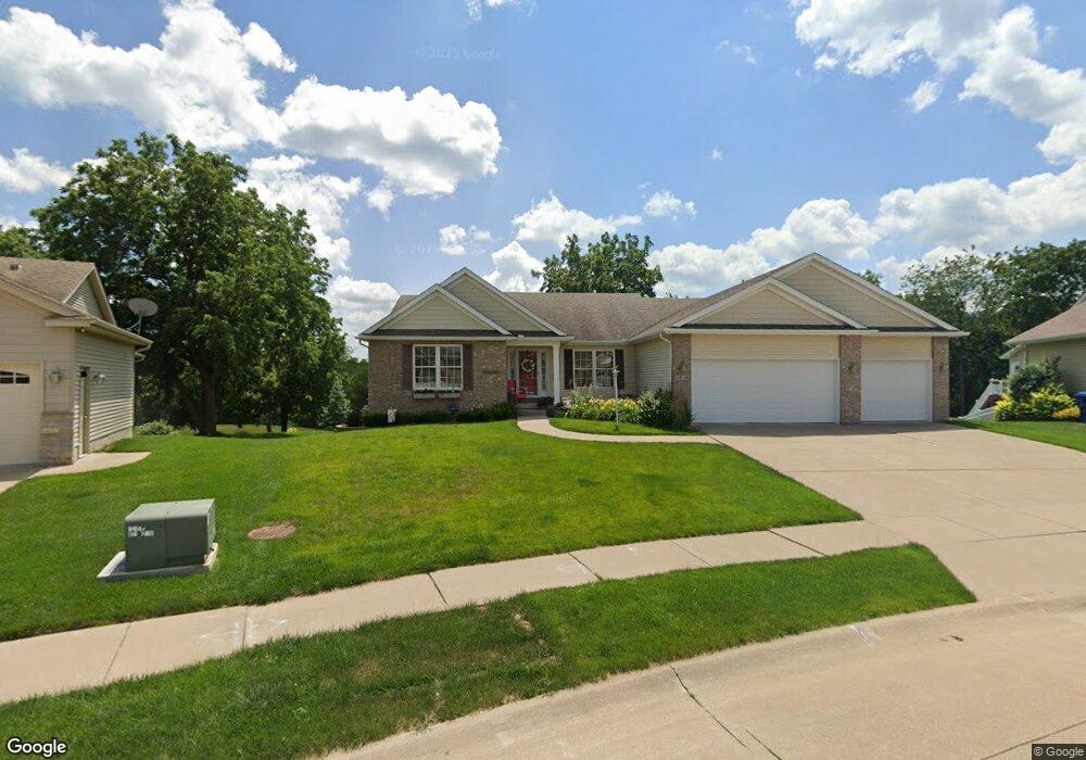
5529 Delton Dr Davenport, IA 52804
Outer Davenport/Bettendorf NeighborhoodEstimated Value: $356,000 - $401,836
3
Beds
3
Baths
1,802
Sq Ft
$206/Sq Ft
Est. Value
About This Home
This home is located at 5529 Delton Dr, Davenport, IA 52804 and is currently estimated at $370,709, approximately $205 per square foot. 5529 Delton Dr is a home located in Scott County with nearby schools including Jackson Elementary School, Frank L. Smart Intermediate School, and West High School.
Ownership History
Date
Name
Owned For
Owner Type
Purchase Details
Closed on
Jul 2, 2009
Sold by
Chuck Pekios Co
Bought by
Thronson Paul T and Thronson Geraldine W
Current Estimated Value
Home Financials for this Owner
Home Financials are based on the most recent Mortgage that was taken out on this home.
Original Mortgage
$40,000
Interest Rate
4.86%
Mortgage Type
Purchase Money Mortgage
Purchase Details
Closed on
Aug 18, 2006
Sold by
Advance Homes Inc
Bought by
Chuck Pekins Co
Create a Home Valuation Report for This Property
The Home Valuation Report is an in-depth analysis detailing your home's value as well as a comparison with similar homes in the area
Home Values in the Area
Average Home Value in this Area
Purchase History
| Date | Buyer | Sale Price | Title Company |
|---|---|---|---|
| Thronson Paul T | $315,000 | None Available | |
| Chuck Pekins Co | $177,000 | None Available |
Source: Public Records
Mortgage History
| Date | Status | Borrower | Loan Amount |
|---|---|---|---|
| Closed | Thronson Paul T | $40,000 |
Source: Public Records
Tax History Compared to Growth
Tax History
| Year | Tax Paid | Tax Assessment Tax Assessment Total Assessment is a certain percentage of the fair market value that is determined by local assessors to be the total taxable value of land and additions on the property. | Land | Improvement |
|---|---|---|---|---|
| 2024 | $5,816 | $363,650 | $69,540 | $294,110 |
| 2023 | $6,196 | $359,590 | $69,540 | $290,050 |
| 2022 | $6,222 | $302,320 | $56,500 | $245,820 |
| 2021 | $6,222 | $302,320 | $56,500 | $245,820 |
| 2020 | $6,282 | $301,310 | $56,500 | $244,810 |
| 2019 | $6,496 | $301,310 | $56,500 | $244,810 |
| 2018 | $6,352 | $301,310 | $56,500 | $244,810 |
| 2017 | $1,657 | $301,310 | $56,500 | $244,810 |
| 2016 | $6,336 | $301,310 | $0 | $0 |
| 2015 | $6,336 | $298,350 | $0 | $0 |
| 2014 | $6,432 | $295,910 | $0 | $0 |
| 2013 | $6,264 | $0 | $0 | $0 |
| 2012 | -- | $292,520 | $55,460 | $237,060 |
Source: Public Records
Map
Nearby Homes
- 1417 Rhinelander Dr
- 1515 Rhinelander Dr
- 1536 Rhinelander Dr
- 1634 Rhinelander Ct
- 1631 Westport Dr
- 5321 Friendship Dr Unit 5320
- 5521 Baraboo Ct
- 5529 Baraboo Ct
- 1729 Jenna Dr
- 5910 Austin Ave
- 4738 W 11th St
- 5908 Alec Ave
- 1210 Eagle's Crest Dr
- 4703 W 13th St
- 1335 N Utah Ave
- 4625 W 11th St
- 1310 Calvin St
- 1215 Calvin St
- 1309 Calvin St
- 2104 Blanchard Ct
- 5515 Delton Dr
- 5535 Delton Dr
- 1404 Rhinelander Dr
- 5503 Delton Dr
- 5526 Delton Dr
- 1350 Wisconsin Ave
- 1400 Rhinelander Dr
- Lot 28 Rhinelander Dr
- Lot 29 Rhinelander Dr
- 5445 Delton Dr
- 1412 Rhinelander Dr
- 1410 Racine Ct
- 5433 Delton Dr
- 1420 Rhinelander Dr
- 1403 Rhinelander Dr
- 1401 Racine Ct
- 1422 Racine Ct
- 1432 Rhinelander Dr
- 1411 Racine Ct
- 1434 Racine Ct