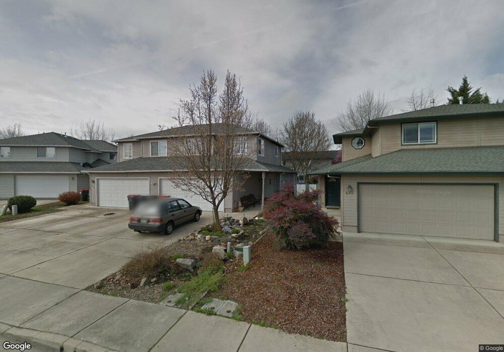
553 Brittni Ln Central Point, OR 97502
Estimated Value: $302,000 - $345,000
3
Beds
3
Baths
1,506
Sq Ft
$217/Sq Ft
Est. Value
About This Home
This home is located at 553 Brittni Ln, Central Point, OR 97502 and is currently estimated at $326,337, approximately $216 per square foot. 553 Brittni Ln is a home located in Jackson County with nearby schools including Central Point Elementary School, Scenic Middle School, and Crater High School.
Ownership History
Date
Name
Owned For
Owner Type
Purchase Details
Closed on
Nov 7, 2016
Sold by
Dye Phillip D
Bought by
Butterworth Deanne A and Butterworth Timothy S
Current Estimated Value
Purchase Details
Closed on
Jun 29, 2010
Sold by
Secretary Of Veterans Affairs
Bought by
Dye Phillip D
Home Financials for this Owner
Home Financials are based on the most recent Mortgage that was taken out on this home.
Original Mortgage
$132,795
Interest Rate
4.79%
Mortgage Type
VA
Purchase Details
Closed on
Apr 29, 2010
Sold by
Wells Fargo Bank N A
Bought by
The Secretary Of Veterans Affairs
Purchase Details
Closed on
Dec 27, 2006
Sold by
Murphy Leslie T
Bought by
Ford Anna L
Home Financials for this Owner
Home Financials are based on the most recent Mortgage that was taken out on this home.
Original Mortgage
$211,900
Interest Rate
6.22%
Mortgage Type
VA
Purchase Details
Closed on
Sep 29, 1998
Sold by
Sun Country Const & Development Inc
Bought by
Murphy Leslie T
Home Financials for this Owner
Home Financials are based on the most recent Mortgage that was taken out on this home.
Original Mortgage
$97,143
Interest Rate
6.88%
Mortgage Type
FHA
Create a Home Valuation Report for This Property
The Home Valuation Report is an in-depth analysis detailing your home's value as well as a comparison with similar homes in the area
Home Values in the Area
Average Home Value in this Area
Purchase History
| Date | Buyer | Sale Price | Title Company |
|---|---|---|---|
| Butterworth Deanne A | $131,550 | None Available | |
| Dye Phillip D | $130,000 | First American Title | |
| The Secretary Of Veterans Affairs | $132,195 | Fa | |
| Wells Fargo Bank N A | $132,195 | Fa | |
| Ford Anna L | $211,900 | Ticor Title | |
| Murphy Leslie T | $97,500 | Jackson County Title |
Source: Public Records
Mortgage History
| Date | Status | Borrower | Loan Amount |
|---|---|---|---|
| Previous Owner | Dye Phillip D | $132,795 | |
| Previous Owner | Ford Anna L | $211,900 | |
| Previous Owner | Murphy Leslie T | $97,143 |
Source: Public Records
Tax History Compared to Growth
Tax History
| Year | Tax Paid | Tax Assessment Tax Assessment Total Assessment is a certain percentage of the fair market value that is determined by local assessors to be the total taxable value of land and additions on the property. | Land | Improvement |
|---|---|---|---|---|
| 2025 | $2,935 | $176,510 | $68,190 | $108,320 |
| 2024 | $2,935 | $171,370 | $66,200 | $105,170 |
| 2023 | $2,840 | $166,380 | $64,280 | $102,100 |
| 2022 | $2,774 | $166,380 | $64,280 | $102,100 |
| 2021 | $2,695 | $161,540 | $62,400 | $99,140 |
| 2020 | $2,616 | $156,840 | $60,580 | $96,260 |
| 2019 | $2,552 | $147,850 | $57,100 | $90,750 |
| 2018 | $2,474 | $143,550 | $55,440 | $88,110 |
| 2017 | $2,412 | $143,550 | $55,440 | $88,110 |
| 2016 | $2,342 | $135,320 | $52,250 | $83,070 |
| 2015 | $2,243 | $135,320 | $52,250 | $83,070 |
| 2014 | $2,186 | $127,560 | $49,250 | $78,310 |
Source: Public Records
Map
Nearby Homes
- 928 Brandi Way
- 1060 Hopkins Rd
- 851 Juanita Way
- 571 Briarwood Dr
- 921 Pittview Ave
- 1017 Fairfield Ave
- 1025 Fairfield Ave
- 301 Freeman Rd Unit 100
- 301 Freeman Rd Unit 23
- 301 Freeman Rd Unit 85
- 230 Peninger Rd
- 555 Freeman Rd Unit 128
- 555 Freeman Rd Unit 146
- 555 Freeman Rd Unit 204
- 555 Freeman Rd Unit 209
- 3496 Edella St
- 460 Federal Way
- 1600 E Pine St
- 881 Westrop Dr
- 1840 E Pine St
- 557 Brittni Ln
- 547 Brittni Ln
- 559 Brittni Ln
- 541 Brittni Ln
- 542 Village Dr Unit 17
- 544 Village Dr Unit E18
- 562 Village Dr Unit F21
- 539 Brittni Ln
- 561 Brittni Ln
- 564 Village Dr Unit 22
- 902 Brandi Way
- 532 Village Dr Unit 13
- 532 Village Rd
- 546 Village Dr Unit E19
- 548 & 554 Brittni Ln
- 533 Brittni Ln
- 566 Village Dr Unit F23
- 534 Village Dr Unit D14
- 548 Brittni Ln
- 906 Brandi Way