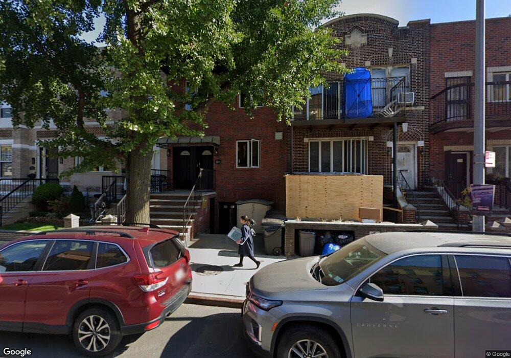
553 Dahill Rd Unit 1 Brooklyn, NY 11218
Borough Park NeighborhoodEstimated Value: $903,000 - $1,447,331
--
Bed
--
Bath
2,707
Sq Ft
$463/Sq Ft
Est. Value
About This Home
This home is located at 553 Dahill Rd Unit 1, Brooklyn, NY 11218 and is currently estimated at $1,254,583, approximately $463 per square foot. 553 Dahill Rd Unit 1 is a home located in Kings County with nearby schools including P.S./I.S. 192 Magnet School For Math And Science Inquiry, I.S. 223 The Montauk, and Franklin Delano Roosevelt High School.
Ownership History
Date
Name
Owned For
Owner Type
Purchase Details
Closed on
Jan 5, 2015
Sold by
Friedman Aron and Friedman Devorah
Bought by
Mandelbaum Hersh
Current Estimated Value
Purchase Details
Closed on
Jul 12, 2005
Sold by
Mandelbaum Hersh and Mandelbaum Pesi
Bought by
Mandelbaum Pesi
Create a Home Valuation Report for This Property
The Home Valuation Report is an in-depth analysis detailing your home's value as well as a comparison with similar homes in the area
Home Values in the Area
Average Home Value in this Area
Purchase History
| Date | Buyer | Sale Price | Title Company |
|---|---|---|---|
| Mandelbaum Hersh | -- | -- | |
| Mandelbaum Hersh | -- | -- | |
| Mandelbaum Pesi | -- | -- | |
| Mandelbaum Pesi | -- | -- |
Source: Public Records
Mortgage History
| Date | Status | Borrower | Loan Amount |
|---|---|---|---|
| Closed | Mandelbaum Pesi | $0 |
Source: Public Records
Tax History Compared to Growth
Tax History
| Year | Tax Paid | Tax Assessment Tax Assessment Total Assessment is a certain percentage of the fair market value that is determined by local assessors to be the total taxable value of land and additions on the property. | Land | Improvement |
|---|---|---|---|---|
| 2025 | $6,407 | $44,160 | $3,600 | $40,560 |
| 2024 | $6,407 | $45,912 | $3,600 | $42,312 |
| 2023 | $6,479 | $56,328 | $3,600 | $52,728 |
| 2022 | $6,321 | $51,936 | $3,600 | $48,336 |
| 2021 | $6,286 | $44,736 | $3,600 | $41,136 |
| 2020 | $2,948 | $51,224 | $3,600 | $47,624 |
| 2019 | $5,561 | $51,224 | $3,600 | $47,624 |
| 2018 | $5,419 | $26,584 | $2,522 | $24,062 |
| 2017 | $5,378 | $26,384 | $2,701 | $23,683 |
| 2016 | $4,976 | $24,891 | $3,034 | $21,857 |
| 2015 | $3,627 | $23,483 | $3,180 | $20,303 |
| 2014 | $3,627 | $22,154 | $3,600 | $18,554 |
Source: Public Records
Map
Nearby Homes
- 819 McDonald Ave
- 755 McDonald Ave
- 751 McDonald Ave
- 302 Ditmas Ave
- 304 Ditmas Ave
- 311 Ditmas Ave
- 649 E 3rd St
- 1553 39th St
- 1551 39th St
- 734 E 5th St Unit 4L
- 540 Ocean Pkwy Unit 4H
- 510 Ocean Pkwy Unit 3J
- 510 Ocean Pkwy Unit 4J
- 570 Ocean Pkwy Unit 4E
- 525 Ocean Pkwy Unit 4J
- 640 Ditmas Ave Unit 16
- 702 Ocean Pkwy Unit 1B
- 522 E 5th St
- 580 E 7th St
- 708 Ditmas Ave
- 553 Dahill Rd
- 553 Dahill Rd Unit 3
- 553 Dahill Rd Unit 2
- 555 Dahill Rd
- 551 Dahill Rd
- 557 Dahill Rd
- 549 Dahill Rd
- 547 Dahill Rd
- 563 Dahill Rd
- 563 Dahill Rd Unit 3
- 563 Dahill Rd Unit 2
- 563 Dahill Rd Unit 1
- 545 Dahill Rd
- 565 Dahill Rd
- 541 Dahill Rd
- 814-816 McDonald Ave
- 812 McDonald Ave
- 818 McDonald Ave
- 798 McDonald Ave
- 796 McDonald Ave