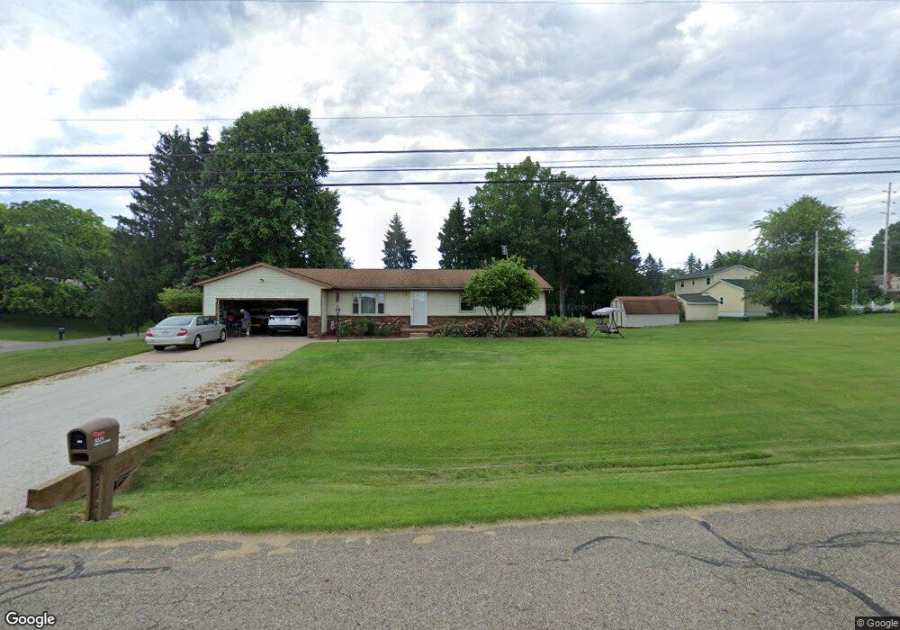
5531 Apple Ridge Cir Clinton, OH 44216
Estimated Value: $239,108 - $321,000
3
Beds
1
Bath
1,370
Sq Ft
$211/Sq Ft
Est. Value
About This Home
This home is located at 5531 Apple Ridge Cir, Clinton, OH 44216 and is currently estimated at $289,527, approximately $211 per square foot. 5531 Apple Ridge Cir is a home located in Summit County with nearby schools including Greenwood Elementary School, Green Intermediate Elementary School, and Green Primary School.
Ownership History
Date
Name
Owned For
Owner Type
Purchase Details
Closed on
Jun 22, 2022
Sold by
Durst David L
Bought by
Durst David L and Durst Kathleen M
Current Estimated Value
Create a Home Valuation Report for This Property
The Home Valuation Report is an in-depth analysis detailing your home's value as well as a comparison with similar homes in the area
Home Values in the Area
Average Home Value in this Area
Purchase History
| Date | Buyer | Sale Price | Title Company |
|---|---|---|---|
| Durst David L | -- | Flasck Legal Services |
Source: Public Records
Tax History Compared to Growth
Tax History
| Year | Tax Paid | Tax Assessment Tax Assessment Total Assessment is a certain percentage of the fair market value that is determined by local assessors to be the total taxable value of land and additions on the property. | Land | Improvement |
|---|---|---|---|---|
| 2025 | $2,983 | $72,867 | $15,936 | $56,931 |
| 2024 | $2,983 | $72,867 | $15,936 | $56,931 |
| 2023 | $2,983 | $72,867 | $15,936 | $56,931 |
| 2022 | $2,752 | $52,805 | $11,550 | $41,255 |
| 2021 | $2,579 | $52,805 | $11,550 | $41,255 |
| 2020 | $2,529 | $52,810 | $11,550 | $41,260 |
| 2019 | $2,769 | $54,190 | $9,420 | $44,770 |
| 2018 | $2,831 | $54,190 | $9,420 | $44,770 |
| 2017 | $2,496 | $54,190 | $9,420 | $44,770 |
| 2016 | $2,484 | $44,870 | $9,420 | $35,450 |
| 2015 | $2,496 | $44,870 | $9,420 | $35,450 |
| 2014 | $2,480 | $44,870 | $9,420 | $35,450 |
| 2013 | $2,573 | $46,230 | $9,420 | $36,810 |
Source: Public Records
Map
Nearby Homes
- 5626 Arlington Rd Unit 5628
- 1031 Karla Dr
- 5354 Arlington Rd
- 0 S Arlington Rd Unit 4494606
- 5052 Arlington Rd
- 8694 Candlewood Ave NW
- 8176 Staten Cir NW
- 810 Mount Pleasant St NW
- 4909 Timbercreek Cir
- 5430 Thursby Rd
- 8640 Foxglove Ave NW
- 8445 Morrilton Cir NW
- Allegheny Plan at Stoney Creek
- Lehigh Plan at Stoney Creek
- Hudson Plan at Stoney Creek
- Columbia Plan at Stoney Creek
- Aviano Plan at Stoney Creek
- 4870 Firwood Dr
- 1692 Koons Rd
- 1425 Hazeldell Dr
- 5536 Arlington Rd
- 5526 Arlington Rd
- 5509 Apple Ridge Cir
- 5530 Apple Ridge Cir
- 5520 Apple Ridge Cir
- 5516 Arlington Rd
- 5510 Apple Ridge Cir
- 5497 Apple Ridge Cir
- 5500 Apple Ridge Cir
- 1105 Apple Ridge Rd
- 5485 Apple Ridge Cir
- 5490 Apple Ridge Cir
- 5535 Arlington Rd
- 5519 Arlington Rd
- 5555 Arlington Rd
- 5505 Arlington Rd
- 5480 Apple Ridge Cir
- 1106 Apple Ridge Rd
- 5473 Apple Ridge Cir
- 5575 Arlington Rd