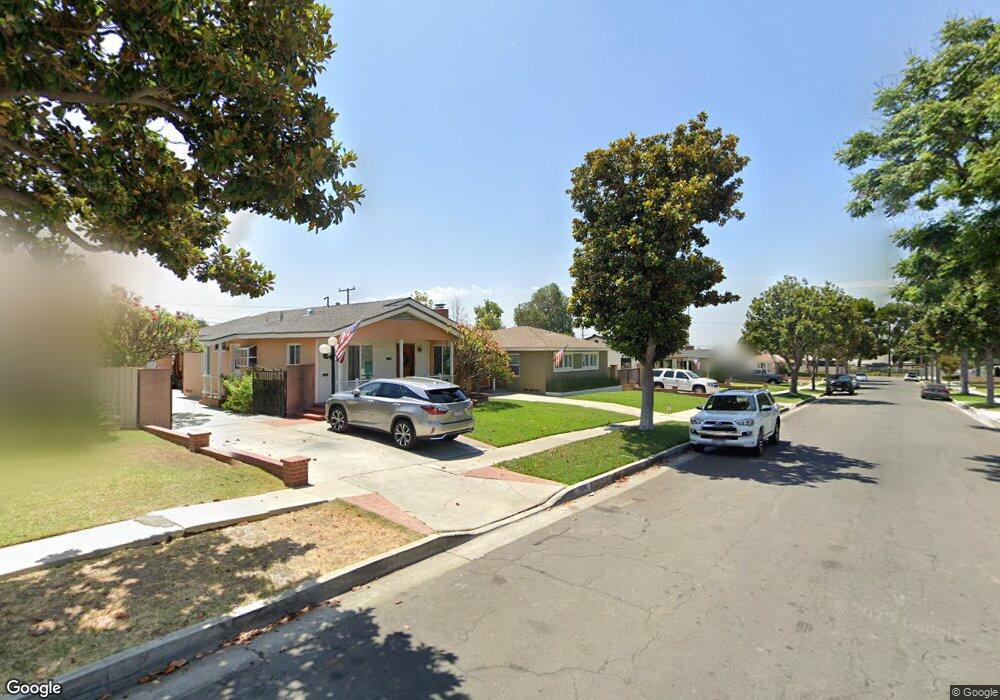
5532 Mavis Ave Whittier, CA 90601
West Whittier NeighborhoodEstimated Value: $665,214 - $727,000
2
Beds
1
Bath
931
Sq Ft
$755/Sq Ft
Est. Value
About This Home
This home is located at 5532 Mavis Ave, Whittier, CA 90601 and is currently estimated at $702,804, approximately $754 per square foot. 5532 Mavis Ave is a home located in Los Angeles County with nearby schools including Orange Grove Elementary School, Walter F. Dexter Middle School, and Whittier High School.
Ownership History
Date
Name
Owned For
Owner Type
Purchase Details
Closed on
Oct 9, 2018
Sold by
Brennan Shawn Patrick and Brennan Ann Louise
Bought by
Brennan Shawn P and Brennan Anna L
Current Estimated Value
Purchase Details
Closed on
Sep 17, 2018
Sold by
Brennan Shawn Patrick
Bought by
Brennan Shawn Patrick and Brennan Anna Louise
Purchase Details
Closed on
Sep 2, 2008
Sold by
Brennan Richard Wayne and The Richard Wayne Brennan Revo
Bought by
Brennan Richard Wayne and The Richard Wayne Brennan Revocable Tr
Purchase Details
Closed on
Aug 29, 2008
Sold by
Brennan Ricahrd Wayne
Bought by
Brennan Ricahrd Wayne and The Ricahrd Wayne Brennan Revocable Tr
Purchase Details
Closed on
Jul 3, 2008
Sold by
Brennan Richard Wayne
Bought by
Brennan Richard Wayne
Create a Home Valuation Report for This Property
The Home Valuation Report is an in-depth analysis detailing your home's value as well as a comparison with similar homes in the area
Home Values in the Area
Average Home Value in this Area
Purchase History
| Date | Buyer | Sale Price | Title Company |
|---|---|---|---|
| Brennan Shawn P | -- | None Available | |
| Brennan Shawn Patrick | -- | None Available | |
| Brennan Shawn Patrick | -- | None Available | |
| Brennan Richard Wayne | -- | None Available | |
| Brennan Ricahrd Wayne | -- | None Available | |
| Brennan Richard Wayne | -- | None Available |
Source: Public Records
Tax History
| Year | Tax Paid | Tax Assessment Tax Assessment Total Assessment is a certain percentage of the fair market value that is determined by local assessors to be the total taxable value of land and additions on the property. | Land | Improvement |
|---|---|---|---|---|
| 2025 | $1,329 | $60,483 | $27,909 | $32,574 |
| 2024 | $1,329 | $59,298 | $27,362 | $31,936 |
| 2023 | $1,340 | $58,136 | $26,826 | $31,310 |
| 2022 | $1,299 | $56,997 | $26,300 | $30,697 |
| 2021 | $1,185 | $55,881 | $25,785 | $30,096 |
| 2019 | $1,017 | $54,225 | $25,021 | $29,204 |
| 2018 | $909 | $53,163 | $24,531 | $28,632 |
| 2016 | $843 | $51,100 | $23,579 | $27,521 |
| 2015 | $844 | $50,333 | $23,225 | $27,108 |
| 2014 | $822 | $49,348 | $22,771 | $26,577 |
Source: Public Records
Map
Nearby Homes
- 5518 Rockne Ave
- 10602 Monaco Ct
- 5235 Andalucia Ct
- 5315 Bihr Ct
- 5433 Mesagrove Ave
- 10605 Cordoba Ct
- 5205 Tierra Bonita Dr
- 5029 Tierra Antigua Dr Unit 107
- 10607 Orange Dr
- 5523 Pioneer Blvd Unit 30
- 5519 Pioneer Blvd Unit 42
- 5593 Pioneer Blvd
- 5903 Redman Ave
- 5915 Morrill Ave
- 5729 Juarez Ave
- 10608 Whittier Blvd
- 11141 Dorland St
- 10853 Glencannon Dr
- 3735 Croton Ave
- 12408 Carinthia Dr
- 5538 Mavis Ave
- 5528 Mavis Ave
- 5542 Mavis Ave
- 5522 Mavis Ave
- 5531 Rockne Ave
- 5535 Rockne Ave
- 5548 Mavis Ave
- 5518 Mavis Ave
- 5525 Rockne Ave
- 5541 Rockne Ave
- 5519 Rockne Ave
- 5533 Mavis Ave
- 5547 Rockne Ave
- 5552 Mavis Ave
- 5537 Mavis Ave
- 5512 Mavis Ave
- 5527 Mavis Ave
- 5543 Mavis Ave
- 5523 Mavis Ave
- 5513 Rockne Ave
Your Personal Tour Guide
Ask me questions while you tour the home.