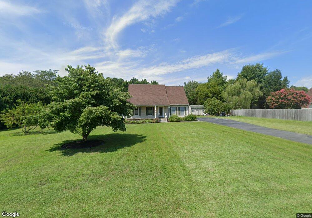
5536 Cedarcrest Rd Salisbury, MD 21801
South Salisbury NeighborhoodEstimated Value: $286,123 - $336,000
--
Bed
2
Baths
1,638
Sq Ft
$191/Sq Ft
Est. Value
About This Home
This home is located at 5536 Cedarcrest Rd, Salisbury, MD 21801 and is currently estimated at $312,531, approximately $190 per square foot. 5536 Cedarcrest Rd is a home located in Wicomico County with nearby schools including Westside Primary School, Westside Intermediate School, and Salisbury Middle School.
Ownership History
Date
Name
Owned For
Owner Type
Purchase Details
Closed on
Jan 10, 1994
Sold by
Culver Robert L
Bought by
Aebly Kenneth J and Aebly Christine
Current Estimated Value
Home Financials for this Owner
Home Financials are based on the most recent Mortgage that was taken out on this home.
Original Mortgage
$92,000
Interest Rate
7.23%
Purchase Details
Closed on
Dec 31, 1992
Sold by
High Banks Landing Inc
Bought by
Culver Robert L
Home Financials for this Owner
Home Financials are based on the most recent Mortgage that was taken out on this home.
Original Mortgage
$162,500
Interest Rate
8.14%
Purchase Details
Closed on
Oct 13, 1989
Sold by
Elzey Guy S and Elzey Beverly
Bought by
High Banks Landing Inc
Home Financials for this Owner
Home Financials are based on the most recent Mortgage that was taken out on this home.
Original Mortgage
$148,492
Interest Rate
9.95%
Create a Home Valuation Report for This Property
The Home Valuation Report is an in-depth analysis detailing your home's value as well as a comparison with similar homes in the area
Home Values in the Area
Average Home Value in this Area
Purchase History
| Date | Buyer | Sale Price | Title Company |
|---|---|---|---|
| Aebly Kenneth J | $92,000 | -- | |
| Culver Robert L | $235,000 | -- | |
| High Banks Landing Inc | $225,000 | -- |
Source: Public Records
Mortgage History
| Date | Status | Borrower | Loan Amount |
|---|---|---|---|
| Closed | Aebly Kenneth J | $92,000 | |
| Previous Owner | Culver Robert L | $162,500 | |
| Previous Owner | High Banks Landing Inc | $148,492 |
Source: Public Records
Tax History Compared to Growth
Tax History
| Year | Tax Paid | Tax Assessment Tax Assessment Total Assessment is a certain percentage of the fair market value that is determined by local assessors to be the total taxable value of land and additions on the property. | Land | Improvement |
|---|---|---|---|---|
| 2025 | $1,718 | $190,000 | $0 | $0 |
| 2024 | $1,718 | $177,100 | $0 | $0 |
| 2023 | $1,683 | $164,200 | $39,200 | $125,000 |
| 2022 | $1,696 | $160,567 | $0 | $0 |
| 2021 | $1,641 | $156,933 | $0 | $0 |
| 2020 | $1,641 | $153,300 | $35,200 | $118,100 |
| 2019 | $1,653 | $152,200 | $0 | $0 |
| 2018 | $1,649 | $151,100 | $0 | $0 |
| 2017 | $1,638 | $150,000 | $0 | $0 |
| 2016 | -- | $149,067 | $0 | $0 |
| 2015 | $1,650 | $148,133 | $0 | $0 |
| 2014 | $1,650 | $147,200 | $0 | $0 |
Source: Public Records
Map
Nearby Homes
- 26298 High Banks Dr
- 26694 Pemberton Dr
- 0 King Stuart Dr Unit MDWC2018516
- 26244 Kensington Ln
- 5474 Royal Mile Blvd
- 5688 Kirkpatrick Ct
- 5461 Loch Ness Terrace
- LOT 19 Brandywood Ln
- Lot #8 Arrowwood Ct
- 5709 Royal Mile Blvd
- 5088 Sailfish Dr
- 5437 Nithsdale Dr
- 5006 Ladys Ct
- 5991 Hounds Bay Cir
- 26882 Pratt Rd
- 5686 N Nithsdale Dr Unit N
- 5541 E Nithsdale Dr
- 6151 Trails End Ct
- 26924 Black Horse Run
- 6177 Ayrshire Dr
- 26521 Pemberton Dr
- 5520 Cedarcrest Rd
- 26515 Pemberton Dr
- 5541 N Upper Ferry Rd
- 5525 N Upper Ferry Rd
- 26503 Pemberton Dr
- 5508 Cedarcrest Rd
- 5515 N Upper Ferry Rd
- 5494 Cedarcrest Rd
- 5503 N Upper Ferry Rd
- 5538 N Upper Ferry Rd
- 26479 Pemberton Dr
- 5508 N Upper Ferry Rd
- 26512 Riverbank Rd
- 26490 Riverbank Rd
- 26478 Pemberton Dr
- 26454 Pemberton Dr
- 26535 Riverbank Rd
- 26525 Riverbank Rd
- 26559 Riverbank Rd