Estimated Value: $472,946 - $1,679,000
5
Beds
6
Baths
3,592
Sq Ft
$304/Sq Ft
Est. Value
About This Home
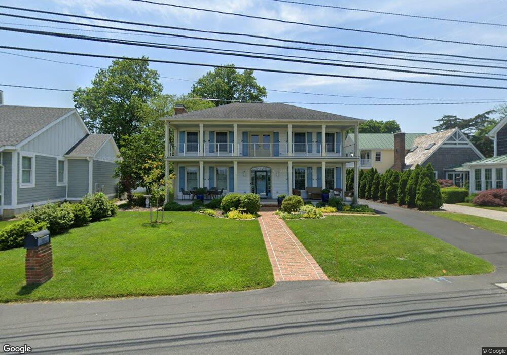
This home is located at 554 Pilottown Rd, Lewes, DE 19958 and is currently estimated at $1,090,987, approximately $303 per square foot. 554 Pilottown Rd is a home located in Sussex County with nearby schools including Lewes Elementary School, Mariner Middle School, and Cape Henlopen High School.
Ownership History
Date
Name
Owned For
Owner Type
Purchase Details
Closed on
Jul 3, 2018
Sold by
Kileen Debra M
Bought by
Wagner Geoffrey C and Wagner Jennifer D
Current Estimated Value
Home Financials for this Owner
Home Financials are based on the most recent Mortgage that was taken out on this home.
Original Mortgage
$1,430,000
Outstanding Balance
$1,227,278
Interest Rate
4.5%
Mortgage Type
New Conventional
Estimated Equity
-$136,291
Purchase Details
Closed on
Aug 20, 1996
Bought by
Killeen Vincent B and Killeen Debra M
Create a Home Valuation Report for This Property
The Home Valuation Report is an in-depth analysis detailing your home's value as well as a comparison with similar homes in the area
Home Values in the Area
Average Home Value in this Area
Purchase History
| Date | Buyer | Sale Price | Title Company |
|---|---|---|---|
| Wagner Geoffrey C | $1,930 | -- | |
| Killeen Vincent B | -- | -- |
Source: Public Records
Mortgage History
| Date | Status | Borrower | Loan Amount |
|---|---|---|---|
| Open | Wagner Geoffrey C | $1,430,000 |
Source: Public Records
Tax History Compared to Growth
Tax History
| Year | Tax Paid | Tax Assessment Tax Assessment Total Assessment is a certain percentage of the fair market value that is determined by local assessors to be the total taxable value of land and additions on the property. | Land | Improvement |
|---|---|---|---|---|
| 2025 | $2,319 | $59,400 | $7,050 | $52,350 |
| 2024 | $2,928 | $59,400 | $7,050 | $52,350 |
| 2023 | $2,925 | $59,400 | $7,050 | $52,350 |
| 2022 | $2,823 | $59,400 | $7,050 | $52,350 |
| 2021 | $2,797 | $59,400 | $7,050 | $52,350 |
| 2020 | $2,789 | $59,400 | $7,050 | $52,350 |
| 2019 | $2,793 | $59,400 | $7,050 | $52,350 |
| 2018 | $2,609 | $59,400 | $0 | $0 |
| 2017 | $2,498 | $59,400 | $0 | $0 |
| 2016 | $2,373 | $59,400 | $0 | $0 |
| 2015 | $2,256 | $59,400 | $0 | $0 |
| 2014 | $2,239 | $59,100 | $0 | $0 |
Source: Public Records
Map
Nearby Homes
- 157 Tyler's Cir Unit 15
- 165 Tyler's Cir
- The Bethany Plan at Fisher's Cove
- Cassidy Plan at Fisher's Cove
- 159 Tylers Cir Unit 14
- 149 Jacks Way Unit 18
- 131 New Rd
- 1710 Bay Ave
- 5 Clayton Ave
- 310 Burton Ave Unit A
- 4 Clayton Ave
- 422 Burton Ave
- 322 Captains Cir
- 325 Captains Cir
- 305 Seagull Dr
- 240 2nd St
- 228 2nd St
- 225 2nd St
- Lot 3 N Mulberry St
- Lot 4 Mulberry St
- 550 Pilottown Rd
- 558 Pilottown Rd
- 551 Pilottown Rd
- 1 Harborview Rd
- 1 Harborview Rd
- 2 Harborview Rd
- 570 Pilottown Rd
- 534 Pilottown Rd
- 1 Hoornkill Ave
- 530 Pilottown Rd
- 3 Harborview Rd
- 580 Pilottown Rd
- 3 Hoornkill Ave
- 526 Pilottown Rd
- 6 Carey Ln
- 582 Pilottown Rd
- 5 Harborview Rd
- 2 Hoornkill Ave
- 2 Hoornkill Ave
- 2 Hoornkill Ave