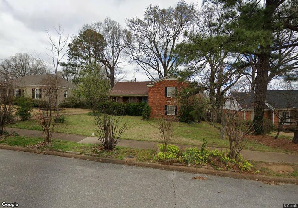
5540 Barfield Rd Memphis, TN 38120
Audubon Park NeighborhoodEstimated Value: $409,817 - $443,000
4
Beds
3
Baths
2,552
Sq Ft
$167/Sq Ft
Est. Value
About This Home
This home is located at 5540 Barfield Rd, Memphis, TN 38120 and is currently estimated at $427,204, approximately $167 per square foot. 5540 Barfield Rd is a home located in Shelby County with nearby schools including Richland Elementary School, White Station Middle, and White Station High.
Ownership History
Date
Name
Owned For
Owner Type
Purchase Details
Closed on
Aug 27, 2009
Sold by
Brown Joel M and Brown Kristie E Sutterman
Bought by
Benson Peter and Benson Martina
Current Estimated Value
Home Financials for this Owner
Home Financials are based on the most recent Mortgage that was taken out on this home.
Original Mortgage
$198,475
Outstanding Balance
$129,802
Interest Rate
5.19%
Mortgage Type
New Conventional
Estimated Equity
$297,402
Purchase Details
Closed on
Apr 13, 2005
Sold by
Weeks Paul L and Weeks Mary Betts
Bought by
Brown Joel M and Sutterman Kristie E
Home Financials for this Owner
Home Financials are based on the most recent Mortgage that was taken out on this home.
Original Mortgage
$201,400
Interest Rate
5.74%
Mortgage Type
Fannie Mae Freddie Mac
Create a Home Valuation Report for This Property
The Home Valuation Report is an in-depth analysis detailing your home's value as well as a comparison with similar homes in the area
Home Values in the Area
Average Home Value in this Area
Purchase History
| Date | Buyer | Sale Price | Title Company |
|---|---|---|---|
| Benson Peter | $233,500 | None Available | |
| Brown Joel M | $212,000 | -- |
Source: Public Records
Mortgage History
| Date | Status | Borrower | Loan Amount |
|---|---|---|---|
| Open | Benson Peter | $198,475 | |
| Previous Owner | Brown Joel M | $201,400 |
Source: Public Records
Tax History Compared to Growth
Tax History
| Year | Tax Paid | Tax Assessment Tax Assessment Total Assessment is a certain percentage of the fair market value that is determined by local assessors to be the total taxable value of land and additions on the property. | Land | Improvement |
|---|---|---|---|---|
| 2025 | $2,740 | $105,975 | $19,125 | $86,850 |
| 2024 | $2,740 | $80,825 | $19,125 | $61,700 |
| 2023 | $4,924 | $80,825 | $19,125 | $61,700 |
| 2022 | $4,924 | $80,825 | $19,125 | $61,700 |
| 2021 | $4,981 | $80,825 | $19,125 | $61,700 |
| 2020 | $4,491 | $61,975 | $15,900 | $46,075 |
| 2019 | $4,491 | $61,975 | $15,900 | $46,075 |
| 2018 | $4,491 | $61,975 | $15,900 | $46,075 |
| 2017 | $2,547 | $61,975 | $15,900 | $46,075 |
| 2016 | $2,254 | $51,575 | $0 | $0 |
| 2014 | $2,254 | $51,575 | $0 | $0 |
Source: Public Records
Map
Nearby Homes
- 5504 Normandy Rd
- 5649 Normandy Rd
- 5429 Normandy Rd
- 221 N Yates Rd
- 5575 Walnut Grove Rd
- 5681 Normandy Rd
- 5532 Gwynne Rd
- 5676 Walnut Grove Place
- 5429 Walnut Grove Rd
- 5690 Walnut Grove Rd
- 5360 Normandy Ave
- 5702 Buxbriar Ave
- 5385 Walnut Grove Rd
- 19 E Yates Rd S
- 5704 Ashbriar Ave
- 5737 Buxbriar Ave
- 5395 Gwynne Rd
- 5680 N Angela Rd
- 50 Grove Dale St
- 5468 Mason Rd
- 5532 Barfield Rd
- 5548 Barfield Rd
- 5545 Rich Rd
- 5537 Rich Rd
- 5524 Barfield Rd
- 5556 Barfield Rd
- 5553 Rich Rd
- 5529 Rich Rd
- 5539 Barfield Rd
- 5547 Barfield Rd
- 5531 Barfield Rd
- 5516 Barfield Rd
- 5564 Barfield Rd
- 5561 Rich Rd
- 5521 Rich Rd
- 5523 Barfield Rd
- 5515 Barfield Rd
- 5563 Barfield Rd
- 5569 Rich Rd
- 5572 Barfield Rd