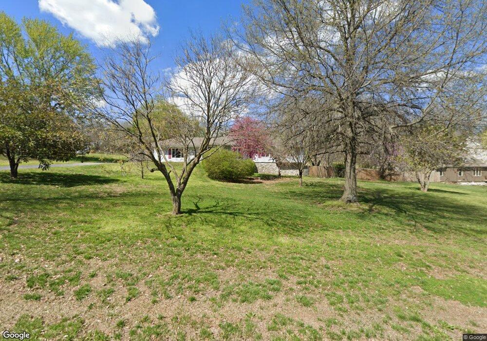
5543 E Bennett St Springfield, MO 65809
Southeast Springfield NeighborhoodEstimated Value: $299,000 - $444,000
3
Beds
3
Baths
3,148
Sq Ft
$125/Sq Ft
Est. Value
About This Home
This home is located at 5543 E Bennett St, Springfield, MO 65809 and is currently estimated at $391,938, approximately $124 per square foot. 5543 E Bennett St is a home located in Greene County with nearby schools including Hickory Hills K-8 School and Glendale High School.
Ownership History
Date
Name
Owned For
Owner Type
Purchase Details
Closed on
Jan 18, 2008
Sold by
Lasalla Bank Na
Bought by
Wilks John M and Wilks Joyce F
Current Estimated Value
Home Financials for this Owner
Home Financials are based on the most recent Mortgage that was taken out on this home.
Original Mortgage
$96,000
Outstanding Balance
$60,566
Interest Rate
6.15%
Mortgage Type
Future Advance Clause Open End Mortgage
Estimated Equity
$331,372
Purchase Details
Closed on
Sep 25, 2006
Sold by
L.C Kozeny and L.C Mccbbin
Bought by
Laselle Bank Na Series 2003-Bc11
Create a Home Valuation Report for This Property
The Home Valuation Report is an in-depth analysis detailing your home's value as well as a comparison with similar homes in the area
Home Values in the Area
Average Home Value in this Area
Purchase History
| Date | Buyer | Sale Price | Title Company |
|---|---|---|---|
| Wilks John M | -- | None Available | |
| Laselle Bank Na Series 2003-Bc11 | $118,152 | None Available |
Source: Public Records
Mortgage History
| Date | Status | Borrower | Loan Amount |
|---|---|---|---|
| Open | Wilks John M | $96,000 |
Source: Public Records
Tax History
| Year | Tax Paid | Tax Assessment Tax Assessment Total Assessment is a certain percentage of the fair market value that is determined by local assessors to be the total taxable value of land and additions on the property. | Land | Improvement |
|---|---|---|---|---|
| 2025 | $2,320 | $44,770 | $8,440 | $36,330 |
| 2024 | $2,315 | $41,580 | $8,440 | $33,140 |
| 2023 | $2,199 | $41,580 | $8,440 | $33,140 |
| 2022 | $1,966 | $36,220 | $8,440 | $27,780 |
| 2021 | $1,966 | $36,220 | $8,440 | $27,780 |
| 2020 | $1,963 | $34,490 | $8,440 | $26,050 |
| 2019 | $1,909 | $34,490 | $8,440 | $26,050 |
| 2018 | $1,595 | $28,830 | $8,440 | $20,390 |
| 2017 | $1,580 | $26,430 | $8,440 | $17,990 |
| 2016 | $1,448 | $26,430 | $8,440 | $17,990 |
| 2015 | $1,437 | $26,430 | $8,440 | $17,990 |
| 2014 | $1,378 | $26,400 | $8,440 | $17,960 |
Source: Public Records
Map
Nearby Homes
- 1410 S Briar Ave
- 1430 S Jameston Rd
- 5956 E Sumac Ln
- 1643 S Crepe Myrtle Ln
- 1619 S Crepe Myrtle Ln
- 1626 S Pinecone Path
- 1627 S Crepe Myrtle Ln
- 1608 S Crepe Myrtle Ln
- 1646 S Pinecone Path
- 1634 S Pinecone Path
- 1601 S Crepe Myrtle Ln
- Lot 12 S Markham Ct
- 751 S Farm Road 197
- Tract 3 S Farm Road 199
- 2149 S Cedar Hill Ave
- 846 White Diamond Ct
- 4728 E Forest Trails Dr Unit Lot 29
- 4748 Forest Trails Dr
- Lot 12 Farm Road 134
- 2173 S Pin Oak Dr
- 5561 E Bennett St
- 5525 E Bennett St
- 5509 E Bennett St
- 1411 S Briar Ave
- 5611 E Bennett St
- 5608 E Bennett St
- 1410 S Jameston Rd
- 1321 S Berkshire Ave
- 1287 S Berkshire Ave
- 1431 S Briar Ave
- 1430 S Briar Ave
- 5479 E Bennett St
- 1307 S Berkshire Ave
- 5626 E Bennett St
- 1411 S Jameston Rd
- 5637 E Bennett St
- 1263 S Berkshire Ave
- 1449 S Briar Ave
- 5443 E Bennett St
- 5636 E Meadowmere St
Your Personal Tour Guide
Ask me questions while you tour the home.