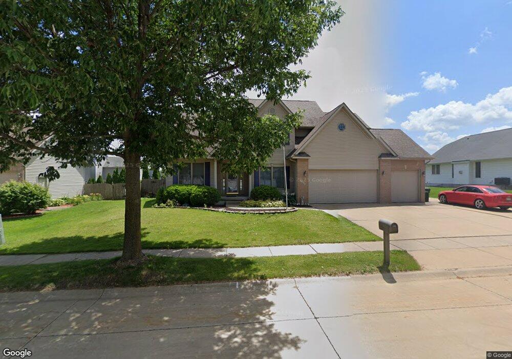
5547 Shawnee Dr Davenport, IA 52804
Outer Davenport/Bettendorf NeighborhoodEstimated Value: $394,000 - $462,000
5
Beds
8
Baths
2,786
Sq Ft
$155/Sq Ft
Est. Value
About This Home
This home is located at 5547 Shawnee Dr, Davenport, IA 52804 and is currently estimated at $432,533, approximately $155 per square foot. 5547 Shawnee Dr is a home located in Scott County with nearby schools including Walnut Hill Elementary School, South Christian Elementary School, and Frank L. Smart Intermediate School.
Ownership History
Date
Name
Owned For
Owner Type
Purchase Details
Closed on
Dec 17, 2010
Sold by
Germann Steven H and Germann Carla J
Bought by
Tan Cuc and Tan Christina
Current Estimated Value
Home Financials for this Owner
Home Financials are based on the most recent Mortgage that was taken out on this home.
Original Mortgage
$216,000
Outstanding Balance
$142,707
Interest Rate
4.22%
Mortgage Type
New Conventional
Estimated Equity
$289,826
Create a Home Valuation Report for This Property
The Home Valuation Report is an in-depth analysis detailing your home's value as well as a comparison with similar homes in the area
Home Values in the Area
Average Home Value in this Area
Purchase History
| Date | Buyer | Sale Price | Title Company |
|---|---|---|---|
| Tan Cuc | $270,000 | None Available |
Source: Public Records
Mortgage History
| Date | Status | Borrower | Loan Amount |
|---|---|---|---|
| Open | Tan Cuc | $216,000 |
Source: Public Records
Tax History Compared to Growth
Tax History
| Year | Tax Paid | Tax Assessment Tax Assessment Total Assessment is a certain percentage of the fair market value that is determined by local assessors to be the total taxable value of land and additions on the property. | Land | Improvement |
|---|---|---|---|---|
| 2025 | $7,052 | $438,950 | $63,920 | $375,030 |
| 2024 | $6,914 | $404,860 | $63,920 | $340,940 |
| 2023 | $7,264 | $406,880 | $63,920 | $342,960 |
| 2022 | $6,568 | $348,970 | $51,940 | $297,030 |
| 2021 | $6,568 | $315,000 | $51,940 | $263,060 |
| 2020 | $7,010 | $315,000 | $51,940 | $263,060 |
| 2019 | $7,246 | $331,440 | $51,940 | $279,500 |
| 2018 | $6,726 | $331,440 | $51,940 | $279,500 |
| 2017 | $1,752 | $315,000 | $51,940 | $263,060 |
| 2016 | $6,688 | $314,130 | $0 | $0 |
| 2015 | $6,688 | $311,420 | $0 | $0 |
| 2014 | $6,722 | $273,960 | $0 | $0 |
| 2013 | $5,784 | $0 | $0 | $0 |
| 2012 | -- | $283,590 | $50,980 | $232,610 |
Source: Public Records
Map
Nearby Homes
- 1422 Racine Ct
- 5529 Baraboo Ct
- 5321 Friendship Dr Unit 5320
- 1729 Jenna Dr
- 5910 Austin Ave
- 5908 Alec Ave
- 4738 W 11th St
- 6225 W Locust St
- 1210 Eagle's Crest Dr
- 4703 W 13th St
- 4836 W Pleasant St
- 4501 W 14th St
- 1312 Emerald Dr
- 2218 Emerald Dr
- 2025 Emerald Dr
- 1310 Calvin St
- 1215 Calvin St
- 1139 Calvin St
- 2230 Emerald Dr
- 4017 W 13th St
- 5529 Shawnee Dr
- 1545 Rhinelander Dr
- 1450 Racine Ct
- 1620 Greenbay Ct
- 1620 Green Bay Ct
- 5515 Shawnee Dr
- 1613 Rhinelander Ct
- 1442 Racine Ct
- 1621 Rhinelander Ct
- 1626 Greenbay Ct
- 5433 Shawnee Dr
- 1542 Rhinelander Dr
- Lot 23 Shawnee Dr
- Lot 13 Shawnee Dr
- Lot 15 Shawnee Dr
- Lot 14 Shawnee Dr
- Lot 12 Shawnee Dr
- 1626 Green Bay Ct
- 1434 Racine Ct
- 1612 Rhinelander Ct