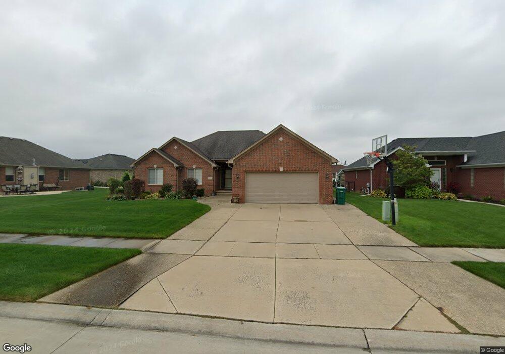
55483 Frost Dr Macomb, MI 48042
Estimated Value: $454,000 - $473,000
--
Bed
2
Baths
1,975
Sq Ft
$235/Sq Ft
Est. Value
About This Home
This home is located at 55483 Frost Dr, Macomb, MI 48042 and is currently estimated at $463,177, approximately $234 per square foot. 55483 Frost Dr is a home located in Macomb County with nearby schools including New Haven High School, St. Peter Lutheran School, and Lutheran North High School.
Ownership History
Date
Name
Owned For
Owner Type
Purchase Details
Closed on
Aug 17, 2022
Sold by
Daristotile Renato M and Daristotile Arica
Bought by
Renato And Arica Daristotile Living Trust
Current Estimated Value
Purchase Details
Closed on
Mar 27, 2008
Sold by
Brookshire Development Llc
Bought by
Daristotile Renato M and Daristotile Arica
Purchase Details
Closed on
Feb 28, 2006
Sold by
Ograndviii Lp
Bought by
Brookshire Development Llc and Nardone Homes Inc
Create a Home Valuation Report for This Property
The Home Valuation Report is an in-depth analysis detailing your home's value as well as a comparison with similar homes in the area
Home Values in the Area
Average Home Value in this Area
Purchase History
| Date | Buyer | Sale Price | Title Company |
|---|---|---|---|
| Renato And Arica Daristotile Living Trust | -- | None Listed On Document | |
| Daristotile Renato M | $70,000 | Metropolitan Title Company | |
| Brookshire Development Llc | -- | Metropolitan Title Company | |
| Brookshire Development Llc | $84,000 | Greco |
Source: Public Records
Tax History Compared to Growth
Tax History
| Year | Tax Paid | Tax Assessment Tax Assessment Total Assessment is a certain percentage of the fair market value that is determined by local assessors to be the total taxable value of land and additions on the property. | Land | Improvement |
|---|---|---|---|---|
| 2025 | $6,110 | $222,500 | $0 | $0 |
| 2024 | $2,639 | $212,000 | $0 | $0 |
| 2023 | $2,501 | $202,600 | $0 | $0 |
| 2022 | $5,173 | $173,700 | $0 | $0 |
| 2021 | $5,342 | $163,800 | $0 | $0 |
| 2020 | $2,299 | $152,300 | $0 | $0 |
| 2019 | $4,793 | $146,200 | $0 | $0 |
| 2018 | $4,649 | $139,000 | $0 | $0 |
| 2017 | $4,648 | $130,880 | $32,000 | $98,880 |
| 2016 | $4,049 | $130,870 | $0 | $0 |
| 2015 | $3,869 | $115,740 | $0 | $0 |
| 2014 | $3,869 | $105,060 | $19,000 | $86,060 |
| 2013 | $1,850 | $105,060 | $0 | $0 |
Source: Public Records
Map
Nearby Homes
- 19376 Ryan Dr
- 19364 Ryan Dr
- 55614 Estates Ln
- 19340 Ryan Dr
- 54689 Ann Dr
- 54763 Brenda Dr
- 19178 Paddington Ln
- 56470 Leeds Ln
- 19097 Paddington Ln
- 55144 Saint Paul Dr
- 19059 Thompson Dr
- 55203 Saint Paul Dr
- 18727 Saint Matthew Dr
- 56452 Scotland
- 55813 Stewart Dr
- 55789 Stewart Dr
- 18620 Stallmann Dr
- 18544 Stallman Dr
- 56543 Hastings Dr
- 18298 Tiger Dr
- 55511 Frost Dr
- 20323 Lansbury Dr
- 20351 Lansbury Dr
- 20295 Lansbury Dr
- 55537 Frost Dr
- 55532 Fallbrooke Dr
- 55504 Fallbrooke Dr
- 20267 Lansbury Dr
- 55496 Frost Dr
- 55565 Frost Dr
- 55560 Fallbrooke Dr
- 55524 Frost Dr
- 55468 Frost Dr
- 55440 Frost Dr
- 55552 Frost Dr
- 55588 Fallbrooke Dr
- 20310 Lansbury Dr
- 55593 Frost Dr
- 20338 Lansbury Dr
- 20366 Lansbury Dr