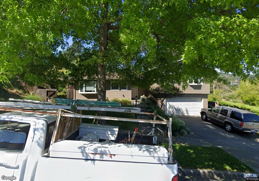
555 Montecillo Rd San Rafael, CA 94903
Terra Linda NeighborhoodEstimated Value: $1,089,000 - $1,399,000
3
Beds
3
Baths
1,803
Sq Ft
$695/Sq Ft
Est. Value
About This Home
This home is located at 555 Montecillo Rd, San Rafael, CA 94903 and is currently estimated at $1,253,375, approximately $695 per square foot. 555 Montecillo Rd is a home located in Marin County with nearby schools including Vallecito Elementary School, Miller Creek Middle School, and Terra Linda High School.
Ownership History
Date
Name
Owned For
Owner Type
Purchase Details
Closed on
May 16, 2025
Sold by
James Walter Rice and James Marie Sophia
Bought by
James Walter Rice And Marie Sophia Rice Survi and Rice
Current Estimated Value
Purchase Details
Closed on
Jan 29, 2019
Sold by
Rice James W and Rice Marie Sophia
Bought by
Rice James Walter and Rice Marie Sophia
Create a Home Valuation Report for This Property
The Home Valuation Report is an in-depth analysis detailing your home's value as well as a comparison with similar homes in the area
Home Values in the Area
Average Home Value in this Area
Purchase History
| Date | Buyer | Sale Price | Title Company |
|---|---|---|---|
| James Walter Rice And Marie Sophia Rice Survi | -- | None Listed On Document | |
| Rice James Walter | -- | None Available |
Source: Public Records
Tax History
| Year | Tax Paid | Tax Assessment Tax Assessment Total Assessment is a certain percentage of the fair market value that is determined by local assessors to be the total taxable value of land and additions on the property. | Land | Improvement |
|---|---|---|---|---|
| 2025 | $5,315 | $273,674 | $73,219 | $200,455 |
| 2024 | $4,841 | $268,309 | $71,783 | $196,526 |
| 2023 | $4,742 | $263,048 | $70,376 | $192,672 |
| 2022 | $4,508 | $257,890 | $68,996 | $188,894 |
| 2021 | $4,273 | $252,834 | $67,643 | $185,191 |
| 2020 | $4,234 | $250,243 | $66,950 | $183,293 |
| 2019 | $3,953 | $245,336 | $65,637 | $179,699 |
| 2018 | $3,895 | $240,526 | $64,350 | $176,176 |
| 2017 | $3,719 | $235,810 | $63,089 | $172,721 |
| 2016 | $3,612 | $231,187 | $61,852 | $169,335 |
| 2015 | $3,464 | $227,714 | $60,923 | $166,791 |
| 2014 | $3,194 | $223,254 | $59,729 | $163,525 |
Source: Public Records
Map
Nearby Homes
- 94 Forest Ln
- 89 Forest Ln
- 19 Surrey Ln
- 632 Bamboo Terrace
- 952 Lea Dr Unit 30
- 212 Sylvia Way
- 405 Sylvia Way
- 750 Montecillo Rd
- 776 Montecillo Rd
- 876 Las Ovejas Ave
- 841 Montecillo Rd
- 829 Del Ganado Rd
- 100 Thorndale Dr Unit 125
- 100 Thorndale Dr Unit 327
- 100 Thorndale Dr Unit 233
- 100 Thorndale Dr Unit 116
- 100 Thorndale Dr Unit 106
- 100 Thorndale Dr Unit 353
- 100 Thorndale Dr Unit 360
- 861 Del Ganado Rd
- 551 Montecillo Rd
- 567 Montecillo Rd
- 549 Montecillo Rd
- 560 Montecillo Rd
- 556 Montecillo Rd
- 564 Montecillo Rd
- 106 Forest Ln Unit 122
- 552 Montecillo Rd
- 100 Forest Ln Unit 123
- 118 Forest Ln
- 575 Montecillo Rd
- 116 Forest Ln
- 104 Forest Ln
- 102 Forest Ln
- 570 Montecillo Rd
- 548 Montecillo Rd
- 131 Surrey Ln
- 114 Forest Ln
- 543 Montecillo Rd
- 98 Forest Ln Unit 120
Your Personal Tour Guide
Ask me questions while you tour the home.