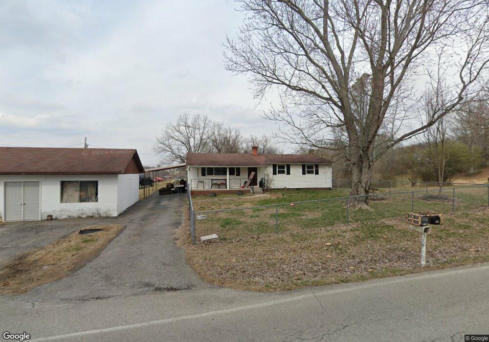
5550 Loudon Ridge Rd Loudon, TN 37774
Estimated Value: $163,454 - $255,000
--
Bed
1
Bath
784
Sq Ft
$253/Sq Ft
Est. Value
About This Home
This home is located at 5550 Loudon Ridge Rd, Loudon, TN 37774 and is currently estimated at $198,614, approximately $253 per square foot. 5550 Loudon Ridge Rd is a home located in Loudon County with nearby schools including Loudon High School.
Ownership History
Date
Name
Owned For
Owner Type
Purchase Details
Closed on
Nov 21, 2019
Sold by
Henry Family Properties Llc
Bought by
Dinh Van Huong and Nguyen Thi Thanh Uyen
Current Estimated Value
Purchase Details
Closed on
Apr 12, 2019
Sold by
Henry Family Properties Llc
Bought by
Thornton Matthew Gene
Home Financials for this Owner
Home Financials are based on the most recent Mortgage that was taken out on this home.
Original Mortgage
$112,100
Interest Rate
4.3%
Mortgage Type
New Conventional
Purchase Details
Closed on
Aug 10, 2005
Sold by
Homer Nix
Bought by
Steven Nix
Create a Home Valuation Report for This Property
The Home Valuation Report is an in-depth analysis detailing your home's value as well as a comparison with similar homes in the area
Home Values in the Area
Average Home Value in this Area
Purchase History
| Date | Buyer | Sale Price | Title Company |
|---|---|---|---|
| Dinh Van Huong | $172,742 | Tennessee Valley Ttl Ins Co | |
| Thornton Matthew Gene | $124,650 | Tennessee Valley Ttl Ins Co | |
| Steven Nix | -- | -- |
Source: Public Records
Mortgage History
| Date | Status | Borrower | Loan Amount |
|---|---|---|---|
| Previous Owner | Thornton Matthew Gene | $112,100 |
Source: Public Records
Tax History Compared to Growth
Tax History
| Year | Tax Paid | Tax Assessment Tax Assessment Total Assessment is a certain percentage of the fair market value that is determined by local assessors to be the total taxable value of land and additions on the property. | Land | Improvement |
|---|---|---|---|---|
| 2025 | $277 | $18,250 | $3,175 | $15,075 |
| 2023 | $277 | $18,250 | $0 | $0 |
| 2022 | $277 | $18,250 | $3,175 | $15,075 |
| 2021 | $277 | $18,250 | $3,175 | $15,075 |
| 2020 | $213 | $18,250 | $3,175 | $15,075 |
| 2019 | $213 | $11,800 | $2,700 | $9,100 |
| 2018 | $213 | $11,800 | $2,700 | $9,100 |
| 2017 | $213 | $11,800 | $2,700 | $9,100 |
| 2016 | $199 | $10,725 | $2,700 | $8,025 |
| 2015 | $199 | $10,725 | $2,700 | $8,025 |
| 2014 | $199 | $10,725 | $2,700 | $8,025 |
Source: Public Records
Map
Nearby Homes
- 1731 Vonore Rd
- 14 Clear Branch Rd
- 561 Robinson Dr
- 1429 Grove St
- 6224 Get Good Hollow Rd
- 280 Robinson Trail
- 101 Pear Tree Ln
- 1.4ac Clear Branch Rd
- 100 Riverview Dr
- 119 Upper St
- 7171 Vonore Rd
- 739 Ferry St
- 1114 Welch Ave
- 1108 Welch Ave
- 501 Ferry St
- 902 Rosedale Ave
- 305 Church St
- 104 Church St
- 806 Commerce St
- 171 Trail View Dr
- 5742 Loudon Ridge Rd
- 393 Littleton Dr
- 825 Littleton Dr
- 881 Littleton Dr
- 0 Lake Ferry Dr Unit 1097256
- 0 Bay Creek Dr Unit 1069549
- 0 Lake Ferry Dr Unit 1057089
- 824 Littleton Dr
- 180 Littleton Dr
- 0 N Hwy 72 Unit 671082
- 0 N Hwy 72 Unit 857361
- 0 N Hwy 72 Unit 918099
- 0 N Hwy 72 Unit 931544
- 0 N Hwy 72 Unit 1096731
- 0 N Hwy 72 Unit 1132097
- 0 N Hwy 72 Unit 980138
- 0 N Hwy 72 Unit 1057390
- 0 N Hwy 72 Unit 1173716
- 0 Littleton Dr Unit 589245
- 0 Littleton Dr