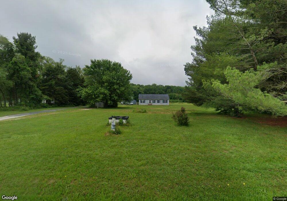
5552 Sandtown Rd Felton, DE 19943
Estimated Value: $368,227 - $412,000
3
Beds
2
Baths
1,548
Sq Ft
$257/Sq Ft
Est. Value
About This Home
This home is located at 5552 Sandtown Rd, Felton, DE 19943 and is currently estimated at $397,557, approximately $256 per square foot. 5552 Sandtown Rd is a home located in Kent County with nearby schools including Lake Forest North Elementary School, Lake Forest Central Elementary School, and W.T. Chipman Middle School.
Ownership History
Date
Name
Owned For
Owner Type
Purchase Details
Closed on
Jun 18, 2021
Sold by
Hershberger Darla M
Bought by
Hershberger Darla M
Current Estimated Value
Home Financials for this Owner
Home Financials are based on the most recent Mortgage that was taken out on this home.
Original Mortgage
$150,000
Outstanding Balance
$131,513
Interest Rate
2.9%
Mortgage Type
New Conventional
Estimated Equity
$266,044
Purchase Details
Closed on
Aug 1, 1994
Bought by
Hershberger Darla M and Zitter Frank J
Create a Home Valuation Report for This Property
The Home Valuation Report is an in-depth analysis detailing your home's value as well as a comparison with similar homes in the area
Home Values in the Area
Average Home Value in this Area
Purchase History
| Date | Buyer | Sale Price | Title Company |
|---|---|---|---|
| Hershberger Darla M | -- | None Available | |
| Hershberger Darla M | $54,000 | -- |
Source: Public Records
Mortgage History
| Date | Status | Borrower | Loan Amount |
|---|---|---|---|
| Open | Hershberger Darla M | $150,000 |
Source: Public Records
Tax History Compared to Growth
Tax History
| Year | Tax Paid | Tax Assessment Tax Assessment Total Assessment is a certain percentage of the fair market value that is determined by local assessors to be the total taxable value of land and additions on the property. | Land | Improvement |
|---|---|---|---|---|
| 2025 | $1,192 | $321,200 | $103,000 | $218,200 |
| 2024 | $1,192 | $321,200 | $103,000 | $218,200 |
| 2023 | $1,085 | $44,400 | $10,900 | $33,500 |
| 2022 | $973 | $44,400 | $10,900 | $33,500 |
| 2021 | $922 | $44,400 | $10,900 | $33,500 |
| 2020 | $961 | $44,400 | $10,900 | $33,500 |
| 2019 | $962 | $44,400 | $10,900 | $33,500 |
| 2018 | $952 | $44,400 | $10,900 | $33,500 |
| 2017 | $989 | $44,400 | $0 | $0 |
| 2016 | $386 | $17,700 | $0 | $0 |
| 2015 | $367 | $17,700 | $0 | $0 |
| 2014 | $362 | $17,700 | $0 | $0 |
Source: Public Records
Map
Nearby Homes
- 4841 Sandtown Rd
- Lot 18 Burnite Mill Rd
- Lot 17 Burnite Mill Rd
- Lot 16 Burnite Mill Rd
- 302 Woodsedge Ln
- 9507 Burnite Mill Rd
- 0 Black Swamp Rd
- 115 W High St
- 216 W High St
- 700-769 Sandtown Rd
- 3705 Firetower Rd
- 25 E High St
- 897 Horsepen Rd
- 2821 Sandtown Rd
- 1406 Turkey Point Rd
- 5403 Willow Grove Rd
- Lot #1 S Dupont Hwy
- 622 Henry Cowgill Rd
- 47 Refuge Run
- 10289 S Dupont Hwy
- 5496 Sandtown Rd
- 5587 Sandtown Rd
- 5566 Sandtown Rd
- 5618 Sandtown Rd Unit 2
- 5618 Sandtown Rd
- 5468 Sandtown Rd
- 5430 Sandtown Rd
- 5459 Sandtown Rd
- 5619 Sandtown Rd
- 5645 Sandtown Rd
- 5394 Sandtown Rd
- 5531 Sandtown Rd
- 5431 Sandtown Rd
- 5665 Sandtown Rd
- 5698 Sandtown Rd
- 5374 Sandtown Rd
- 5411 Sandtown Rd
- 5709 Sandtown Rd
- 5375 Sandtown Rd
- 5732 Sandtown Rd