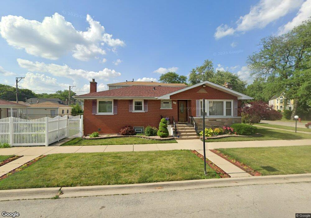
556 E 94th St Chicago, IL 60619
Roseland NeighborhoodEstimated Value: $205,000 - $298,000
3
Beds
1
Bath
1,255
Sq Ft
$185/Sq Ft
Est. Value
About This Home
This home is located at 556 E 94th St, Chicago, IL 60619 and is currently estimated at $231,643, approximately $184 per square foot. 556 E 94th St is a home located in Cook County with nearby schools including Gillespie Elementary School, Harlan Community Academy High School, and Christian S T E M Scholars.
Ownership History
Date
Name
Owned For
Owner Type
Purchase Details
Closed on
Oct 10, 1998
Sold by
Bankers Trust Co Of California Na
Bought by
Dean Michelle J
Current Estimated Value
Home Financials for this Owner
Home Financials are based on the most recent Mortgage that was taken out on this home.
Original Mortgage
$70,000
Interest Rate
6.81%
Purchase Details
Closed on
Jun 29, 1992
Sold by
Va
Bought by
Dean Marc E
Home Financials for this Owner
Home Financials are based on the most recent Mortgage that was taken out on this home.
Original Mortgage
$62,200
Interest Rate
8.5%
Mortgage Type
VA
Create a Home Valuation Report for This Property
The Home Valuation Report is an in-depth analysis detailing your home's value as well as a comparison with similar homes in the area
Home Values in the Area
Average Home Value in this Area
Purchase History
| Date | Buyer | Sale Price | Title Company |
|---|---|---|---|
| Dean Michelle J | -- | -- | |
| Dean Marc E | $65,001 | -- |
Source: Public Records
Mortgage History
| Date | Status | Borrower | Loan Amount |
|---|---|---|---|
| Previous Owner | Dean Michelle J | $70,000 | |
| Previous Owner | Dean Marc E | $62,200 |
Source: Public Records
Tax History Compared to Growth
Tax History
| Year | Tax Paid | Tax Assessment Tax Assessment Total Assessment is a certain percentage of the fair market value that is determined by local assessors to be the total taxable value of land and additions on the property. | Land | Improvement |
|---|---|---|---|---|
| 2024 | $1,903 | $12,200 | $4,185 | $8,015 |
| 2023 | $1,830 | $13,000 | $5,580 | $7,420 |
| 2022 | $1,830 | $13,000 | $5,580 | $7,420 |
| 2021 | $1,811 | $13,000 | $5,580 | $7,420 |
| 2020 | $1,695 | $11,331 | $4,464 | $6,867 |
| 2019 | $1,675 | $12,452 | $4,464 | $7,988 |
| 2018 | $1,645 | $12,452 | $4,464 | $7,988 |
| 2017 | $2,561 | $15,272 | $3,906 | $11,366 |
| 2016 | $2,559 | $15,272 | $3,906 | $11,366 |
| 2015 | $2,318 | $15,272 | $3,906 | $11,366 |
| 2014 | $1,768 | $12,095 | $3,348 | $8,747 |
| 2013 | $1,722 | $12,095 | $3,348 | $8,747 |
Source: Public Records
Map
Nearby Homes
- 9311 S Burnside Ave
- 9418 S Champlain Ave
- 9302 S Eberhart Ave
- 9425 S Vernon Ave
- 605 E 92nd Place
- 627 E 92nd Place
- 9300 S Vernon Ave
- 9326 S King Dr
- 710 E 95th St
- 728 E 95th St
- 9220 S King Dr
- 730 E 95th St
- 543 E 91st Place
- 9400 S Calumet Ave
- 9422 S Calumet Ave
- 9456 S Calumet Ave
- 9259 S Cottage Grove Ave
- 549 E 91st St
- 521 E 91st St
- 715 E 91st Place
- 9352 S Saint Lawrence Ave
- 9348 S Saint Lawrence Ave
- 9346 S St Lawrence Ave
- 9346 S Saint Lawrence Ave
- 557 E 94th St
- 9357 S Rhodes Ave
- 9342 S Saint Lawrence Ave
- 9355 S Rhodes Ave
- 9353 S Rhodes Ave
- 9355 S Saint Lawrence Ave
- 9349 S Rhodes Ave
- 9340 S Saint Lawrence Ave
- 9361 S St Lawrence Ave
- 9347 S Rhodes Ave
- 9401 S Rhodes Ave
- 9408 S Saint Lawrence Ave
- 9359 S Saint Lawrence Ave
- 9353 S Saint Lawrence Ave
- 9361 S Saint Lawrence Ave
- 9403 S Saint Lawrence Ave