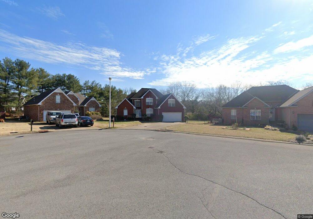
556 Forrest Pointe Dr Murfreesboro, TN 37130
Estimated Value: $419,674 - $476,000
--
Bed
4
Baths
2,165
Sq Ft
$207/Sq Ft
Est. Value
About This Home
This home is located at 556 Forrest Pointe Dr, Murfreesboro, TN 37130 and is currently estimated at $448,919, approximately $207 per square foot. 556 Forrest Pointe Dr is a home located in Rutherford County with nearby schools including Black Fox Elementary School, Christiana Middle School, and Riverdale High School.
Ownership History
Date
Name
Owned For
Owner Type
Purchase Details
Closed on
May 24, 2016
Sold by
Saysanadasy Chome
Bought by
Saysandasy Tracy
Current Estimated Value
Purchase Details
Closed on
May 6, 1997
Sold by
Williams Jerry L
Bought by
Saysanadasy and Tracy
Purchase Details
Closed on
Aug 7, 1995
Sold by
Landmark Homes Of Tenn Inc
Bought by
Todd Tanney
Purchase Details
Closed on
May 22, 1995
Sold by
Landmark Homes Of Tenn Inc
Bought by
Landmark Homes Of Tenn Inc
Purchase Details
Closed on
Sep 6, 1994
Sold by
Forrest Partnership
Bought by
Landmark Homes Of Tenn Inc
Create a Home Valuation Report for This Property
The Home Valuation Report is an in-depth analysis detailing your home's value as well as a comparison with similar homes in the area
Home Values in the Area
Average Home Value in this Area
Purchase History
| Date | Buyer | Sale Price | Title Company |
|---|---|---|---|
| Saysandasy Tracy | -- | -- | |
| Saysanadasy | $150,000 | -- | |
| Todd Tanney | $139,025 | -- | |
| Landmark Homes Of Tenn Inc | $17,900 | -- | |
| Landmark Homes Of Tenn Inc | -- | -- |
Source: Public Records
Tax History Compared to Growth
Tax History
| Year | Tax Paid | Tax Assessment Tax Assessment Total Assessment is a certain percentage of the fair market value that is determined by local assessors to be the total taxable value of land and additions on the property. | Land | Improvement |
|---|---|---|---|---|
| 2025 | $2,408 | $85,125 | $13,750 | $71,375 |
| 2024 | $2,408 | $85,125 | $13,750 | $71,375 |
| 2023 | $1,597 | $85,125 | $13,750 | $71,375 |
| 2022 | $1,376 | $85,125 | $13,750 | $71,375 |
| 2021 | $1,119 | $50,425 | $10,625 | $39,800 |
| 2020 | $1,119 | $50,425 | $10,625 | $39,800 |
| 2019 | $1,119 | $50,425 | $10,625 | $39,800 |
| 2018 | $1,538 | $50,425 | $0 | $0 |
| 2017 | $1,563 | $40,225 | $0 | $0 |
| 2016 | $1,563 | $40,225 | $0 | $0 |
| 2015 | $1,563 | $40,225 | $0 | $0 |
| 2014 | $1,000 | $40,225 | $0 | $0 |
| 2013 | -- | $40,250 | $0 | $0 |
Source: Public Records
Map
Nearby Homes
- 610 Messick Ct
- 1341 Shearron Ct
- 710 Saratoga Dr
- 1280 Middle Tennessee Blvd Unit C2
- 1280 Middle Tennessee Blvd Unit D6
- 1118 Houston Dr
- 1103 Virginia Ave
- 1016 Silver Point Dr
- 923 SE Broad St Unit 4
- 1003 Tyler Ct
- 411 Tremont Dr
- 1315 Bradyville Pike Unit 2
- 1315 Bradyville Pike Unit 1
- 602 Johnson St
- 706 Mars St
- 1103 S Baird Ln
- 1330 Eagle St
- 1326 Atlas St
- 1518 Cameron Ct
- 1302 Dr Martin Luther King Blvd Unit 26
- 562 Forrest Pointe Dr
- 550 Forrest Pointe Dr
- 602 Saratoga Dr
- 568 Forrest Pointe Dr
- 544 Forrest Pointe Dr
- 606 Saratoga Dr
- 574 Forrest Pointe Dr
- 603 Saratoga Dr
- 557 Forrest Pointe Dr
- 538 Forrest Pointe Dr
- 551 Forrest Pointe Dr
- 602 Messick Ct
- 607 Saratoga Dr
- 604 Messick Ct
- 610 Saratoga Dr
- 1446 Anita Ct
- 532 Forrest Pointe Dr
- 608 Messick Ct
- 545 Forrest Pointe Dr
- 614 Messick Ct