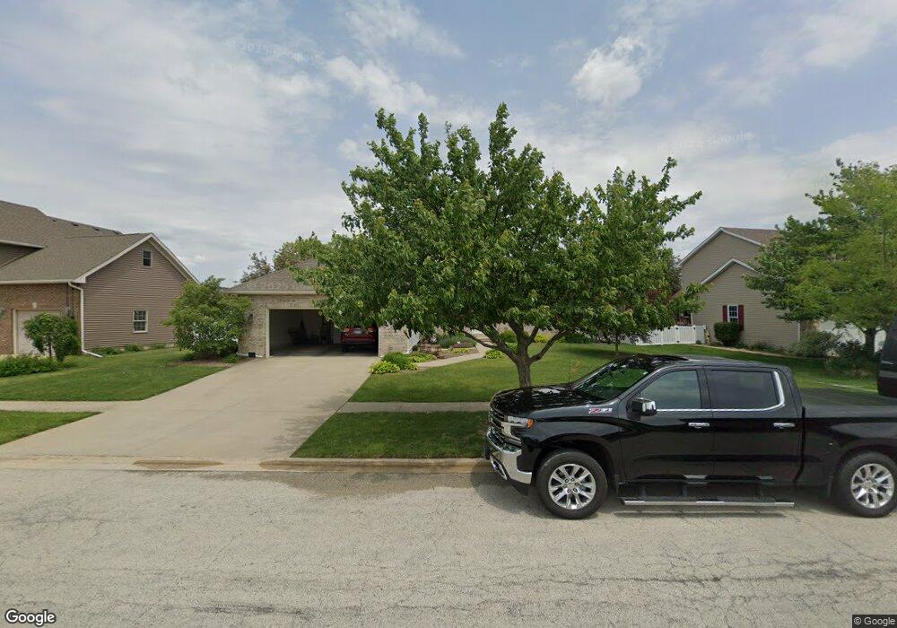
556 Highpoint Cir N Bourbonnais, IL 60914
Estimated Value: $335,000 - $354,000
3
Beds
2
Baths
1,750
Sq Ft
$197/Sq Ft
Est. Value
About This Home
This home is located at 556 Highpoint Cir N, Bourbonnais, IL 60914 and is currently estimated at $344,484, approximately $196 per square foot. 556 Highpoint Cir N is a home located in Kankakee County with nearby schools including Noel Levasseur Elementary School, Liberty Intermediate School, and Bourbonnais Upper Grade Center.
Ownership History
Date
Name
Owned For
Owner Type
Purchase Details
Closed on
Dec 22, 2006
Sold by
Fourth Generation Builders
Bought by
Murtha Michael J and Murtha Angela R
Current Estimated Value
Home Financials for this Owner
Home Financials are based on the most recent Mortgage that was taken out on this home.
Original Mortgage
$185,000
Outstanding Balance
$110,914
Interest Rate
6.36%
Mortgage Type
New Conventional
Estimated Equity
$233,570
Create a Home Valuation Report for This Property
The Home Valuation Report is an in-depth analysis detailing your home's value as well as a comparison with similar homes in the area
Home Values in the Area
Average Home Value in this Area
Purchase History
| Date | Buyer | Sale Price | Title Company |
|---|---|---|---|
| Murtha Michael J | $235,500 | Standard Title |
Source: Public Records
Mortgage History
| Date | Status | Borrower | Loan Amount |
|---|---|---|---|
| Open | Murtha Michael J | $185,000 |
Source: Public Records
Tax History
| Year | Tax Paid | Tax Assessment Tax Assessment Total Assessment is a certain percentage of the fair market value that is determined by local assessors to be the total taxable value of land and additions on the property. | Land | Improvement |
|---|---|---|---|---|
| 2024 | $7,583 | $102,559 | $12,030 | $90,529 |
| 2023 | $6,706 | $92,521 | $11,139 | $81,382 |
| 2022 | $6,226 | $83,630 | $10,736 | $72,894 |
| 2021 | $5,985 | $80,392 | $10,500 | $69,892 |
| 2020 | $5,914 | $78,240 | $10,219 | $68,021 |
| 2019 | $5,775 | $75,961 | $9,921 | $66,040 |
| 2018 | $5,523 | $72,943 | $9,774 | $63,169 |
| 2017 | $5,849 | $71,164 | $9,536 | $61,628 |
| 2016 | $5,689 | $69,511 | $9,395 | $60,116 |
| 2015 | $5,671 | $68,514 | $9,302 | $59,212 |
| 2014 | $5,499 | $69,124 | $9,302 | $59,822 |
| 2013 | -- | $70,732 | $9,302 | $61,430 |
Source: Public Records
Map
Nearby Homes
- 521 Highpoint Cir N
- 1582 Mid Court Dr
- 172 Anita Dr
- 1356 Eagle Bluff Dr
- 220 Kathy Dr
- 1313 Eagle Bluff Dr
- 22 Emery Dr
- 1230 Eagle Bluff Dr
- 605 Chase Ct
- 471 Spring Park Loop
- 501 Spring Park Loop
- 859 Pheasant Run
- 9 Hilltop Dr
- 5659 N 1000 West Rd
- 1533 Stefanie Ln
- 1565 Stefanie Ln
- 1 Saint Francis Dr
- 490 Meadows Rd N
- 375 Meadows Rd N
- 30 Saint Pauls Dr
- 542 Highpoint Cir N
- 570 Highpoint Cir N
- 390 Centerpoint Dr S
- 528 Highpoint Cir N
- 396 Centerpoint Dr S
- 384 Centerpoint Dr S
- 565 Highpoint Cir N
- 555 Highpoint Cir N
- 547 Highpoint Cir N
- 514 Highpoint Cir N
- 485 Highpoint Cir S
- 575 Highpoint Cir N
- 378 Centerpoint Dr S
- 539 Highpoint Cir N
- 395 Centerpoint Dr N
- 529 Highpoint Cir N
- 465 Halfway Rd
- 500 Highpoint Cir N
- 465 Highpoint Cir S
- 372 Centerpoint Dr S
Your Personal Tour Guide
Ask me questions while you tour the home.