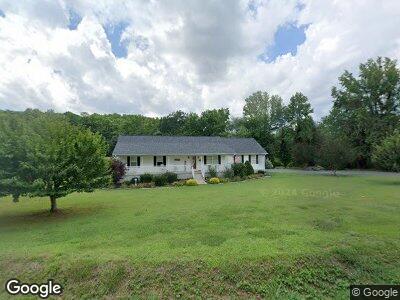
556 Owl Nest Rd Landrum, SC 29356
Estimated Value: $456,128 - $788,000
5
Beds
4
Baths
2,490
Sq Ft
$233/Sq Ft
Est. Value
About This Home
This home is located at 556 Owl Nest Rd, Landrum, SC 29356 and is currently estimated at $579,282, approximately $232 per square foot. 556 Owl Nest Rd is a home located in Spartanburg County with nearby schools including O.P. Earle Elementary School, Landrum Middle School, and Landrum High School.
Ownership History
Date
Name
Owned For
Owner Type
Purchase Details
Closed on
Oct 16, 2009
Sold by
Price Sonya C and Price Brian T
Bought by
Allen Andrew Tate and Allen Cherlon Wood
Current Estimated Value
Home Financials for this Owner
Home Financials are based on the most recent Mortgage that was taken out on this home.
Original Mortgage
$237,649
Interest Rate
5.04%
Mortgage Type
New Conventional
Create a Home Valuation Report for This Property
The Home Valuation Report is an in-depth analysis detailing your home's value as well as a comparison with similar homes in the area
Home Values in the Area
Average Home Value in this Area
Purchase History
| Date | Buyer | Sale Price | Title Company |
|---|---|---|---|
| Allen Andrew Tate | $235,000 | -- | |
| Price Sonya C | -- | -- |
Source: Public Records
Mortgage History
| Date | Status | Borrower | Loan Amount |
|---|---|---|---|
| Open | Smith Carl Maskell | $220,000 | |
| Closed | Allen Andrew Tate | $237,649 | |
| Previous Owner | Price Brian T | $200,000 | |
| Previous Owner | Price Brian T | $70,000 | |
| Previous Owner | Price Brian T | $94,000 |
Source: Public Records
Tax History Compared to Growth
Tax History
| Year | Tax Paid | Tax Assessment Tax Assessment Total Assessment is a certain percentage of the fair market value that is determined by local assessors to be the total taxable value of land and additions on the property. | Land | Improvement |
|---|---|---|---|---|
| 2024 | $2,774 | $14,680 | $1,632 | $13,048 |
| 2023 | $2,774 | $14,680 | $1,632 | $13,048 |
| 2022 | $2,594 | $13,468 | $1,224 | $12,244 |
| 2021 | $2,594 | $13,468 | $1,224 | $12,244 |
| 2020 | $2,562 | $13,468 | $1,224 | $12,244 |
| 2019 | $2,562 | $12,650 | $1,150 | $11,500 |
| 2018 | $2,397 | $12,650 | $1,150 | $11,500 |
| 2017 | $2,067 | $11,000 | $1,016 | $9,984 |
| 2016 | $7,188 | $16,500 | $1,524 | $14,976 |
| 2015 | $1,684 | $8,116 | $1,016 | $7,100 |
| 2014 | $1,389 | $8,116 | $1,016 | $7,100 |
Source: Public Records
Map
Nearby Homes
- 101 Moccasin Way
- 0 N Blackstock Rd
- 00 Hawk Springs Dr
- 557 Landseer Dr
- 553 Landseer Dr
- 569 Landseer Dr
- 561 Landseer Dr
- 573 Landseer Dr
- 565 Landseer Dr
- 226 State Road S-42-2985
- 140 Clearwater Rd
- 112 Highway 14 W
- 1515 S Blackstock Rd
- 395 Mountainview Rd
- 395 Mountainview Rd Unit 395 Mountainview Roa
- 601 W Rutherford St
- 620 Oak Grove Rd
- 500 W Rutherford St
- 208 W Durham St
- 110 Goforth Rd
- 556 Owl Nest Rd
- 556 Owl Nest Rd
- 555 Owl Nest Rd
- 558 Owl Nest Rd
- 560 Owl Nest Rd Unit 566
- 528 Owl Nest Rd
- 547 Owl Nest Rd
- 566 Owl Nest Rd
- 571 Owl Nest Rd
- 1001 Highway 14 W
- 925 Highway 14 W
- 515 Owl Nest Rd
- 202 Lexington Rd
- 1010 Highway 14 W
- 250 Lexington Rd
- 1029 Highway 14 W
- 205 Lexington Rd
- 285 Lexington Rd
- 250 State Road S-42-865
- 312 Lexington Rd