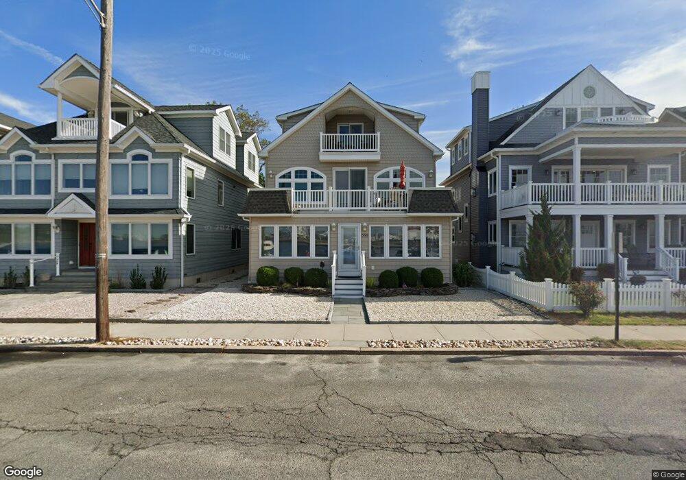
556 Riverside Dr Unit Summer-25 Manasquan, NJ 08736
Estimated Value: $1,699,000 - $2,839,000
4
Beds
5
Baths
2,815
Sq Ft
$854/Sq Ft
Est. Value
About This Home
This home is located at 556 Riverside Dr Unit Summer-25, Manasquan, NJ 08736 and is currently estimated at $2,403,694, approximately $853 per square foot. 556 Riverside Dr Unit Summer-25 is a home located in Monmouth County with nearby schools including Manasquan Elementary School, Manasquan High School, and St. Peter School.
Ownership History
Date
Name
Owned For
Owner Type
Purchase Details
Closed on
May 6, 2024
Sold by
Day Dennis A and Day Janice O
Bought by
Beatus Llc
Current Estimated Value
Purchase Details
Closed on
Jun 6, 2006
Sold by
Pursel Harry S
Bought by
Day Dennis A and Day Janice O
Home Financials for this Owner
Home Financials are based on the most recent Mortgage that was taken out on this home.
Original Mortgage
$600,000
Interest Rate
6.62%
Mortgage Type
New Conventional
Purchase Details
Closed on
Feb 24, 2006
Sold by
American Timber Co
Bought by
Pursel Ii Harry S and Pursel Joan
Home Financials for this Owner
Home Financials are based on the most recent Mortgage that was taken out on this home.
Original Mortgage
$712,500
Interest Rate
8%
Mortgage Type
Adjustable Rate Mortgage/ARM
Create a Home Valuation Report for This Property
The Home Valuation Report is an in-depth analysis detailing your home's value as well as a comparison with similar homes in the area
Home Values in the Area
Average Home Value in this Area
Purchase History
| Date | Buyer | Sale Price | Title Company |
|---|---|---|---|
| Beatus Llc | $2,550,000 | Acres Land Title | |
| Beatus Llc | $2,550,000 | Acres Land Title | |
| Day Dennis A | $1,050,000 | -- | |
| Pursel Ii Harry S | $675,000 | -- |
Source: Public Records
Mortgage History
| Date | Status | Borrower | Loan Amount |
|---|---|---|---|
| Previous Owner | Day Dennis A | $600,000 | |
| Previous Owner | Pursel Ii Harry S | $712,500 |
Source: Public Records
Tax History Compared to Growth
Tax History
| Year | Tax Paid | Tax Assessment Tax Assessment Total Assessment is a certain percentage of the fair market value that is determined by local assessors to be the total taxable value of land and additions on the property. | Land | Improvement |
|---|---|---|---|---|
| 2025 | $18,404 | $1,035,100 | $595,000 | $440,100 |
| 2024 | $17,711 | $1,035,100 | $595,000 | $440,100 |
| 2023 | $17,711 | $1,035,100 | $595,000 | $440,100 |
| 2022 | $17,038 | $1,035,100 | $595,000 | $440,100 |
| 2021 | $17,038 | $1,035,100 | $595,000 | $440,100 |
| 2020 | $16,810 | $1,035,100 | $595,000 | $440,100 |
| 2019 | $16,179 | $1,035,100 | $595,000 | $440,100 |
| 2018 | $15,816 | $1,035,100 | $595,000 | $440,100 |
| 2017 | $15,216 | $1,035,100 | $595,000 | $440,100 |
| 2016 | $15,073 | $1,035,100 | $595,000 | $440,100 |
| 2015 | $15,318 | $896,300 | $554,000 | $342,300 |
| 2014 | $13,255 | $776,500 | $554,000 | $222,500 |
Source: Public Records
Map
Nearby Homes
- 563 Trout Ave
- 23 Ocean Ave N
- 521 Brielle Rd
- 109 Boardwalk
- 226 3rd Ave
- 207 4th Ave
- 2 Beachcomber Ln Unit 7-2
- 6 Beachcomber Ln Unit 6
- 580 E Main St Unit 4
- 1A Water St
- 22 Crescent Dr
- 17 Crescent Dr
- 149 Glimmer Glass Cir
- 10 Brunswick Place
- 202 Yale Ave
- 216 Ocean Ave
- 504 Green Ave
- 222 Ocean Ave
- 25 Niblick St
- 43 Pearce Ct
- 556 Riverside Dr
- 554 Riverside Dr
- 560 Riverside Dr
- 550 Riverside Dr
- 564 Riverside Dr
- 566 Riverside Dr
- 548 Riverside Dr
- 563 Perch Ave
- 559 Perch Ave
- 569 1/2 Perch Ave
- 565 Perch Ave
- 569 Perch Ave
- 555 Perch Ave
- 568 Riverside Dr
- 553 Perch Ave
- 573 1/2 Perch Ave
- 573 Perch Ave
- 551 Perch Ave
- 407 Beachfront
- 419 Beachfront