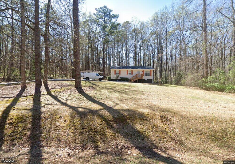
5565 Denson Blvd Morrow, GA 30260
Estimated Value: $119,497 - $198,000
3
Beds
1
Bath
936
Sq Ft
$163/Sq Ft
Est. Value
About This Home
This home is located at 5565 Denson Blvd, Morrow, GA 30260 and is currently estimated at $152,374, approximately $162 per square foot. 5565 Denson Blvd is a home located in Clayton County with nearby schools including Thurgood Marshall Elementary School, Morrow Middle School, and Morrow High School.
Ownership History
Date
Name
Owned For
Owner Type
Purchase Details
Closed on
Sep 30, 1998
Sold by
Puccio John and Puccio Broome, W
Bought by
Britten Kelly A
Current Estimated Value
Home Financials for this Owner
Home Financials are based on the most recent Mortgage that was taken out on this home.
Original Mortgage
$59,472
Outstanding Balance
$11,959
Interest Rate
6.8%
Mortgage Type
FHA
Estimated Equity
$140,415
Purchase Details
Closed on
Oct 7, 1997
Sold by
Prenell Louis D
Bought by
Contimortgage Corp
Create a Home Valuation Report for This Property
The Home Valuation Report is an in-depth analysis detailing your home's value as well as a comparison with similar homes in the area
Purchase History
| Date | Buyer | Sale Price | Title Company |
|---|---|---|---|
| Britten Kelly A | $60,000 | -- | |
| Contimortgage Corp | $50,000 | -- |
Source: Public Records
Mortgage History
| Date | Status | Borrower | Loan Amount |
|---|---|---|---|
| Open | Britten Kelly A | $59,472 |
Source: Public Records
Tax History
| Year | Tax Paid | Tax Assessment Tax Assessment Total Assessment is a certain percentage of the fair market value that is determined by local assessors to be the total taxable value of land and additions on the property. | Land | Improvement |
|---|---|---|---|---|
| 2025 | $1,202 | $40,160 | $4,000 | $36,160 |
| 2024 | $1,157 | $38,440 | $4,000 | $34,440 |
| 2023 | $1,313 | $36,360 | $4,000 | $32,360 |
| 2022 | $691 | $26,400 | $4,000 | $22,400 |
| 2021 | $401 | $18,960 | $4,000 | $14,960 |
| 2020 | $383 | $18,389 | $4,000 | $14,389 |
| 2019 | $328 | $16,927 | $3,600 | $13,327 |
| 2018 | $276 | $15,648 | $3,600 | $12,048 |
| 2017 | $264 | $15,326 | $3,600 | $11,726 |
| 2016 | $264 | $15,344 | $3,600 | $11,744 |
| 2015 | $269 | $0 | $0 | $0 |
| 2014 | $244 | $14,931 | $3,600 | $11,331 |
Source: Public Records
Map
Nearby Homes
- 2247 Cypress Ave
- 5651 Handley Blvd
- 0 Poplar Ave Unit 10481115
- 0 Poplar Ave Unit 7543163
- 0 Herndon Blvd Unit 10625476
- 0 Herndon Blvd Unit 7686770
- 0 Herndon Blvd Unit 10699259
- 5372 Bryant Blvd
- 5420 Herndon Blvd
- 0 Denson Blvd Unit 1527338
- 5356 Creekview Way
- 2105 Forest Pkwy
- 2183 Miranda Dr
- 2272 Santa fe St Unit 21
- 2207 Miranda Dr
- 2276 Santa fe St Unit 19
- 2316 Santa fe St Unit 5
- 2194 Miranda Dr
- 2202 Miranda Dr
- 2271 Santa fe St Unit 23
- 5570 Denson Blvd
- 5560 Denson Blvd
- 5589 Denson Blvd
- 5525 Denson Blvd
- 5575 Attucks Blvd
- 5581 Attucks Blvd
- 5531 Bryant Blvd
- 5567 Attucks Blvd
- 5567 Bryant Blvd
- 5559 Attucks Blvd
- 5595 Attucks Blvd
- 5530 Attucks Blvd
- 4898 Bryant Blvd
- 5625 Denson Blvd
- 5628 Attucks Blvd
- 5505 Denson Blvd
- 5493 Bryant Blvd
- 5544 Bryant Blvd
- 5518 Bryant Blvd
- 5516 Bryant Blvd
Your Personal Tour Guide
Ask me questions while you tour the home.