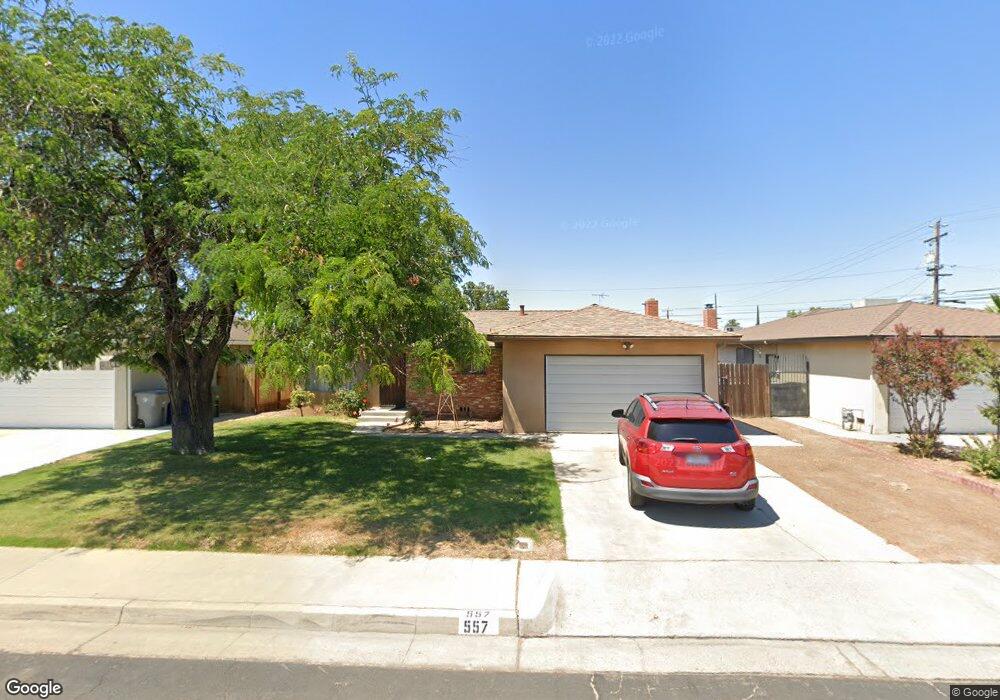
557 W Scott Ave Clovis, CA 93612
Estimated Value: $361,387 - $375,000
3
Beds
2
Baths
1,398
Sq Ft
$262/Sq Ft
Est. Value
About This Home
This home is located at 557 W Scott Ave, Clovis, CA 93612 and is currently estimated at $366,796, approximately $262 per square foot. 557 W Scott Ave is a home located in Fresno County with nearby schools including Sierra Vista Elementary School, Clark Intermediate School, and Clovis High School.
Ownership History
Date
Name
Owned For
Owner Type
Purchase Details
Closed on
Jan 22, 2002
Sold by
Bachiller Rayfel M
Bought by
Ward Mathew Greg and Ward Jennifer Perez
Current Estimated Value
Home Financials for this Owner
Home Financials are based on the most recent Mortgage that was taken out on this home.
Original Mortgage
$88,000
Outstanding Balance
$35,961
Interest Rate
7.04%
Estimated Equity
$330,835
Create a Home Valuation Report for This Property
The Home Valuation Report is an in-depth analysis detailing your home's value as well as a comparison with similar homes in the area
Home Values in the Area
Average Home Value in this Area
Purchase History
| Date | Buyer | Sale Price | Title Company |
|---|---|---|---|
| Ward Mathew Greg | $110,000 | Stewart Title |
Source: Public Records
Mortgage History
| Date | Status | Borrower | Loan Amount |
|---|---|---|---|
| Open | Ward Mathew Greg | $88,000 | |
| Closed | Ward Mathew Greg | $22,000 |
Source: Public Records
Tax History
| Year | Tax Paid | Tax Assessment Tax Assessment Total Assessment is a certain percentage of the fair market value that is determined by local assessors to be the total taxable value of land and additions on the property. | Land | Improvement |
|---|---|---|---|---|
| 2025 | $2,921 | $162,478 | $36,921 | $125,557 |
| 2023 | $2,848 | $156,172 | $35,489 | $120,683 |
| 2022 | $2,823 | $153,111 | $34,794 | $118,317 |
| 2021 | $2,773 | $150,110 | $34,112 | $115,998 |
| 2020 | $2,745 | $148,572 | $33,763 | $114,809 |
| 2019 | $2,711 | $145,659 | $33,101 | $112,558 |
| 2018 | $1,628 | $142,803 | $32,452 | $110,351 |
| 2017 | $1,599 | $140,004 | $31,816 | $108,188 |
| 2016 | $1,544 | $137,260 | $31,193 | $106,067 |
| 2015 | $1,520 | $135,199 | $30,725 | $104,474 |
| 2014 | $1,490 | $132,552 | $30,124 | $102,428 |
Source: Public Records
Map
Nearby Homes
- 487 W San Jose Ave
- 3600 W Shaw Ave
- 647 W Dennis Dr
- 1335 Cindy Ave
- 2110 Helm Ave Unit 19
- 1314 Terry Ave
- 593 W Alamos Ave
- 1629 Willow Ave
- 431 W Alamos Ave Unit 4
- 2236 Peach Ave Unit 3
- 2236 Peach Ave Unit 4
- 1500 Villa Ave Unit 107
- 1500 Villa Ave Unit 170
- 1500 Villa Ave Unit 27
- 1500 Villa Ave Unit spc 7
- 1650 Villa Ave Unit 48
- 1272 Villa Ave Unit 69
- 1272 Villa Ave Unit 76
- 1272 Villa Ave Unit SPC92
- 821 W Fairmont Ave
- 567 W Scott Ave
- 547 W Scott Ave
- 558 W San Jose Ave
- 568 W San Jose Ave
- 548 W San Jose Ave
- 577 W Scott Ave
- 578 W San Jose Ave
- 558 W Scott Ave
- 548 W Scott Ave
- 568 W Scott Ave
- 587 W Scott Ave
- 527 W Scott Ave
- 578 W Scott Ave
- 588 W San Jose Ave
- 528 W San Jose Ave
- 597 W Scott Ave
- 588 W Scott Ave
- 526 W Scott Ave
- 517 W Scott Ave
- 598 W San Jose Ave
Your Personal Tour Guide
Ask me questions while you tour the home.