Estimated Value: $854,414 - $1,041,000
4
Beds
3
Baths
2,448
Sq Ft
$382/Sq Ft
Est. Value
About This Home
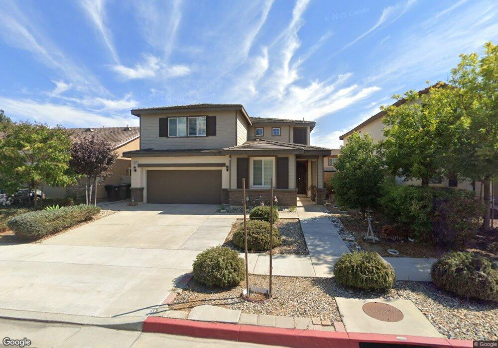
This home is located at 5571 Buckthorn Ct, Chino, CA 91710 and is currently estimated at $934,354, approximately $381 per square foot. 5571 Buckthorn Ct is a home with nearby schools including Walnut Avenue Elementary, Magnolia Junior High, and Chino High School.
Ownership History
Date
Name
Owned For
Owner Type
Purchase Details
Closed on
Oct 14, 2024
Sold by
Kong Liang and Zhang Mengyi
Bought by
Kong Liang
Current Estimated Value
Purchase Details
Closed on
Dec 22, 2015
Sold by
Fh Ii Llc
Bought by
Kong Liang and Zhang Meng Yi
Home Financials for this Owner
Home Financials are based on the most recent Mortgage that was taken out on this home.
Original Mortgage
$224,915
Interest Rate
3.96%
Mortgage Type
New Conventional
Create a Home Valuation Report for This Property
The Home Valuation Report is an in-depth analysis detailing your home's value as well as a comparison with similar homes in the area
Home Values in the Area
Average Home Value in this Area
Purchase History
| Date | Buyer | Sale Price | Title Company |
|---|---|---|---|
| Kong Liang | -- | Accommodation/Courtesy Recordi | |
| Kong Liang | $535,000 | Orange Coast Title Company |
Source: Public Records
Mortgage History
| Date | Status | Borrower | Loan Amount |
|---|---|---|---|
| Previous Owner | Kong Liang | $224,915 |
Source: Public Records
Tax History Compared to Growth
Tax History
| Year | Tax Paid | Tax Assessment Tax Assessment Total Assessment is a certain percentage of the fair market value that is determined by local assessors to be the total taxable value of land and additions on the property. | Land | Improvement |
|---|---|---|---|---|
| 2025 | $6,851 | $633,231 | $221,630 | $411,601 |
| 2024 | $6,851 | $620,814 | $217,284 | $403,530 |
| 2023 | $6,660 | $608,642 | $213,024 | $395,618 |
| 2022 | $6,615 | $596,708 | $208,847 | $387,861 |
| 2021 | $6,430 | $585,008 | $204,752 | $380,256 |
| 2020 | $6,346 | $579,010 | $202,653 | $376,357 |
| 2019 | $6,233 | $567,656 | $198,679 | $368,977 |
| 2018 | $6,094 | $556,525 | $194,783 | $361,742 |
| 2017 | $5,984 | $545,613 | $190,964 | $354,649 |
| 2016 | $1,651 | $152,530 | $152,530 | $0 |
| 2015 | -- | $0 | $0 | $0 |
Source: Public Records
Map
Nearby Homes
- 5610 Guardian Way
- 12351 Twin Gables Dr
- 12524 Ross Ave
- 12635 Franklin Ct Unit 8b
- 5382 Park Place
- 12796 17th St
- 5640 Riverside Dr Unit 119
- 12321 Gardenia Place
- 12836 12th St Unit 27
- 12811 Oaks Ave
- 2321 S Magnolia Ave Unit 6E
- 11782 Vernon Ave
- 12951 Benson Ave Unit 118
- 12951 Red Cedar Way
- 5925 Riverside Dr Unit 12
- 5500 Francis Ave
- 4965 Independence St
- 12939 5th St
- 4887 Philadelphia St
- 0 C St
- 5565 Buckthorn Ct
- 5581 Buckthorn Ct
- 5572 Guardian Way
- 5557 Buckthorn Ct
- 5580 Guardian Way
- 5564 Guardian Way
- 12347 Grey Owl Way
- 5556 Guardian Way
- 5549 Buckthorn Ct
- 5550 Guardian Way
- 12339 Grey Owl Way
- 5601 Buckthorn Ct
- 12346 Grey Owl Way
- 5539 Buckthorn Ct
- 5602 Guardian Way
- 5542 Guardian Way
- 12340 Grey Owl Way
- 12331 Grey Owl Way
- 5609 Buckthorn Ct
- 5604 Buckthorn Ct