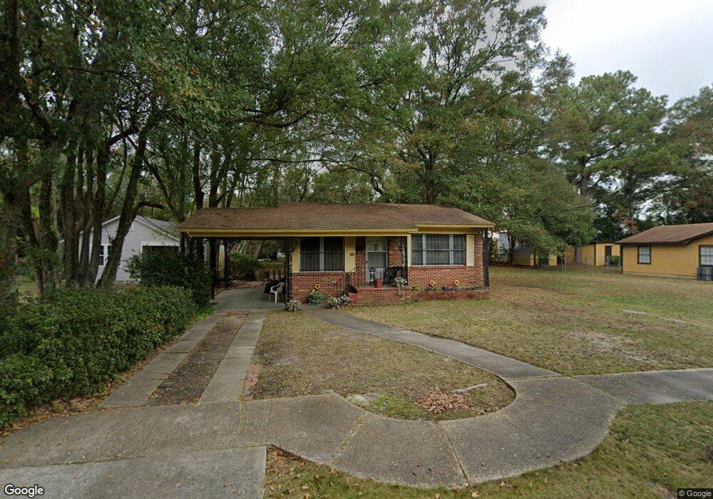
558 Crenshaw St Mobile, AL 36606
Rickarby NeighborhoodEstimated Value: $64,000 - $95,000
2
Beds
1
Bath
1,134
Sq Ft
$68/Sq Ft
Est. Value
About This Home
This home is located at 558 Crenshaw St, Mobile, AL 36606 and is currently estimated at $76,913, approximately $67 per square foot. 558 Crenshaw St is a home located in Mobile County with nearby schools including Leinkauf Elementary School, Williamson High School, and Little Flower Catholic School.
Ownership History
Date
Name
Owned For
Owner Type
Purchase Details
Closed on
Jun 23, 2008
Sold by
Jackson Lelia and Horn Sandra R
Bought by
Jackson Lelia
Current Estimated Value
Home Financials for this Owner
Home Financials are based on the most recent Mortgage that was taken out on this home.
Original Mortgage
$40,600
Outstanding Balance
$25,946
Interest Rate
5.97%
Mortgage Type
FHA
Estimated Equity
$50,967
Purchase Details
Closed on
Mar 31, 2008
Sold by
Jackson Gary
Bought by
Jackson Lelia
Create a Home Valuation Report for This Property
The Home Valuation Report is an in-depth analysis detailing your home's value as well as a comparison with similar homes in the area
Home Values in the Area
Average Home Value in this Area
Purchase History
| Date | Buyer | Sale Price | Title Company |
|---|---|---|---|
| Jackson Lelia | -- | None Available | |
| Jackson Lelia | -- | None Available |
Source: Public Records
Mortgage History
| Date | Status | Borrower | Loan Amount |
|---|---|---|---|
| Open | Jackson Lelia | $40,600 |
Source: Public Records
Tax History Compared to Growth
Tax History
| Year | Tax Paid | Tax Assessment Tax Assessment Total Assessment is a certain percentage of the fair market value that is determined by local assessors to be the total taxable value of land and additions on the property. | Land | Improvement |
|---|---|---|---|---|
| 2024 | -- | $4,570 | $800 | $3,770 |
| 2023 | $207 | $4,320 | $800 | $3,520 |
| 2022 | $197 | $4,150 | $800 | $3,350 |
| 2021 | $193 | $4,090 | $800 | $3,290 |
| 2020 | $193 | $4,090 | $800 | $3,290 |
| 2019 | $186 | $3,980 | $0 | $0 |
| 2018 | $186 | $3,980 | $0 | $0 |
| 2017 | $198 | $4,180 | $0 | $0 |
| 2016 | $262 | $5,180 | $0 | $0 |
| 2013 | $294 | $5,520 | $0 | $0 |
Source: Public Records
Map
Nearby Homes
- 559 Westwood St
- 419 Crenshaw St
- 417 Crenshaw St
- 556 Seminole St
- 570 Clarke St
- 603 Mohawk St
- 552 Glenwood St
- 616 Morgan Ave
- 571 Glenwood St
- 603 Glenwood St
- 460 Pinehill Dr
- 449 Williams St
- 654 Holcombe Ave
- 707 Euclid Ave
- 503 Dauphin Island Pkwy
- 559 Dauphin Island Pkwy
- 263 Morgan Ave
- 2155 Old Government St
- 720 Johnston Ave
- 1958 Myrtle Ave
- 556 Crenshaw St
- 560 Crenshaw St
- 420 Crenshaw St
- 562 Crenshaw St
- 561 Westwood St
- 563 Westwood St
- 418 Crenshaw St
- 564 Crenshaw St
- 565 Westwood St
- 563 Crenshaw St
- 561 Crenshaw St
- 565 Crenshaw St
- 416 Crenshaw St
- 566 Crenshaw St
- 567 Westwood St
- 559 Crenshaw St
- 569 Crenshaw St
- 568 Crenshaw St
- 571 Crenshaw St
- 421 Crenshaw St