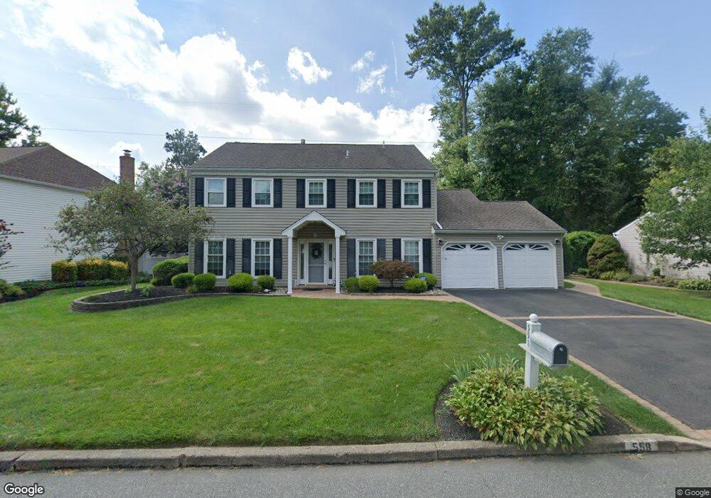
558 Fairman Ln Langhorne, PA 19047
Estimated Value: $746,000 - $832,000
4
Beds
3
Baths
2,602
Sq Ft
$297/Sq Ft
Est. Value
About This Home
This home is located at 558 Fairman Ln, Langhorne, PA 19047 and is currently estimated at $773,472, approximately $297 per square foot. 558 Fairman Ln is a home located in Bucks County with nearby schools including Pearl S. Buck Elementary School, Maple Point Middle School, and Neshaminy High School.
Ownership History
Date
Name
Owned For
Owner Type
Purchase Details
Closed on
Nov 3, 2005
Sold by
Lankford Philip A and Lankford Sandra L
Bought by
Welsh Michael J and Welsh Doreen A
Current Estimated Value
Home Financials for this Owner
Home Financials are based on the most recent Mortgage that was taken out on this home.
Original Mortgage
$155,000
Outstanding Balance
$85,083
Interest Rate
6.07%
Mortgage Type
Fannie Mae Freddie Mac
Estimated Equity
$688,389
Purchase Details
Closed on
Jun 27, 2001
Sold by
Amoroso Salvatore J and Amoroso Deborah S
Bought by
Lankford Philip A and Lankford Sandra L
Home Financials for this Owner
Home Financials are based on the most recent Mortgage that was taken out on this home.
Original Mortgage
$217,600
Interest Rate
6.77%
Create a Home Valuation Report for This Property
The Home Valuation Report is an in-depth analysis detailing your home's value as well as a comparison with similar homes in the area
Home Values in the Area
Average Home Value in this Area
Purchase History
| Date | Buyer | Sale Price | Title Company |
|---|---|---|---|
| Welsh Michael J | $440,000 | None Available | |
| Lankford Philip A | $272,000 | Lawyers Title Insurance Corp |
Source: Public Records
Mortgage History
| Date | Status | Borrower | Loan Amount |
|---|---|---|---|
| Open | Welsh Michael J | $155,000 | |
| Previous Owner | Lankford Philip A | $217,600 |
Source: Public Records
Tax History Compared to Growth
Tax History
| Year | Tax Paid | Tax Assessment Tax Assessment Total Assessment is a certain percentage of the fair market value that is determined by local assessors to be the total taxable value of land and additions on the property. | Land | Improvement |
|---|---|---|---|---|
| 2025 | $8,708 | $40,000 | $6,200 | $33,800 |
| 2024 | $8,708 | $40,000 | $6,200 | $33,800 |
| 2023 | $8,570 | $40,000 | $6,200 | $33,800 |
| 2022 | $8,345 | $40,000 | $6,200 | $33,800 |
| 2021 | $8,345 | $40,000 | $6,200 | $33,800 |
| 2020 | $8,245 | $40,000 | $6,200 | $33,800 |
| 2019 | $8,061 | $40,000 | $6,200 | $33,800 |
| 2018 | $7,913 | $40,000 | $6,200 | $33,800 |
| 2017 | $7,711 | $40,000 | $6,200 | $33,800 |
| 2016 | $7,711 | $40,000 | $6,200 | $33,800 |
| 2015 | $7,900 | $40,000 | $6,200 | $33,800 |
| 2014 | $7,900 | $40,000 | $6,200 | $33,800 |
Source: Public Records
Map
Nearby Homes
- 14303 Cornerstone Dr
- 2703 Lynbrooke Dr Unit 81
- 462 Scott Ct
- 2602 Waterford Rd Unit 96
- 28130 Hickory Ln
- 2007 Waterford Rd Unit 81
- 30139 Hickory Ln
- 181 Fillmore Way
- 1749 Locust Dr
- 1948 Satter Ct
- 195 Roosevelt Dr
- 164 Tyler Way
- 81 Lavender Dr
- 30 Tupelo Ln
- 24 Tupelo Ln
- 5801 Spruce Mill Dr Unit 450
- 1977 4th St
- 654A Woodford Ln
- 1651 Covington Rd Unit 26
- 647A Rose Hollow Dr Unit B
- 548 Fairman Ln
- 568 Fairman Ln
- 538 Fairman Ln
- 559 Fairman Ln
- 483 Croasdale Dr
- 528 Fairman Ln
- 493 Croasdale Dr
- 442 Croasdale Dr
- 450 Atkinson Ln
- 462 Croasdale Dr
- 441 Atkinson Ln
- 482 Croasdale Dr
- 283 Croasdale Dr
- 460 Atkinson Ln
- 503 Croasdale Dr
- 518 Fairman Ln
- 148 Flint Rd
- 492 Croasdale Dr
- 158 Flint Rd
- 451 Atkinson Ln