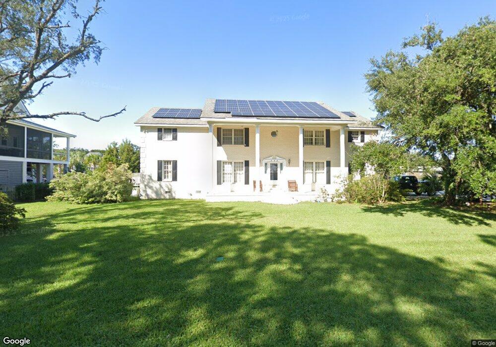
558 Lynne Ave Charleston, SC 29412
James Island NeighborhoodEstimated Value: $1,220,000 - $1,672,470
5
Beds
3
Baths
3,534
Sq Ft
$398/Sq Ft
Est. Value
About This Home
This home is located at 558 Lynne Ave, Charleston, SC 29412 and is currently estimated at $1,407,118, approximately $398 per square foot. 558 Lynne Ave is a home located in Charleston County with nearby schools including Stiles Point Elementary School, Camp Road Middle, and James Island Charter High School.
Ownership History
Date
Name
Owned For
Owner Type
Purchase Details
Closed on
Apr 20, 2012
Sold by
Wood Harlen P and Wood Joyce J
Bought by
Wood Harlen P and Wood Joyce J
Current Estimated Value
Home Financials for this Owner
Home Financials are based on the most recent Mortgage that was taken out on this home.
Original Mortgage
$938,250
Interest Rate
4.13%
Mortgage Type
Reverse Mortgage Home Equity Conversion Mortgage
Purchase Details
Closed on
Apr 13, 2010
Sold by
Wood Harlen P and Wood Joyce J
Bought by
Wood Harlen P and Wood Joyce J
Create a Home Valuation Report for This Property
The Home Valuation Report is an in-depth analysis detailing your home's value as well as a comparison with similar homes in the area
Home Values in the Area
Average Home Value in this Area
Purchase History
| Date | Buyer | Sale Price | Title Company |
|---|---|---|---|
| Wood Harlen P | -- | -- | |
| Wood Harlen P | -- | -- |
Source: Public Records
Mortgage History
| Date | Status | Borrower | Loan Amount |
|---|---|---|---|
| Closed | Wood Harlen P | $938,250 |
Source: Public Records
Tax History Compared to Growth
Tax History
| Year | Tax Paid | Tax Assessment Tax Assessment Total Assessment is a certain percentage of the fair market value that is determined by local assessors to be the total taxable value of land and additions on the property. | Land | Improvement |
|---|---|---|---|---|
| 2024 | $3,388 | $24,610 | $0 | $0 |
| 2023 | $2,761 | $24,610 | $0 | $0 |
| 2022 | $2,532 | $24,610 | $0 | $0 |
| 2021 | $2,722 | $24,610 | $0 | $0 |
| 2020 | $2,754 | $24,610 | $0 | $0 |
| 2019 | $2,517 | $21,130 | $0 | $0 |
| 2017 | $2,681 | $23,130 | $0 | $0 |
| 2016 | $2,565 | $23,130 | $0 | $0 |
| 2015 | $2,680 | $23,130 | $0 | $0 |
| 2014 | $2,196 | $0 | $0 | $0 |
| 2011 | -- | $0 | $0 | $0 |
Source: Public Records
Map
Nearby Homes
- 634 Lynne Ave
- 922 Preston Rd
- 764 Creekside Dr
- 746 Tallwood Rd
- 939 Mikell Dr
- 660 Ayers Dr
- 544 Fort Johnson Rd
- 1313 Salt Marsh Cove
- 672 Ayers Dr
- 762 Swanson Ave
- 460 Trapier Dr
- 0 Fort Johnson Rd Unit 25005735
- 706 Sterling Dr
- 683 Edmonds Dr
- 957 Regatta Rd
- 965 Mooring Dr
- 3009 Allison Cove Dr
- 1024 Greenhill Rd
- 808 Waxwood Ln
- 1032 Greenhill Rd Unit A
- 564 Lynne Ave
- 0 Lynne Ave Unit 9913931
- 0 Lynne Ave Unit 9295951
- 0 Lynne Ave Unit 2740511
- 0 Lynne Ave Unit 2741648
- 0 Lynne Ave Unit 2720384
- 0 Lynne Ave Unit 9285979
- 0 Lynne Ave Unit 2741654
- 0 Lynne Ave Unit 2720383
- 0 Lynne Ave Unit 2529475
- 0 Lynne Ave Unit 2520041
- 0 Lynne Ave Unit 9800636
- 0 Lynne Ave Unit 2537948
- 0 Lynne Ave Unit 2537944
- 0 Lynne Ave Unit 9912545
- 0 Lynne Ave Unit 2003602
- 0 Lynne Ave Unit 2808646
- 0 Lynne Ave Unit 2808645
- 0 Lynne Ave Unit 2815967
- 0 Lynne Ave Unit 2830596