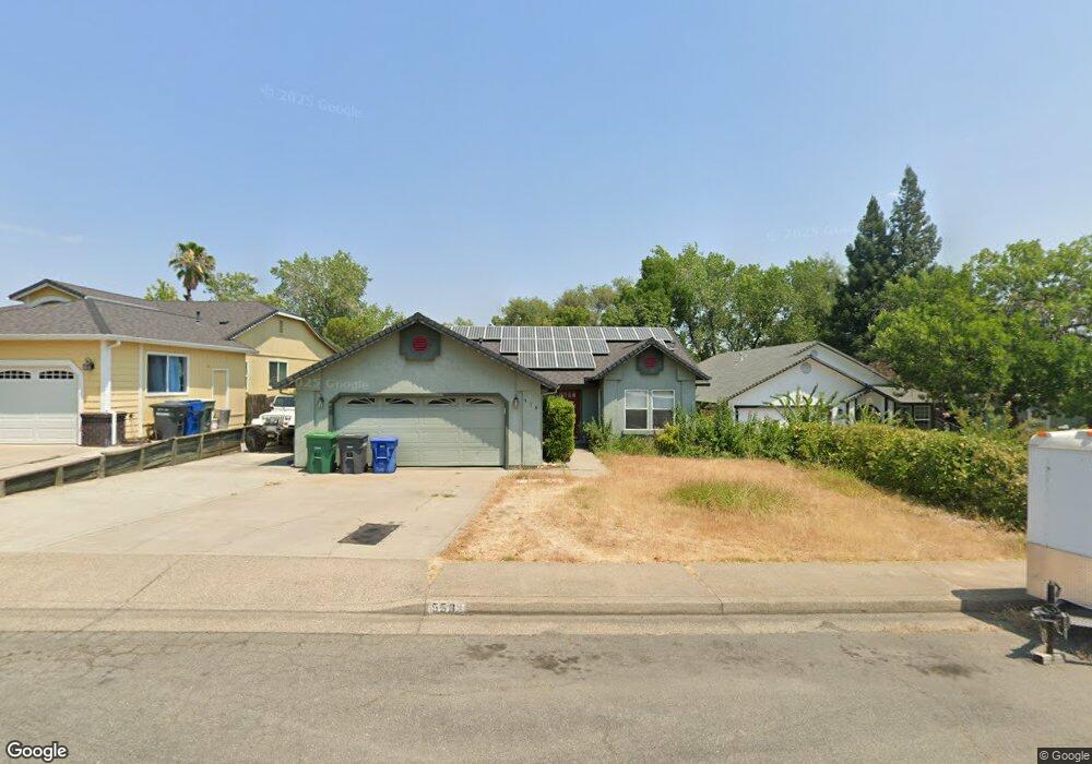
558 Martinique Cir Redding, CA 96003
North Hilltop NeighborhoodEstimated Value: $406,000 - $426,742
3
Beds
2
Baths
1,750
Sq Ft
$238/Sq Ft
Est. Value
About This Home
This home is located at 558 Martinique Cir, Redding, CA 96003 and is currently estimated at $415,686, approximately $237 per square foot. 558 Martinique Cir is a home located in Shasta County with nearby schools including Turtle Bay, Sequoia Middle School, and Shasta High School.
Ownership History
Date
Name
Owned For
Owner Type
Purchase Details
Closed on
Jun 21, 2017
Sold by
Sanborn Karen J
Bought by
Sanborn David E
Current Estimated Value
Purchase Details
Closed on
Oct 18, 2005
Sold by
Sanborn David E and Sanborn Karen J
Bought by
Sanborn David E and Sanborn Karen J
Purchase Details
Closed on
Nov 14, 1996
Sold by
Bell Steven D and Bell Deborah S
Bought by
Sanborn David E and Sanborn Karen J
Home Financials for this Owner
Home Financials are based on the most recent Mortgage that was taken out on this home.
Original Mortgage
$116,674
Interest Rate
7.86%
Mortgage Type
VA
Create a Home Valuation Report for This Property
The Home Valuation Report is an in-depth analysis detailing your home's value as well as a comparison with similar homes in the area
Home Values in the Area
Average Home Value in this Area
Purchase History
| Date | Buyer | Sale Price | Title Company |
|---|---|---|---|
| Sanborn David E | -- | None Available | |
| Sanborn David E | -- | -- | |
| Sanborn David E | $121,000 | First American Title Co |
Source: Public Records
Mortgage History
| Date | Status | Borrower | Loan Amount |
|---|---|---|---|
| Previous Owner | Sanborn David E | $116,674 |
Source: Public Records
Tax History Compared to Growth
Tax History
| Year | Tax Paid | Tax Assessment Tax Assessment Total Assessment is a certain percentage of the fair market value that is determined by local assessors to be the total taxable value of land and additions on the property. | Land | Improvement |
|---|---|---|---|---|
| 2025 | $2,470 | $237,752 | $39,072 | $198,680 |
| 2024 | $2,432 | $233,091 | $38,306 | $194,785 |
| 2023 | $2,432 | $228,521 | $37,555 | $190,966 |
| 2022 | $2,390 | $224,041 | $36,819 | $187,222 |
| 2021 | $2,378 | $219,649 | $36,098 | $183,551 |
| 2020 | $2,407 | $217,397 | $35,728 | $181,669 |
| 2019 | $2,288 | $213,135 | $35,028 | $178,107 |
| 2018 | $2,306 | $208,957 | $34,342 | $174,615 |
| 2017 | $2,293 | $204,861 | $33,669 | $171,192 |
| 2016 | $2,221 | $200,845 | $33,009 | $167,836 |
| 2015 | $2,192 | $197,829 | $32,514 | $165,315 |
| 2014 | $2,177 | $193,955 | $31,878 | $162,077 |
Source: Public Records
Map
Nearby Homes
- 719 Saint Thomas Pkwy
- 454 Alamine Dr
- 720 Stonebriar Trail
- 726 Stonebriar Trail
- 732 Stonebriar Trail
- 738 Stonebriar Trail
- 11 Tanglewood Ln
- 444 Ridgecrest Trail Unit 119
- 488 Ridgecrest Trail Unit 132
- 488 Ridgecrest Trail Unit 133
- 466 Ridgecrest Trail Unit 136
- 200 Ridgetop Dr Unit 4
- 1026 Palisades Ave
- 856 Mission de Oro Dr
- 592 Mill Valley Pkwy
- 823 Mission Sierra Ct
- 825 Mission Sierra Ct
- 654 Rogue River Way
- 11037 Erickson Way
- 953 Tanglewood Dr
- 570 Martinique Cir
- 546 Martinique Cir
- 582 Martinique Cir
- 534 Martinique Cir Unit 1
- 534 Martinique Cir
- 695 Saint Thomas Pkwy
- 522 Martinique Cir
- 594 Martinique Cir
- 0 Martinique Cir
- 707 Saint Thomas Pkwy
- 689 Saint Thomas Pkwy
- 565 Martinique Cir
- 553 Martinique Cir
- 510 Martinique Cir
- 577 Martinique Cir
- 541 Martinique Cir
- 695 St Thomas Pkwy
- 589 Martinique Cir
- 529 Martinique Cir
- 683 Saint Thomas Pkwy