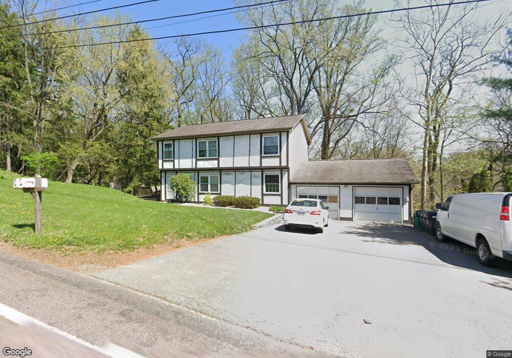
558 Union Ave Pittsburgh, PA 15202
Ross Township NeighborhoodEstimated Value: $261,000 - $326,857
4
Beds
2
Baths
1,836
Sq Ft
$158/Sq Ft
Est. Value
About This Home
This home is located at 558 Union Ave, Pittsburgh, PA 15202 and is currently estimated at $290,464, approximately $158 per square foot. 558 Union Ave is a home located in Allegheny County with nearby schools including Highcliff Elementary School, North Hills Middle School, and North Hills Senior High School.
Ownership History
Date
Name
Owned For
Owner Type
Purchase Details
Closed on
Aug 2, 2013
Sold by
Gray Michael E
Bought by
Abdoolraman Muhammad
Current Estimated Value
Home Financials for this Owner
Home Financials are based on the most recent Mortgage that was taken out on this home.
Original Mortgage
$119,000
Outstanding Balance
$88,531
Interest Rate
4.4%
Mortgage Type
New Conventional
Estimated Equity
$201,933
Purchase Details
Closed on
Feb 22, 1989
Bought by
Gray Michael E
Create a Home Valuation Report for This Property
The Home Valuation Report is an in-depth analysis detailing your home's value as well as a comparison with similar homes in the area
Home Values in the Area
Average Home Value in this Area
Purchase History
| Date | Buyer | Sale Price | Title Company |
|---|---|---|---|
| Abdoolraman Muhammad | $140,000 | -- | |
| Gray Michael E | $82,500 | -- |
Source: Public Records
Mortgage History
| Date | Status | Borrower | Loan Amount |
|---|---|---|---|
| Open | Abdoolraman Muhammad | $119,000 |
Source: Public Records
Tax History Compared to Growth
Tax History
| Year | Tax Paid | Tax Assessment Tax Assessment Total Assessment is a certain percentage of the fair market value that is determined by local assessors to be the total taxable value of land and additions on the property. | Land | Improvement |
|---|---|---|---|---|
| 2025 | $3,446 | $127,000 | $33,500 | $93,500 |
| 2024 | $3,446 | $127,000 | $33,500 | $93,500 |
| 2023 | $3,446 | $127,000 | $33,500 | $93,500 |
| 2022 | $3,362 | $127,000 | $33,500 | $93,500 |
| 2021 | $601 | $127,000 | $33,500 | $93,500 |
| 2020 | $3,312 | $127,000 | $33,500 | $93,500 |
| 2019 | $3,261 | $127,000 | $33,500 | $93,500 |
| 2018 | $601 | $127,000 | $33,500 | $93,500 |
| 2017 | $3,204 | $127,000 | $33,500 | $93,500 |
| 2016 | $601 | $127,000 | $33,500 | $93,500 |
| 2015 | $601 | $127,000 | $33,500 | $93,500 |
| 2014 | $3,136 | $127,000 | $33,500 | $93,500 |
Source: Public Records
Map
Nearby Homes
- 23 Dartmouth Ave
- 147 Peony Ave
- 145 Georgetown Ave
- 134 Georgetown Ave
- 111 Lilac Ave
- 132 Lilac Ave
- 104 Georgetown Ave
- 170 Gass Rd
- 102 William St
- 100 Spyglass Dr
- 4 Pioneer Ave
- 125 Bronx Ave
- 113 Spruce Valley Dr
- 106 Spyglass Dr
- 224 Bronx Ave
- 179 Lakewood Ave
- 19 Marquette Rd
- 28 Shannopin Dr
- 139 Lakewood Ave
- 172 Lakewood Ave
- 558 Union Ave Extension
- 554 Union Ave
- 550 Union Ave
- 331 Princeton Ave
- 127 Amherst Ave
- 400 Princeton Ave
- 159 Courtney Mill Rd
- 100 Springview Rd
- 125 Amherst Ave
- 329 Princeton Ave
- 153 Courtney Mill Rd
- 102 Springview Rd
- 102 Springview Ave
- 324 Princeton Ave
- 327 Princeton Ave
- 121 Amherst Ave
- 124 Amherst Ave
- 325 Princeton Ave
- 119 Amherst Ave
- 117 Amherst Ave