Estimated Value: $244,000 - $279,255
3
Beds
2
Baths
1,066
Sq Ft
$244/Sq Ft
Est. Value
About This Home
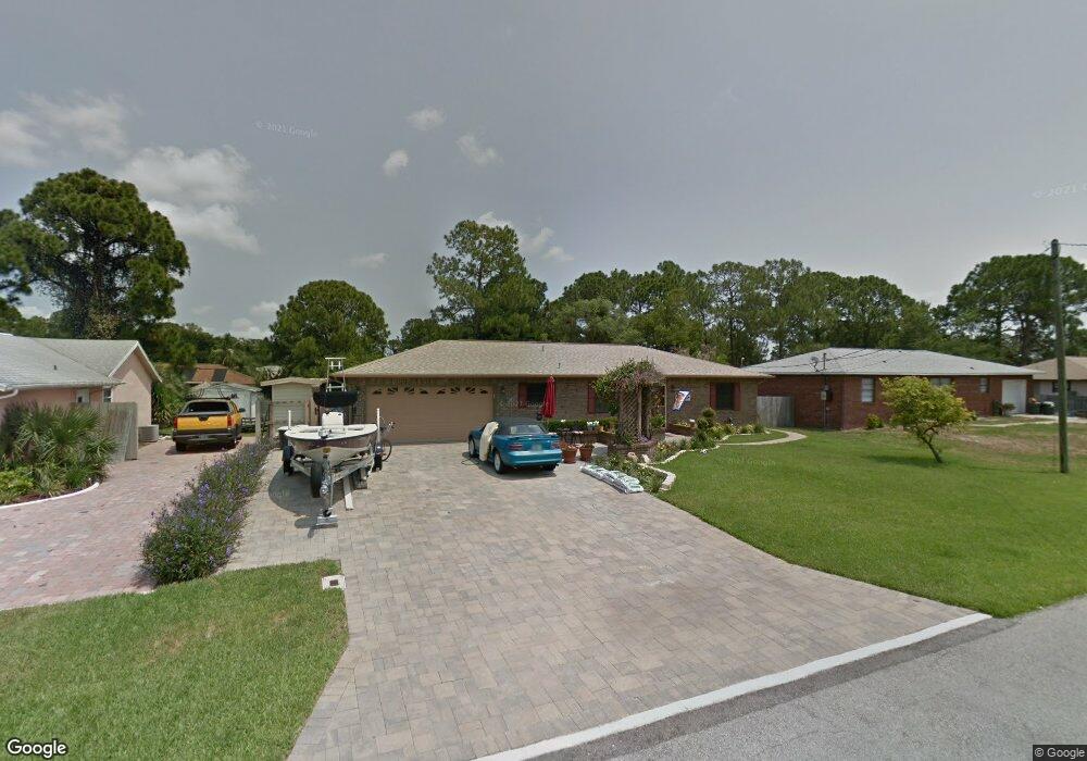
This home is located at 5580 Brandon St, Cocoa, FL 32927 and is currently estimated at $259,814, approximately $243 per square foot. 5580 Brandon St is a home located in Brevard County with nearby schools including Enterprise Elementary School, Space Coast Junior/Senior High School, and East Atlantic Prep of Brevard County.
Ownership History
Date
Name
Owned For
Owner Type
Purchase Details
Closed on
Mar 29, 2011
Sold by
Coastal Bank
Bought by
Brantley Carl H and Brantley Amy E
Current Estimated Value
Home Financials for this Owner
Home Financials are based on the most recent Mortgage that was taken out on this home.
Original Mortgage
$30,000
Interest Rate
4.92%
Purchase Details
Closed on
Oct 19, 1999
Sold by
Brantley Carl L
Bought by
Brantley Carl H and Brantley Amy E
Create a Home Valuation Report for This Property
The Home Valuation Report is an in-depth analysis detailing your home's value as well as a comparison with similar homes in the area
Home Values in the Area
Average Home Value in this Area
Purchase History
| Date | Buyer | Sale Price | Title Company |
|---|---|---|---|
| Brantley Carl H | $35,000 | Superior Title Insurance Age | |
| Brantley Carl H | $25,000 | -- |
Source: Public Records
Mortgage History
| Date | Status | Borrower | Loan Amount |
|---|---|---|---|
| Closed | Brantley Carl H | $30,000 |
Source: Public Records
Tax History
| Year | Tax Paid | Tax Assessment Tax Assessment Total Assessment is a certain percentage of the fair market value that is determined by local assessors to be the total taxable value of land and additions on the property. | Land | Improvement |
|---|---|---|---|---|
| 2025 | $1,161 | $92,210 | -- | -- |
| 2024 | $1,128 | $89,620 | -- | -- |
| 2023 | $1,128 | $87,010 | $0 | $0 |
| 2022 | $1,045 | $84,480 | $0 | $0 |
| 2021 | $1,039 | $82,020 | $0 | $0 |
| 2020 | $999 | $80,890 | $0 | $0 |
| 2019 | $935 | $79,080 | $0 | $0 |
| 2018 | $927 | $77,610 | $0 | $0 |
| 2017 | $919 | $76,020 | $0 | $0 |
| 2016 | $920 | $74,460 | $18,000 | $56,460 |
| 2015 | $931 | $73,950 | $15,000 | $58,950 |
| 2014 | $935 | $73,370 | $11,000 | $62,370 |
Source: Public Records
Map
Nearby Homes
- 5555 Brandon St
- 5680 Brandon St
- 7065 Hundred Acre Dr
- 6990 Bryant Rd
- 7200 Oakwood Ave
- 7230 Venus Ave
- 6815 Bryant Rd
- TBD Freeport Rd
- 6760 Cairo Rd
- 6615 Dock Ave
- 6581 Bancroft Ave
- 5740 Friendly St
- 5165 Patricia St
- 5155 Mayflower St
- 7635 Fringe Place
- 7419 Hackberry Rd
- 7429 Hackberry Rd
- 7368 Crepe Myrtle Ct
- 5075 Carter St
- 5080 Mayflower St
- 5570 Brandon St
- 5590 Brandon St
- 5585 Hemsing St
- 5595 Hemsing St
- 5560 Brandon St
- 5600 Brandon St
- 5585 Brandon St
- 5595 Brandon St
- 5565 Hemsing St
- 5605 Hemsing St
- 5620 Brandon St
- 5615 Brandon St
- 5565 Brandon St
- 5605 Brandon St
- 5610 Brandon St
- 6950 Pluto Ave
- 5615 Hemsing St
- 6970 Pluto Ave
- 5630 Brandon St
- 5580 Hemsing St
Your Personal Tour Guide
Ask me questions while you tour the home.