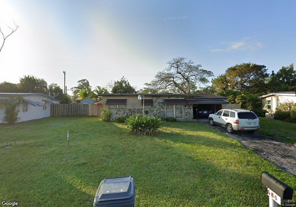
5580 Maypop Rd West Palm Beach, FL 33415
Forest Hill Village NeighborhoodEstimated Value: $295,933 - $390,000
--
Bed
1
Bath
898
Sq Ft
$386/Sq Ft
Est. Value
About This Home
This home is located at 5580 Maypop Rd, West Palm Beach, FL 33415 and is currently estimated at $346,983, approximately $386 per square foot. 5580 Maypop Rd is a home located in Palm Beach County with nearby schools including Forest Hill Elementary School, Irs Program At Moriarty, and Okeeheelee Middle School.
Ownership History
Date
Name
Owned For
Owner Type
Purchase Details
Closed on
Sep 15, 2025
Sold by
Mccall Elisabeth M
Bought by
Dm Enterprise Of The Palm Beaches Llc
Current Estimated Value
Purchase Details
Closed on
Aug 18, 2022
Sold by
Mccall Ora E
Bought by
Owensby Ora E
Purchase Details
Closed on
Nov 21, 1996
Sold by
Mistretta Toni-Ann
Bought by
Mccall Ora E
Home Financials for this Owner
Home Financials are based on the most recent Mortgage that was taken out on this home.
Original Mortgage
$52,454
Interest Rate
7.83%
Mortgage Type
FHA
Purchase Details
Closed on
Aug 18, 1990
Sold by
Neff Donald H
Bought by
Neff Toni Ann Mistretta
Create a Home Valuation Report for This Property
The Home Valuation Report is an in-depth analysis detailing your home's value as well as a comparison with similar homes in the area
Home Values in the Area
Average Home Value in this Area
Purchase History
| Date | Buyer | Sale Price | Title Company |
|---|---|---|---|
| Dm Enterprise Of The Palm Beaches Llc | $241,000 | Pcg Title Insurance Agency Llc | |
| Owensby Ora E | -- | Miller Steven G | |
| Owensby Ora E | -- | Miller Steven G | |
| Mccall Ora E | $52,500 | -- | |
| Neff Toni Ann Mistretta | -- | -- |
Source: Public Records
Mortgage History
| Date | Status | Borrower | Loan Amount |
|---|---|---|---|
| Previous Owner | Mccall Ora E | $52,454 |
Source: Public Records
Tax History Compared to Growth
Tax History
| Year | Tax Paid | Tax Assessment Tax Assessment Total Assessment is a certain percentage of the fair market value that is determined by local assessors to be the total taxable value of land and additions on the property. | Land | Improvement |
|---|---|---|---|---|
| 2024 | $1,944 | $239,596 | -- | -- |
| 2023 | $3,769 | $233,710 | $164,698 | $69,012 |
| 2022 | $1,103 | $64,398 | $0 | $0 |
| 2021 | $1,063 | $62,522 | $0 | $0 |
| 2020 | $1,045 | $61,659 | $0 | $0 |
| 2019 | $1,048 | $60,273 | $0 | $0 |
| 2018 | $922 | $59,149 | $0 | $0 |
| 2017 | $893 | $57,932 | $0 | $0 |
| 2016 | $896 | $56,740 | $0 | $0 |
| 2015 | $909 | $56,346 | $0 | $0 |
| 2014 | $913 | $55,899 | $0 | $0 |
Source: Public Records
Map
Nearby Homes
- 5642 Cinnamon Dr
- 1970 Monks Ct
- 1871 Abbey Rd Unit 19A
- 1943 Iris Rd
- 1763 Abbey Rd
- 1790 Abbey Rd Unit 104B
- 2117 E Bond Dr Unit 1
- 1838 Abbey Rd Unit 208
- 5894 Longbow Ln Unit 10
- 1865 W Chatham Rd
- 1442 Summit Run Cir
- 5975 Forest Hill Blvd Unit 101
- 2084 Laura Ln
- 5954 Longbow Ln Unit 50
- 6074 Forest Hill Blvd Unit 208
- 6074 Forest Hill Blvd Unit 107
- 5935 Forest Hill Blvd Unit 1
- 2106 Sherwood Forest Blvd Unit 17
- 1527 Live Oak Dr
- 6034 Fores Hill Blvd Unit 101
- 5608 Maypop Rd
- 5564 Maypop Rd Unit Rd
- 5581 Calico Rd
- 5595 Calico Rd
- 5565 Calico Rd
- 5565 SW Calico
- 5620 Maypop Rd
- 5607 Calico Rd
- 5561 Calico Rd
- 1894 Maypop Rd
- 5617 Maypop Rd
- 5621 Calico Rd
- 1913 Calico Rd
- 5629 Maypop Rd
- 5632 Maypop Rd
- 1852 Maypop Rd
- 1893 Calico Rd
- 5633 Calico Rd
- 5641 Maypop Rd
- 5644 Maypop Rd