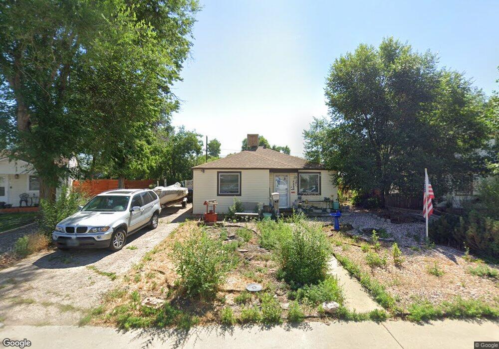
5580 Otis Ct Arvada, CO 80002
Arvada AreaEstimated Value: $468,000 - $522,000
About This Home
This home is located at 5580 Otis Ct, Arvada, CO 80002 and is currently estimated at $488,037, approximately $385 per square foot. 5580 Otis Ct is a home located in Jefferson County with nearby schools including Secrest Elementary School, North Arvada Middle School, and Arvada High School.
Ownership History
We collect this data history from publicly available records. To have your information removed, we recommend requesting removal directly through your county’s website.
Purchase Details
Purchase Details
Purchase Details
Purchase Details
Purchase History
We collect this data history from publicly available records. To have your information removed, we recommend requesting removal directly through your county’s website.
| Date | Buyer | Sale Price | Title Company |
|---|---|---|---|
| $10,000 | Wfg | ||
| $10,822,800 | None Listed On Document | ||
| $225,000 | None Available | ||
| -- | None Available |
Mortgage History
We collect this data history from publicly available records. To have your information removed, we recommend requesting removal directly through your county’s website.
| Date | Status | Borrower | Loan Amount |
|---|---|---|---|
| Previous Owner | $22,250 | ||
| Previous Owner | $89,000 | ||
| Previous Owner | $45,000 |
Tax History
We collect this data history from publicly available records. To have your information removed, we recommend requesting removal directly through your county’s website.
| Year | Tax Paid | Tax Assessment Tax Assessment Total Assessment is a certain percentage of the fair market value that is determined by local assessors to be the total taxable value of land and additions on the property. | Land | Improvement |
|---|---|---|---|---|
| 2025 | $4,440 | $29,546 | $12,216 | $17,330 |
| 2024 | $4,885 | $30,351 | $11,661 | $18,690 |
| 2023 | $4,885 | $30,351 | $11,661 | $18,690 |
| 2022 | $5,714 | $24,929 | $9,229 | $15,700 |
| 2021 | $2,482 | $25,646 | $9,494 | $16,152 |
| 2020 | $2,146 | $22,235 | $7,593 | $14,642 |
| 2019 | $2,117 | $22,235 | $7,593 | $14,642 |
| 2018 | $1,082 | $18,253 | $5,256 | $12,997 |
| 2017 | $991 | $18,253 | $5,256 | $12,997 |
| 2016 | $786 | $16,221 | $5,117 | $11,104 |
| 2015 | $1,297 | $16,221 | $5,117 | $11,104 |
| 2014 | $1,297 | $12,806 | $4,384 | $8,422 |
Map
- 5543 Newland Way
- 5525 Pierce Ct
- 6865 W 55th Place
- 6900 W 55th Place
- 6940 W 55th Place
- 6510 Ralston Rd
- 6937 W 53rd Place
- 6930 W 54th Ave
- 7357 Grandview Ave Unit 202
- 7357 Grandview Ave Unit 203
- 6799 W 52nd Ave
- 5975 Newland St
- 5275 Ingalls St
- 5460 Harlan St Unit 38
- 5220 Ingalls St
- 7303 W 59th Ave
- 6420 W 60th Place
- 6065 Pierce St
- 6012 Jay St Unit 6012
- 7607 Ralston Rd
Ask me questions while you tour the home.