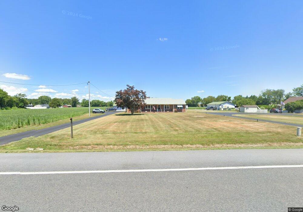
5582 Milford Harrington Hwy Harrington, DE 19952
Estimated Value: $359,000 - $427,817
3
Beds
2
Baths
1,848
Sq Ft
$215/Sq Ft
Est. Value
About This Home
This home is located at 5582 Milford Harrington Hwy, Harrington, DE 19952 and is currently estimated at $397,704, approximately $215 per square foot. 5582 Milford Harrington Hwy is a home located in Kent County with nearby schools including Lake Forest South Elementary School, Lake Forest Central Elementary School, and W.T. Chipman Middle School.
Ownership History
Date
Name
Owned For
Owner Type
Purchase Details
Closed on
Jun 16, 2015
Sold by
Davis Olin B and Wilson Zoe D
Bought by
Ladies Farm Llc
Current Estimated Value
Home Financials for this Owner
Home Financials are based on the most recent Mortgage that was taken out on this home.
Original Mortgage
$140,000
Interest Rate
3.5%
Mortgage Type
New Conventional
Create a Home Valuation Report for This Property
The Home Valuation Report is an in-depth analysis detailing your home's value as well as a comparison with similar homes in the area
Home Values in the Area
Average Home Value in this Area
Purchase History
| Date | Buyer | Sale Price | Title Company |
|---|---|---|---|
| Ladies Farm Llc | -- | None Available |
Source: Public Records
Mortgage History
| Date | Status | Borrower | Loan Amount |
|---|---|---|---|
| Closed | Ladies Farm Llc | $140,000 |
Source: Public Records
Tax History Compared to Growth
Tax History
| Year | Tax Paid | Tax Assessment Tax Assessment Total Assessment is a certain percentage of the fair market value that is determined by local assessors to be the total taxable value of land and additions on the property. | Land | Improvement |
|---|---|---|---|---|
| 2025 | $1,219 | $334,900 | $126,800 | $208,100 |
| 2024 | $1,219 | $334,900 | $126,800 | $208,100 |
| 2023 | $1,219 | $51,800 | $9,700 | $42,100 |
| 2022 | $1,089 | $51,800 | $9,700 | $42,100 |
| 2021 | $1,029 | $51,800 | $9,700 | $42,100 |
| 2020 | $1,074 | $51,800 | $9,700 | $42,100 |
| 2019 | $1,076 | $51,800 | $9,700 | $42,100 |
| 2018 | $1,064 | $51,800 | $9,700 | $42,100 |
| 2017 | $1,108 | $51,800 | $0 | $0 |
| 2016 | $1,013 | $51,800 | $0 | $0 |
| 2015 | $1,108 | $57,600 | $0 | $0 |
| 2014 | $618 | $57,600 | $0 | $0 |
Source: Public Records
Map
Nearby Homes
- 118 Lucky C Dr
- 208 Fernwood Dr
- 4983 Milford Harrington Hwy
- 6307 Milford Harrington Hwy
- 459 Killens Pond Rd
- 644 Pleasant Pine Cir
- 4709 Deep Grass Ln
- 65 Hidden Hollow Dr
- 6872 Milford Harrington Hwy
- 217 Marjorie Ln
- 0 S Dupont Hwy Unit DEKT2030762
- 0 S Dupont Hwy Unit DEKT2035740
- 228 Cams Fortune Way
- 475 Thistlewood Rd
- 506 Shaw Ave
- 54 Minner St
- 0 Cloverfield Ln Unit DEKT2034730
- 3182 Gun and Rod Club Rd
- 11 Simpson St
- 125 E Liberty St
- 5540 Milford Harrington Hwy
- 5628 Milford Harrington Hwy
- 52 Old Airport Rd
- 5514 Milford Harrington Hwy
- 0 Old Airport Rd
- 74 Old Airport Rd
- 00 Old Airport Rd
- 5648 Milford Harrington Hwy
- 43 Old Airport Rd
- 96 Old Airport Rd
- 126 W Lucky Estates Dr
- 124 W Lucky Estates Dr
- 112 Old Airport Rd
- 5674 Milford Harrington Hwy
- 110 Lucky Ln
- 5702 Milford Harrington Hwy
- 87 Old Airport Rd
- 5707 Milford Harrington Hwy
- 107 Old Airport Rd
- 127 W Lucky Estates Dr