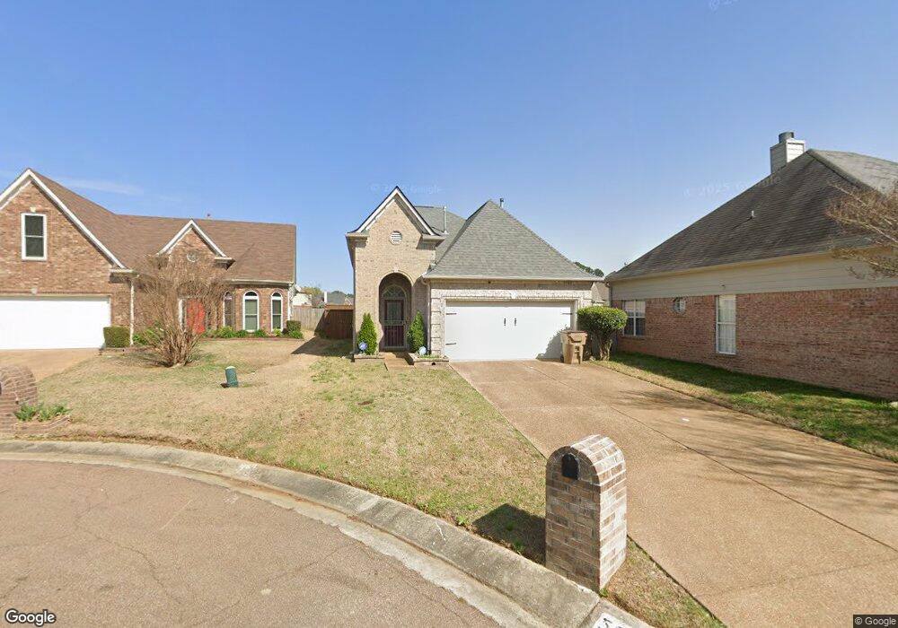
5582 Queens Ring Cove Memphis, TN 38125
Southern Shelby County NeighborhoodEstimated Value: $215,525 - $246,000
3
Beds
2
Baths
1,394
Sq Ft
$163/Sq Ft
Est. Value
About This Home
This home is located at 5582 Queens Ring Cove, Memphis, TN 38125 and is currently estimated at $227,381, approximately $163 per square foot. 5582 Queens Ring Cove is a home located in Shelby County with nearby schools including Highland Oaks Elementary School, Highland Oaks Middle School, and Southwind High School.
Ownership History
Date
Name
Owned For
Owner Type
Purchase Details
Closed on
Dec 16, 2004
Sold by
Mark Matthews Development Llc
Bought by
Spencer Beverly A
Current Estimated Value
Home Financials for this Owner
Home Financials are based on the most recent Mortgage that was taken out on this home.
Original Mortgage
$137,637
Outstanding Balance
$66,707
Interest Rate
5.66%
Mortgage Type
FHA
Estimated Equity
$160,674
Purchase Details
Closed on
May 28, 2004
Sold by
Hyneman Bronze Llc
Bought by
Mark Matthews Development Llc
Create a Home Valuation Report for This Property
The Home Valuation Report is an in-depth analysis detailing your home's value as well as a comparison with similar homes in the area
Home Values in the Area
Average Home Value in this Area
Purchase History
| Date | Buyer | Sale Price | Title Company |
|---|---|---|---|
| Spencer Beverly A | $138,725 | -- | |
| Mark Matthews Development Llc | $156,000 | Memphis Title Company |
Source: Public Records
Mortgage History
| Date | Status | Borrower | Loan Amount |
|---|---|---|---|
| Open | Spencer Beverly A | $137,637 |
Source: Public Records
Tax History
| Year | Tax Paid | Tax Assessment Tax Assessment Total Assessment is a certain percentage of the fair market value that is determined by local assessors to be the total taxable value of land and additions on the property. | Land | Improvement |
|---|---|---|---|---|
| 2025 | $1,436 | $58,275 | $11,500 | $46,775 |
| 2024 | $1,436 | $42,350 | $6,750 | $35,600 |
| 2023 | $1,436 | $42,350 | $6,750 | $35,600 |
| 2022 | $1,436 | $42,350 | $6,750 | $35,600 |
| 2021 | $1,461 | $42,350 | $6,750 | $35,600 |
| 2020 | $1,088 | $26,875 | $6,750 | $20,125 |
| 2019 | $1,088 | $26,875 | $6,750 | $20,125 |
| 2018 | $1,088 | $26,875 | $6,750 | $20,125 |
| 2017 | $1,105 | $26,875 | $6,750 | $20,125 |
| 2016 | $1,015 | $23,225 | $0 | $0 |
| 2014 | $1,015 | $23,225 | $0 | $0 |
Source: Public Records
Map
Nearby Homes
- 7206 State Line Rd
- 9635 Geneva Loop N
- 5471 Millers Glen Ln
- 9209 Hickory Dr
- 5407 Riverdale Rd
- 9438 Huron Dr
- 9387 Joe Lyon Blvd
- 9369 Joe Lyon Blvd
- 9389 Bryant Trent Blvd
- 9218 Lakeside Dr
- 7344 Will Cove
- 5406 Stephen Forest Cove
- 5324 Annandale Dr Unit 5324 Annandale Dr TN
- 9025 Billy Pat Dr
- 5275 Annandale Dr
- 9004 Lakeside Cove
- 9160 Plantation Rd
- 5088 S Germantown Rd
- 5088 S Germantown Rd Unit 2
- 5180 Water Point Dr
- 5586 Queens Ring Cove
- 5578 Queens Ring Cove
- 5590 Queens Ring Cove
- 5574 Queens Ring Cove
- 7126 Queens Crown Ct
- 5594 Queens Ring Cove
- 5570 Queens Ring Cove
- 7130 Queens Crown Ct
- 5598 Queens Ring Cove
- 5581 Queens Ring Cove
- 5585 Queens Ring Cove
- 7125 Brook Mill Cove
- 5577 Queens Ring Cove
- 5589 Queens Ring Cove
- 7133 Brook Mill Cove
- 5573 Queens Ring Cove
- 5602 Queens Ring Cove
- 5567 Queens Ring Cove
- 5595 Queens Ring Cove
- 7118 Queens Crown Ct
Your Personal Tour Guide
Ask me questions while you tour the home.