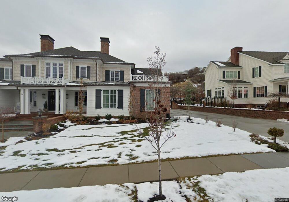
559 N Whitby Woodlans Dr W Alpine, UT 84004
Estimated Value: $1,706,000 - $2,637,000
4
Beds
6
Baths
4,807
Sq Ft
$481/Sq Ft
Est. Value
About This Home
This home is located at 559 N Whitby Woodlans Dr W, Alpine, UT 84004 and is currently estimated at $2,310,618, approximately $480 per square foot. 559 N Whitby Woodlans Dr W is a home located in Utah County with nearby schools including Westfield School, Timberline Middle School, and Lone Peak High School.
Ownership History
Date
Name
Owned For
Owner Type
Purchase Details
Closed on
Jan 5, 2022
Sold by
Eric Teuscher
Bought by
Teuscher Family Trust
Current Estimated Value
Home Financials for this Owner
Home Financials are based on the most recent Mortgage that was taken out on this home.
Original Mortgage
$1,207,000
Outstanding Balance
$1,112,401
Interest Rate
3.11%
Mortgage Type
New Conventional
Estimated Equity
$1,198,217
Purchase Details
Closed on
Dec 6, 2019
Sold by
Alexander Calvin C and Alexander Deborah
Bought by
Teuscher Eric and Teuscher Emily
Home Financials for this Owner
Home Financials are based on the most recent Mortgage that was taken out on this home.
Original Mortgage
$238,000
Interest Rate
5%
Mortgage Type
New Conventional
Purchase Details
Closed on
May 2, 2017
Sold by
Loverland Development Llc
Bought by
Alexander Calvin C and Alexander Deborah
Create a Home Valuation Report for This Property
The Home Valuation Report is an in-depth analysis detailing your home's value as well as a comparison with similar homes in the area
Home Values in the Area
Average Home Value in this Area
Purchase History
| Date | Buyer | Sale Price | Title Company |
|---|---|---|---|
| Teuscher Family Trust | -- | Bartlett Title | |
| Teuscher Eric | -- | Meridian Title Company | |
| Alexander Calvin C | -- | Inwest Title |
Source: Public Records
Mortgage History
| Date | Status | Borrower | Loan Amount |
|---|---|---|---|
| Open | Teuscher Family Trust | $1,207,000 | |
| Previous Owner | Teuscher Eric | $238,000 |
Source: Public Records
Tax History Compared to Growth
Tax History
| Year | Tax Paid | Tax Assessment Tax Assessment Total Assessment is a certain percentage of the fair market value that is determined by local assessors to be the total taxable value of land and additions on the property. | Land | Improvement |
|---|---|---|---|---|
| 2025 | $10,543 | $1,288,925 | $471,300 | $1,872,200 |
| 2024 | $10,543 | $1,228,755 | $0 | $0 |
| 2023 | $10,343 | $1,294,205 | $0 | $0 |
| 2022 | $7,117 | $864,875 | $0 | $0 |
| 2021 | $3,433 | $356,400 | $356,400 | $0 |
| 2020 | $3,189 | $324,000 | $324,000 | $0 |
| 2019 | $3,055 | $324,000 | $324,000 | $0 |
| 2018 | $3,092 | $324,000 | $324,000 | $0 |
| 2017 | $2,237 | $226,800 | $0 | $0 |
| 2016 | $2,323 | $219,600 | $0 | $0 |
| 2015 | $2,134 | $190,800 | $0 | $0 |
| 2014 | $1,750 | $154,800 | $0 | $0 |
Source: Public Records
Map
Nearby Homes
- 35 Sledhill Cir Unit 2
- 659 E Pioneer Rd
- 1249 E Pioneer Rd
- 760 Eagleview Dr
- 475 Grove Dr
- 501 W Devey Dr
- 820 Eagleview Dr
- 443 Lupine Dr Unit 7
- 48 N 100 E
- 30 S Main St
- 19 E Elk Ct
- 381 E Watkins Cir Unit 28
- 287 E Heritage Hills Dr
- 201 E Red Pine Dr Unit 17
- 250 S Main St Unit 7
- 250 S Main St Unit 20
- 250 S Main St Unit 25
- 259 Twin River Loop
- 382 E Heritage Hills Dr
- 177 W Canyon Crest Rd
- 559 N Whitby Woodlans Dr W Unit 3
- 533 N Whitby Woodlands Dr Unit 2
- 575 N Whitby Woodlands Dr
- 564 N Whitby Woodlands Dr
- 522 N Whitby Woodlands Dr
- 511 N Whitby Woodlands Dr
- 592 N Whitby Woodlands Dr Unit 3
- 495 N Whitby Woodlands Dr Unit 9
- 495 N Whitby Woodlands Dr
- 112 W 600 N
- 137 Glacier Lily Dr Unit 10
- 469 Glacier Lily Dr
- 468 N Soldier Cir
- 628 Hillside Cir
- 437 N Whitby Woodlands Dr
- 437 N Whitby Woodlands Dr Unit 7
- 648 Hillside Cir
- 478 Glacier Lily Dr
- 434 N Whitby Woodlands Dr
- 658 Hillside Cir