Estimated Value: $337,000 - $418,000
4
Beds
2
Baths
1,848
Sq Ft
$206/Sq Ft
Est. Value
About This Home
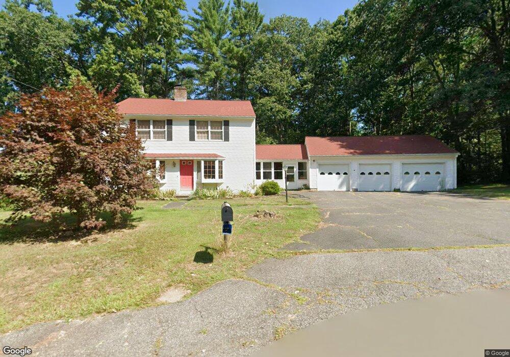
This home is located at 56 Adams Dr, Athol, MA 01331 and is currently estimated at $380,321, approximately $205 per square foot. 56 Adams Dr is a home located in Worcester County with nearby schools including Athol High School.
Ownership History
Date
Name
Owned For
Owner Type
Purchase Details
Closed on
Dec 5, 2013
Sold by
Kilhart Timothy B and Kilhart Darlene A
Bought by
Kilhart Ft and Kilhart Darlene A
Current Estimated Value
Purchase Details
Closed on
Aug 9, 1989
Sold by
Jaillet Elaine
Bought by
Kilhart Timothy
Home Financials for this Owner
Home Financials are based on the most recent Mortgage that was taken out on this home.
Original Mortgage
$97,200
Interest Rate
9.93%
Mortgage Type
Purchase Money Mortgage
Create a Home Valuation Report for This Property
The Home Valuation Report is an in-depth analysis detailing your home's value as well as a comparison with similar homes in the area
Home Values in the Area
Average Home Value in this Area
Purchase History
| Date | Buyer | Sale Price | Title Company |
|---|---|---|---|
| Kilhart Ft | -- | -- | |
| Kilhart Timothy | $108,000 | -- |
Source: Public Records
Mortgage History
| Date | Status | Borrower | Loan Amount |
|---|---|---|---|
| Previous Owner | Kilhart Timothy | $50,000 | |
| Previous Owner | Kilhart Timothy | $75,000 | |
| Previous Owner | Kilhart Timothy | $97,200 |
Source: Public Records
Tax History Compared to Growth
Tax History
| Year | Tax Paid | Tax Assessment Tax Assessment Total Assessment is a certain percentage of the fair market value that is determined by local assessors to be the total taxable value of land and additions on the property. | Land | Improvement |
|---|---|---|---|---|
| 2025 | $4,084 | $321,300 | $50,200 | $271,100 |
| 2024 | $3,927 | $306,100 | $50,200 | $255,900 |
| 2023 | $3,972 | $282,900 | $36,400 | $246,500 |
| 2022 | $3,683 | $229,500 | $34,700 | $194,800 |
| 2021 | $0 | $199,800 | $31,500 | $168,300 |
| 2020 | $0 | $198,600 | $28,700 | $169,900 |
| 2019 | $802 | $195,200 | $27,100 | $168,100 |
| 2018 | $2,843 | $173,600 | $24,600 | $149,000 |
| 2017 | $3,386 | $166,000 | $24,600 | $141,400 |
| 2016 | $3,105 | $156,600 | $24,600 | $132,000 |
| 2015 | $2,980 | $156,600 | $24,600 | $132,000 |
| 2014 | $2,886 | $156,600 | $24,600 | $132,000 |
Source: Public Records
Map
Nearby Homes
- 882 Old Keene Rd
- 0 W Royalston Rd
- 31 Pinedale Rd
- 87 Bellevue Dr E
- 421 Fredette St
- 15 Tully Rd
- 660 Pinedale Ave
- 206 Intervale Ave
- 25 Sunset Ave
- 220 Orange St
- 128 Orange St
- 60 Silver Lake St
- 70 Brattle St
- 84 Ward St
- 106 Ridge Ave
- 330 N Orange Rd
- 282 School St
- 503 School St
- 1179 Main St
- 2791 Old Keene Rd
- 485 W Royalston Rd
- 86 Adams Dr
- 79 Adams Dr
- 25 Adams Dr
- 500 W Royalston Rd
- 101 Adams Dr
- 124 Adams Dr
- 0 Adams Dr
- 460 W Royalston Rd
- 528 W Royalston Rd
- 445 W Royalston Rd
- Lot D-1 Adams Dr
- 125 Adams Dr
- 573 W Royalston Rd
- 421 W Royalston Rd
- 0 W Royalston Rd P:a Unit 71710956
- 0 W Royalston Rd P:a Unit 71803110
- 158 Adams Dr
- 402 W Royalston Rd
- 598 W Royalston Rd