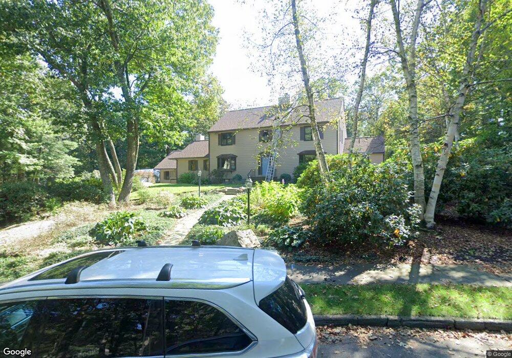
56 Aldridge Rd Needham, MA 02492
Estimated Value: $1,967,151 - $2,441,000
4
Beds
5
Baths
3,476
Sq Ft
$643/Sq Ft
Est. Value
About This Home
This home is located at 56 Aldridge Rd, Needham, MA 02492 and is currently estimated at $2,235,538, approximately $643 per square foot. 56 Aldridge Rd is a home located in Norfolk County with nearby schools including Newman Elementary School, High Rock Middle School, and Pollard Middle School.
Ownership History
Date
Name
Owned For
Owner Type
Purchase Details
Closed on
Jun 19, 2008
Sold by
Shipley Karen L
Bought by
Osman Alan and Osman Susan
Current Estimated Value
Home Financials for this Owner
Home Financials are based on the most recent Mortgage that was taken out on this home.
Original Mortgage
$980,250
Outstanding Balance
$630,629
Interest Rate
6.1%
Mortgage Type
Purchase Money Mortgage
Estimated Equity
$1,604,909
Create a Home Valuation Report for This Property
The Home Valuation Report is an in-depth analysis detailing your home's value as well as a comparison with similar homes in the area
Home Values in the Area
Average Home Value in this Area
Purchase History
| Date | Buyer | Sale Price | Title Company |
|---|---|---|---|
| Osman Alan | $1,307,000 | -- |
Source: Public Records
Mortgage History
| Date | Status | Borrower | Loan Amount |
|---|---|---|---|
| Open | Osman Alan | $980,250 |
Source: Public Records
Tax History Compared to Growth
Tax History
| Year | Tax Paid | Tax Assessment Tax Assessment Total Assessment is a certain percentage of the fair market value that is determined by local assessors to be the total taxable value of land and additions on the property. | Land | Improvement |
|---|---|---|---|---|
| 2025 | $18,008 | $1,698,900 | $896,000 | $802,900 |
| 2024 | $17,345 | $1,385,400 | $700,000 | $685,400 |
| 2023 | $17,410 | $1,335,100 | $700,000 | $635,100 |
| 2022 | $17,432 | $1,303,800 | $700,000 | $603,800 |
| 2021 | $16,989 | $1,303,800 | $700,000 | $603,800 |
| 2020 | $16,760 | $1,341,900 | $700,000 | $641,900 |
| 2019 | $16,567 | $1,337,100 | $700,000 | $637,100 |
| 2018 | $15,885 | $1,337,100 | $700,000 | $637,100 |
| 2017 | $14,939 | $1,256,400 | $700,000 | $556,400 |
| 2016 | $14,499 | $1,256,400 | $700,000 | $556,400 |
| 2015 | $14,185 | $1,256,400 | $700,000 | $556,400 |
| 2014 | $14,491 | $1,244,900 | $700,000 | $544,900 |
Source: Public Records
Map
Nearby Homes
- 50 Aldridge Rd
- 55 Aldridge Rd
- 607 Chestnut St
- 623 Chestnut St
- 72 Stonecrest Dr
- 591 Chestnut St
- 36 Aldridge Rd
- 60 Stonecrest Dr
- 51 Aldridge Rd
- 32 Parkman Way
- 29 Aldridge Rd
- 50 Stonecrest Dr
- 11 Parkman Way
- 73 Stonecrest Dr
- 43 Farley Pond Ln
- 55 Farley Pond Ln
- 11 Aldridge Rd
- 45 Stonecrest Dr
- 45 Stonecrest Dr
- 50 Richardson Dr