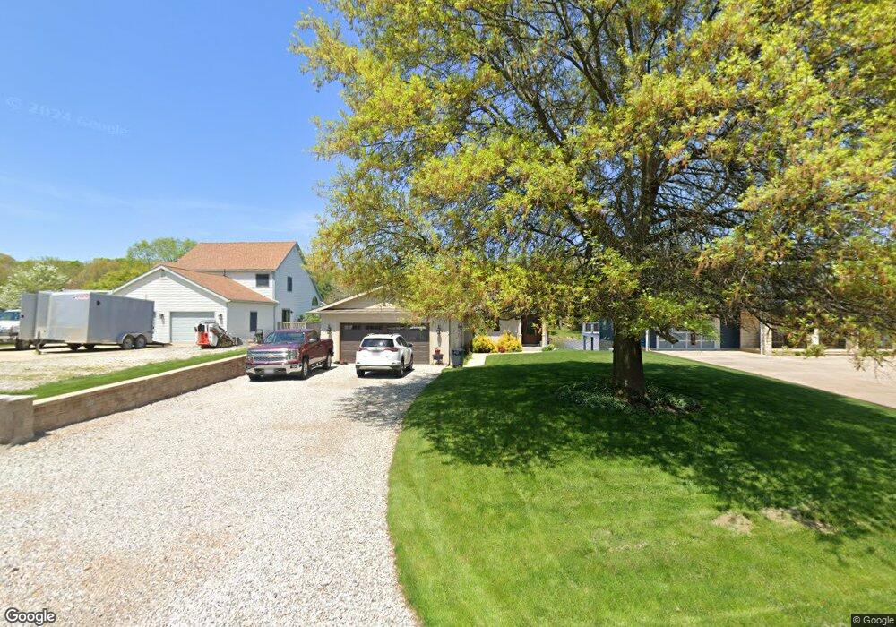
56 Appletree Ct Howard, OH 43028
Apple Valley NeighborhoodEstimated Value: $500,000 - $879,000
2
Beds
3
Baths
1,652
Sq Ft
$429/Sq Ft
Est. Value
About This Home
This home is located at 56 Appletree Ct, Howard, OH 43028 and is currently estimated at $709,082, approximately $429 per square foot. 56 Appletree Ct is a home located in Knox County with nearby schools including East Knox Elementary School and East Knox High School.
Ownership History
Date
Name
Owned For
Owner Type
Purchase Details
Closed on
Feb 8, 2006
Sold by
Pettis Michael L and Pettis Patricia F
Bought by
Robinson James H and Robinson Nancy L
Current Estimated Value
Home Financials for this Owner
Home Financials are based on the most recent Mortgage that was taken out on this home.
Original Mortgage
$200,000
Interest Rate
5.8%
Mortgage Type
New Conventional
Purchase Details
Closed on
Nov 15, 1996
Sold by
Hults Stephen W and Hults Priscil
Bought by
Pettis Michael L and Pettis Patric
Create a Home Valuation Report for This Property
The Home Valuation Report is an in-depth analysis detailing your home's value as well as a comparison with similar homes in the area
Home Values in the Area
Average Home Value in this Area
Purchase History
| Date | Buyer | Sale Price | Title Company |
|---|---|---|---|
| Robinson James H | $72,750 | None Available | |
| Pettis Michael L | $152,000 | -- |
Source: Public Records
Mortgage History
| Date | Status | Borrower | Loan Amount |
|---|---|---|---|
| Closed | Robinson James H | $200,000 |
Source: Public Records
Tax History
| Year | Tax Paid | Tax Assessment Tax Assessment Total Assessment is a certain percentage of the fair market value that is determined by local assessors to be the total taxable value of land and additions on the property. | Land | Improvement |
|---|---|---|---|---|
| 2024 | $7,328 | $204,820 | $88,180 | $116,640 |
| 2023 | $7,807 | $204,820 | $88,180 | $116,640 |
| 2022 | $6,169 | $141,250 | $60,810 | $80,440 |
| 2021 | $6,169 | $141,250 | $60,810 | $80,440 |
| 2020 | $5,873 | $141,250 | $60,810 | $80,440 |
| 2019 | $5,548 | $123,690 | $66,340 | $57,350 |
| 2018 | $5,098 | $121,580 | $66,340 | $55,240 |
| 2017 | $5,431 | $118,470 | $66,340 | $52,130 |
| 2016 | $4,547 | $97,630 | $61,430 | $36,200 |
| 2015 | $4,037 | $97,630 | $61,430 | $36,200 |
| 2014 | $4,044 | $97,630 | $61,430 | $36,200 |
| 2013 | $3,685 | $84,440 | $46,190 | $38,250 |
Source: Public Records
Map
Nearby Homes
- 31 Apple Valley Blvd
- 63 Appleseed Ct
- 0 Apple Valley Dr Unit 225009912
- 0 Apple Valley Dr Unit 5159791
- 0 Apple Valley Dr Unit 9069389
- 0 Apple Valley Dr Unit 20260049
- 4045 Apple Valley Dr Unit LOT 10
- 4045 Apple Valley Dr
- 4053 Apple Valley Dr
- 4006 Apple Valley Dr
- 21311 Coshocton Rd
- 770 Winesap Cir
- 50 Orchard Hills Ct
- 531 Crabapple Dr
- 11 Crabtree Ct
- Lots 392 & 393 Lakeview Heights Dr
- 0 Northern Spy Dr Unit 226000222
- 0 Mcintosh Ct Unit 20250846
- 0 Mcintosh Ct Unit LOT 321
- 48 Mcintosh Ct
- 52 Appletree Ct
- 60 Appletree Ct
- 64 Appletree Ct
- 48 Appletree Ct
- 68 Appletree Ct
- 0 Appletree Ct Unit Lot 32 2737994
- 0 Appletree Ct Unit Lot 32
- 55 Appletree Ct
- 1108 Apple Valley Dr
- 59 Appletree Ct
- 63 Appletree Ct
- 67 Appletree Ct
- 1104 Apple Valley Dr
- 328 Baldwin Dr
- 324 Baldwin Dr
- 1121 Apple Valley Dr
- 336 Baldwin Dr
- 1100 Apple Valley Dr
- 1117 Apple Valley Dr
- 342 Baldwin Dr
Your Personal Tour Guide
Ask me questions while you tour the home.